Ahr Valley
| Ahr Valley | ||
|---|---|---|
|
The Ahr Valley (Mittelahr) |
||
| location | Germany | |
| Waters | Ahr | |
| Mountains | Ahr Mountains | |
| Geographical location | 50 ° 32 ' N , 7 ° 4' E | |
|
|
||
| height | 300 to 180 m above sea level NHN | |
| length | 85 km | |
The Ahr valley is named after the Ahr , a left tributary of the Rhine . It begins with the source of the Ahr in Blankenheim in the Euskirchen district ( North Rhine-Westphalia ) and generally runs eastwards. At its southernmost point, the district of Ahrweiler , and thus Rhineland-Palatinate , is reached. Running through the community of Adenau , the valley bends northeast at the confluence with the Adenauer Bach and reaches the community of Altenahr , from whose main town the typical west-east course resumes, albeit interrupted by river bends. This is where the section begins, which is understood as the Ahr valley in the tourist sense . It is characterized by viticulture on the southern slopes and the picturesque rocky landscape that the river created when it cut into the Ahr mountains around 300 meters deep . In the further course the Ahr reaches the area of the district town Bad Neuenahr-Ahrweiler and finally flows into the Rhine south of Remagen in the area of the town Sinzig .


course
The upper Ahr valley
From the source, the Ahr valley runs in hilly mountainous terrain with meadows, forests and isolated hamlets or farms . The B 258 follows it . The first notable towns are Ahrhütte and Ahrdorf , which still belong to Blankenheim. The Ahr valley then gradually narrows and reaches its southernmost point, where it leaves North Rhine-Westphalia. The first place in Rhineland-Palatinate is Dorsel , above the valley . The B 258 leaves the Ahr valley in Müsch , and the L 73 accompanies the still small river. From here via Antweiler to Fuchshofen the valley runs almost to the north, and then from Schuld via Insul to Dümpelfeld points almost exactly to the east, where the B 257 becomes the new companion. Here, at the junction with the Adenauer Bach flowing from the south, the Ahr strives north-east, leaves the Verbandsgemeinde (VG) Adenau and reaches the VG Altenahr in the Mittelahr area south of the village of Liers, which belongs to Hönningen .
The middle Ahr valley
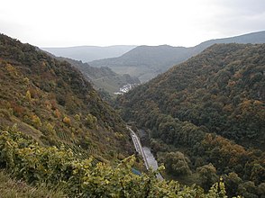
From Hönningen via Ahrbrück , Pützfeld , Kreuzberg , Altenburg to Altenahr , the valley initially stretches northeast. From Ahrbrück the Ahrtalbahn joins the B 257 and follows the valley to the Rhine. At Altenahr the valley bends to the east and initially has an extraordinarily winding course. Here the river is accompanied by the B 267 , which does not follow every loop. The largest loop of the Ahr begins in Altenahr and is under nature protection due to its flora and fauna. From here the valley is cut like a gorge with rugged rock slopes into the Ahr Mountains. From Reimerzhoven , large-scale viticulture is practiced, especially on the north side of the river (i.e. on the southern slopes). At Laach, the Ahr runs through another loop of the valley, then passes the wine towns of Mayschoss , Rech , Dernau and Marienthal one after the other and finally reaches the area of the town of Bad Neuenahr-Ahrweiler . The last bottleneck in the Ahr Valley lies below the Bunter Kuh , a rock formation that almost reaches the river and leaves hardly any space for road and rail. In Walporzheim , the lower Ahr valley begins with the valley floor that has suddenly become wide .
The lower Ahr valley
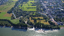
The lower Ahr valley is also characterized by viticulture. The Ahr touches the town centers of Ahrweiler , Bad Neuenahr , Heppingen and Heimersheim , where viticulture ends. The valley floor between Bad Bodendorf on the northern edge and Sinzig on a valley terrace in the south is characterized by arable farming and fruit and vegetable cultivation. The mouth of the Ahr in the Goldene Meile plain near Kripp has again an almost natural character and is under nature protection.
economy
The Ahr Valley is best known for its viticulture . The wine festivals that take place from the beginning of September to the end of October in the individual wine villages, especially in Altenahr , Mayschoss , Rech , Dernau , Walporzheim , Ahrweiler and Heimersheim, play an important role for regional tourism . The area and the Vulkaneifel to the south are also known for mineral water , so the iron-containing springs (e.g. the Apollinaris spring ) made Bad Neuenahr a spa town.
Tourism has been a growing economic factor for years. The headwaters in Blankenheim benefit from it to a lesser extent, but mainly the area of the central Ahr valley between Altenahr and Bad Neuenahr-Ahrweiler. The district town can now be found among the three holiday resorts in Rhineland-Palatinate with the most overnight stays. Dernau should be mentioned as a representative of the municipalities on the Ahrlauf - this is where the change from a winegrowing village to a national holiday destination is most clearly visible.
Culture and sights
One of the sights is the Roman villa of Bad Neuenahr-Ahrweiler , an excavation of Roman settlement remains in Ahrweiler, right on the red wine hiking trail.
At Bad Neuenahr, the Ahr valley is crossed by the striking Ahr valley bridge on the A 61 . The 1.5 km long prestressed concrete bridge , completed in 1975, dominates this part of the valley with its 50 m high concrete piers.
During the Cold War , the Ahr valley was intended as a safe place for the central federal organs in the event of a defense : under the vineyards near Marienthal, in an extension from Dernau to Bad Neuenahr-Ahrweiler, the government bunker, which has now been largely dismantled and was used as a documentation center in March 2008 , was hidden of the Cold War was first made available to the public.
For hikers there is in the Ahr valley
- the AhrSteig with its two blue and red sections and a total of six stages, which has been awarded the "Quality Walk for Wanderable Germany" by the German Hiking Association .
- the red wine hiking trail , which meanders through the vineyards from Altenahr to Bad Neuenahr and continues to Bad Bodendorf .
- the Ahr-Uferweg as well
- the educational viticulture trail.
For cyclists
- the Ahr cycle path , which leads with a slight gradient from the mouth of the Ahr in Sinzig mostly along the Ahr.
Transport and infrastructure
From Remagen, the Ahr Valley Railway first runs two tracks, from Walporzheim a single track up to Ahrbrück . The section leading to Adenau has been closed since 1985. Until 1973 there was also a connection to the Eifel line via the Dümpelfeld – Lissendorf railway line .
The Ahr Valley can be reached by car via the 61 and 565 motorways and the B 257 . In Altenahr this meets the B 267, which runs through the Ahr Valley itself .
By bike, the Ahr cycle path leads about 80 km from the mouth of the Rhine in Remagen / Kripp along the Ahr to Blankenheim in the Eifel. There is a connection to the Urft cycle path towards Rursee and the Erft cycle path to Neuss .
literature
- Vera Kettenbach: The Ahr Valley from Bad Bodendorf to Altenahr. Gaasterland-Verlag, 3rd edition, Düsseldorf 2010, ISBN 978-3-935873-02-4 .
- Heinz Schönewald: Bad Neuenahr. Gaasterland-Verlag, Düsseldorf 2006, ISBN 3-935873-13-1 .
- Heinz Schönewald: Ahrweiler 1945 to 1975. Sutton Verlag, Erfurt 2008
- Hans-Georg Klein: Ahrweiler . Gaasterland-Verlag, Düsseldorf 2005, ISBN 3-935873-05-0 .
- Ahr valley journey . Gaasterland-Verlag, Düsseldorf 2007, ISBN 978-3-935873-18-5 .
- Christoph Bach: The government bunker in the Ahr valley and its history. Gaasterland-Verlag, Jünkerath 2016, ISBN 978-3-943123-18-0 .
- The Ahrthal, picturesque views / after original drawings in steel, made by the most excellent artists. Bonn: Habicht, [approx. 1840], online edition dilibri Rhineland-Palatinate .
- Latest album from beautiful Ahrthal . Bonn: Foppen, [approx. 1870], online edition dilibri Rhineland-Palatinate .
- Heinz Schönewald: Bad Neuenahr - the world bath of the imperial era. Sutton Verlag, Erfurt 2016, ISBN 978-3-86680-465-4 .
- Heinz Schönewald: The History of the Ahr Valley Railway. Eifel-Verlag, Jünkerath 2016.
Web links
- Literature about the Ahr valley in the catalog of the German National Library
- Ahr valley, hotels, holiday apartments, guest houses, events
- Ahrwein, wineries and wine festivals
- AhrSteig, hiking
- Ahrweiler district administration
- Ahr valley path
- The Mittelahr
- Flood on the Ahr
Individual evidence
- ↑ Ahrtal landscape profile of the Federal Agency for Nature Conservation ( information )


