Old town of Rapperswil
The old town of Rapperswil forms the historic town center of Rapperswil , a district of the Swiss municipality of Rapperswil-Jona in the canton of St. Gallen .
Geographical demarcation
The old town of Rapperswil encompasses the historical core of the town of Rapperswil, which was independent until 2006 and which was surrounded by a city wall until 1835 . Its center is today's main square by the town hall with essentially six streets running east and west with predominantly late medieval buildings and a considerable number of small shops and restaurants. Despite an area of less than half a square kilometer, it takes up a third of the area of the Rapperswil district with around 8,000 residents.
history

The buildings on Hintergasse , the former Burggasse with the residences of the servants of the Counts of Rapperswil , including the Bleulerhaus from the 13th century , form what is probably the oldest core of the old town . The Haus zum Alten Sternen on Engelplatz marks the eastern end of the old town.
The fish market square , the harbor and the promenade on Lake Zurich with inns, restaurants and bars were created with the rise of tourism. The medieval fortified inner harbor was located on the site of today's fish marketplace until 1837 , which was razed together with most of the city fortifications from 1834 onwards. Until the 1830s, traffic through the city of Rapperswil ran from the eastern Halstor via the main square through Fischmarktstrasse to the fortified gate at the Fischmarkt. The south gate at today's transition from Fischmarktplatz to Seedammstrasse was until 1859 (opening of the railway and road bridge ) the main passage to the pier with the Heilig Hüsli bridge chapel in front of the city gate.
Today the lower and upper Curti-Haus form the southwestern end of the old town to the preserved lake-side city fortifications at the Capuchin monastery on Endingerhorn , the western branch of the Lindenhof hill.
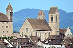
The Herrenberg forms the northern end of the old town and was the former center of power of Rapperswil, with the castle on a rocky chain of hills that reach far into Lake Zurich, the Lindenhof or Castle Hill . Surrounded by water on three sides, the fortification with its high towers is visible from afar and, together with the massive construction of the parish church and the Breny tower, dominates the cityscape of the old town below.
Attractions
| KGS no. | photo | object | Cat. | Type | address | Coordinates |
|---|---|---|---|---|---|---|
| 8233 |

|
The town hall on the main square was first mentioned in 1419 and 1433 as a council chamber . The construction should go back to a watchtower of the first city fortifications, probably to the first half of the 13th century. The building in its current form was built around 1470, renovations were carried out in 1866 and 1895. The building includes the town hall, the council chamber and parts of the city archive. The late Gothic portal to the council chamber is made from a single oak trunk. Worth seeing are the Julius banner , the gold and silver treasure, the round council table (1618), the paintings by the Rapperswil artists Felix Maria Diogg and Johann Michael Hunger as well as the valuable holdings of stained glass. | A. | G | Hauptplatz 1 |
704334 / 231510
|
| 8234 |

|
Rapperswil Castle and the archive and library in the Poland Museum | A. | S / G |
704270 / 231621
|
|
| 9652 |
|
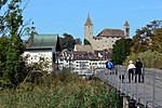
Seedamm (prehistoric / medieval bridges) and remains of the Rapperswil – Jona – Technikum | A. | F. |
704020 / 230945
|
|
|
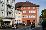
Alter Sternen (1568, 18th century), Rapperswil | B. | G | Engelplatz 2 |
704550 / 231740
|
|

|
Bleulerhaus (1606), Rapperswil | B. | G | Back alley 16 |
704246 / 231525
|
|
|
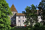
Brenyhaus (15th century, tower early 13th century), Rapperswil | B. | G | Herrenberg 40 |
704440 / 231699
|
|

|
Haus Schlossberg or Oberes Curtihaus (16th / 17th century), Rapperswil | B. | G | Back alley 32 |
704176 / 231536
|
|

|
Heilig Hüsli (16th century) in the lake, Rapperswil | B. | G | Wooden walkway |
704230 / 231090
|
|
|
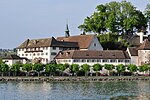
Capuchin monastery with wall ring (17th century), Rapperswil | B. | G | Endingerstrasse 9 |
704050 / 231580
|
|
|
Catholic Church of St. John (1883) with Chapel of Our Lady | B. | G | Herrenberg |
704350 / 231650
|
|

|
Pfrundhäuser (16th century, 1681) | B. | G | Herrenberg 51-57 |
704394 / 231647
|
|

|
Rapperswil City Archives | B. | S. | town hall |
704340 / 231519
|
|

|
City Museum (formerly: Heimatmuseum) | B. | S. | Herrenberg 40 |
704440 / 231699
|
|

|
Lower Curtihaus (1892, wall paintings) | B. | G | Curtiplatz 1 | 704140 / 231520 |
literature
- Peter Röllin: Rapperswil-Jona cultural building set: 36 museums without a roof . Rapperswil-Jona 2005, ISBN 3-033-00478-4 .
Web links
Individual evidence
- ^ Website Rapperswil-Jona
- ↑ Work like in grandfather's time . In: Fachwissen Applica 18/2007
- ↑ Website palafittes.org: Swiss sites in the UNESCO World Heritage Site ( Memento of the original dated May 31, 2016 in the Internet Archive ) Info: The archive link was inserted automatically and has not yet been checked. Please check the original and archive link according to the instructions and then remove this notice. : Rapperswil / Hombrechtikon field Bach (CH-SG-01), Rapperswil-pilot (CH-SG-02), freienbach-hurden rosshorn (CH SZ-01) together with the prehistoric and historic Seequerungen accessed, on February 15, 2013

