Arkenberg
| Arkenberg | ||
|---|---|---|
|
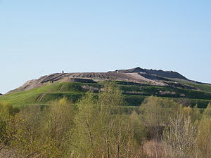
View of the Arkenberge landfill mountain |
||
| height | 121.9 m above sea level NHN | |
| location | Berlin ( Germany ) | |
| Coordinates | 52 ° 38 '17 " N , 13 ° 24' 17" E | |
|
|
||
The name Arkenberge originally referred to a natural mountain range in the Berlin district of Blankenfelde in the Pankow district . The name of the nearby settlement of Berlin-Arkenberge is derived from the name of the chain of hills . A building rubble was built east of this settlement since 1984. In January 2015 it was found that its summit was 121.9 m above sea level. Reached NHN . Since then, it has been considered the highest point in the area of the State of Berlin , replacing the Teufelsberg (120.1 m).
history
The original Arkenberge were a natural range of hills of Pleistocene origin. On a measuring table from 1911, its greatest height is given as 70.3 meters. Large parts of them were excavated in the course of the 20th century, and in the 1950s the railway line of the Berlin outer ring was laid through the area. The highest point of the remaining range of hills is 64.8 meters high, the surrounding area is between 53 and 57 meters high. The Berlin-Arkenberge settlement was built in the area of the Arkenberge since the 1930s .
In 1984 work began on building a rubble dump on an area of 36 hectares east of the settlement . In 1998 the dumping of construction waste was stopped, from 1999 construction waste was accepted for recycling for the purpose of profiling and recultivation of the landfill body. The plan was to create a mountain with two viewing platforms, which are optically separated by a saddle.
Around the year 2000, plans were concretized according to which the area around the Arkenberge should be turned into a recreation area. As of January 2015, the summit should be open to the public from 2019.

On the occasion of the remeasurement at the beginning of 2015, a boulder with an inscription referring to its status as Berlin's highest elevation was placed on the summit.
See also
Web links
Individual evidence
- ↑ a b c On the competition for the highest peak in Berlin , in: Der Tagesspiegel , February 24, 2015, p. 15
- ↑ How Berlin got 14 mountains. In: RBB-online . April 23, 2015, accessed December 11, 2016 .
- ↑ Measurement table sheet 3346, Schönerlinde, 1911.
- ↑ Senate of Berlin (ed.), Digital Topographical Map 1: 10,000 , generated on December 31, 2006.
- ↑ Landfill Arkenberge on the website of the Heim Group, accessed on January 25, 2015.
- ↑ Garbage dump as a slope for mountain bikers. In: Berliner Zeitung , December 14, 2000.
- ↑ Stefan Jacobs: That's the height: Arkenberge The highest mountain in Berlin is recently in Pankow. In: tagesspiegel.de , February 22, 2015.
- ↑ Arkenberge beats Teufelsberg . In: Pankower Allgemeine Zeitung , January 28, 2015.


