Babira
| Babira | ||
|---|---|---|
| location | ||
|
|
||
| Coordinates | 36 ° 33 ' N , 43 ° 1' E | |
| Country |
|
|
| Governorate | Ninawa | |
| District | Tel Kaif | |
| Basic data | ||
| height | 285 m | |
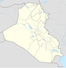
Babira (also Babirah , Bapira or Babire , Arabic بابيرة, DMG Babîră ) is a jesidisches village in the north of Iraq . The village is located about 15 km southwest of Telskuf in the Tel Kaif district in the Ninawa governorate . The place is located in the Nineveh Plain and is one of the disputed areas of Northern Iraq .
population
To the population Babiras mainly include Yazidis .
history
Between 1985 and 1986, some Yezidi villages were destroyed by the construction of the Mosul dam (then still Saddam dam). The Yazidi village of Babira was one of the destroyed villages. In 1987 the inhabitants of the destroyed village were partly forcibly relocated to the newly founded “model village” of the same name, Babira.
See also
Individual evidence
- ↑ VG Bayreuth, judgment of 30.06.2011 - B 3 K 10.30050 - openJur. Retrieved December 22, 2018 .
- ↑ -Reichental is like a big family-. Retrieved December 22, 2018 .
- ^ Eszter Spät: Kurdish Studies - Persecution and the Development of Yezidi Ritual Life . ( academia.edu [accessed January 29, 2019]).
- ↑ Irene Dulz: The Yezidis in Iraq: between "model village" and escape . LIT Verlag Münster, 2001, ISBN 978-3-8258-5704-2 ( google.de [accessed on February 10, 2019]).

