Barra Head (Scotland)
| Barra Head | ||
|---|---|---|
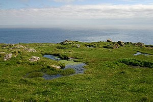
| Pools on the cliffs of Mullach a 'Lagain | ||
| Waters | North Atlantic | |
| Archipelago | Outer Hebrides | |
| Geographical location | 56 ° 48 ′ 0 ″ N , 7 ° 39 ′ 0 ″ W | |
|
|
||
| surface | 2.04 km² | |
| Highest elevation | Sotan 193 m above sea level NN |
|
| Residents | uninhabited | |
Barra Head (also Berneray from Old Norwegian for Bjørn's Island ) is the southernmost island of the Outer Hebrides in Scotland .
Name of the island
Originally the island was called Berneray , while Barra Head was just the name of the southern tip of the island.
geography
Barra Head is 2.0 km². The highest point is the Sotan at 193 meters . The island is uninhabited.
The island is mainly covered by salt marshes , machair and heather .
history
At the southern tip is a lighthouse designed by engineer Robert Stevenson , which has been in operation since 1833. Until 1931, the families of the lighthouse keepers were the only residents of the island. Barra Head has been uninhabited since the automation of the beacon. In 2000 the National Trust for Scotland bought the island.
Flora and fauna
Barra Head has been a seabird sanctuary since 1991 . Together with the neighboring island of Mingulay , it forms a breeding area for hundreds of thousands of seabird pairs, including the razorbill ( Alca torda ).

