
Beuren (Eifel)
| coat of arms | Germany map | |
|---|---|---|

|
Coordinates: 50 ° 6 ' N , 7 ° 5' E |
|
| Basic data | ||
| State : | Rhineland-Palatinate | |
| County : | Cochem cell | |
| Association municipality : | Elms | |
| Height : | 420 m above sea level NHN | |
| Area : | 10.63 km 2 | |
| Residents: | 413 (Dec. 31, 2019) | |
| Population density : | 39 inhabitants per km 2 | |
| Postal code : | 56825 | |
| Area code : | 02675 | |
| License plate : | COC, ZEL | |
| Community key : | 07 1 35 008 | |
| Association administration address: | Marktplatz 1 56766 Ulmen |
|
| Website : | ||
| Local Mayor : | Karl-Peter Uebereck | |
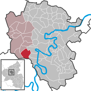
| Location of the local community of Beuren in the Cochem-Zell district | ||
  |
||

Beuren in der Eifel is a municipality in the district of Cochem-Zell in Rhineland-Palatinate . It belongs to the Ulmen community .
geography
Beuren also includes the Beurenermühle and Peltzerhaus residential areas . The local communities of Kliding , Bremm , Sankt Aldegund , Alf , Bengel and Bad Bertrich border Beuren clockwise .
At the end of the 1960s, RWE planned the large Bremm pumped storage plant . Its six-kilometer-long Obersee in the immediately west of Erdenbachtal and the smaller Untersee in eastern Ellerbachtal would have markedly delimited the ridge with Urschmitt , Kliding and Beuren on both sides along state road 106.
history
Apart from traces from Roman times and an ambiguous Buriae in the Moselgau , Beuren is mentioned in a document together with Gevenich and Weiler in 1017 by Poppo von Babenberg (Archbishop of Trier and Elector 1016-1047). Forestry and agriculture have always been the most important economic factors in Beuren. The princely ownership structure within the community used to be complex. Parts belonged to Kurtrier , Kloster Stuben , the lords of Bassenheim, Pyrmont and Winneburg. In 1543 a Pyrmonter Hof owned by Baron Friedrich von Eltz-Pyrmont was named, in 1550 and 1562 a Stuben court, which was presumably sold to the Elector of Trier. In 1585 a court of the Elector of Trier is mentioned. In 1622 the Pyrmonter Hof is owned by Baron Damian Waldbott v. Bassenheim.
“In 1780 the electoral court chamber owned two courtyards of the Stuben monastery, the count von Bassenheim and the baron von Wiltberg each owned a courtyard and the seminarium St. Banthi zu Trier farms in Beuren. The provost of the cathedral at Trier took two parts of the tenth, the third part was divided into eight small parts, which under the electoral court chamber, the baron von Landenberg, the rector zu Driesch, the St. Simeonsstift, the count von Metternich and the waiter's house Elms were distributed according to certain rates. "
In 1794 it was occupied by the French revolutionary army. In the train, Beuren, originally a branch of Bremm , was added to the parish of Urschmitt from 1806 to 1863 . In 1815 the place was assigned to the Kingdom of Prussia at the Congress of Vienna . In 1834 a major fire destroyed almost the entire village, as a result of which many Beuren citizens emigrated. Since 1946 it has been part of the then newly formed state of Rhineland-Palatinate .
Municipal council
The council in Beuren consists of eight council members, who in the local elections on May 26, 2019 in a majority vote were elected, and the honorary mayor as chairman.
See also
Web links
- Website of the local community of Beuren
- Literature about Beuren in the Rhineland-Palatinate State Bibliography
Individual evidence
- ↑ State Statistical Office of Rhineland-Palatinate - population status 2019, districts, communities, association communities ( help on this ).
- ↑ State Statistical Office Rhineland-Palatinate (ed.): Official directory of the municipalities and parts of the municipality. Status: January 2019 [ Version 2020 is available. ] . S. 35 (PDF; 3 MB).
- ↑ Alfons Friderichs: Documents and regests of the cities, communities, castles, monasteries, mills and farms in the Cochem-Zell district until 1900 . Kilomedia Verlag, Trier 2009, p. 73 ff .
- ↑ Elmar Rettinger (edit.): Historisches Ortlexikon Rheinland-Pfalz . Volume 1: Former district of Cochem . Ed .: Alois Gerlich (= historical regional studies . Volume 27 ). Steiner Verlag, Wiesbaden 1985, p. 13 .
- ^ Johann Friedrich Schannat, Georg Bärsch: Eiflia Illustrata or geographical and historical description of the Eifel, 3rd volume, 1st section, 1st section . Verlag Jakob Anton Mayer, Aachen and Leipzig 1852, p. 294 .
- ↑ Emigrants from Beuren, Filz, Gillenbeuren, Kliding, Urschmitt, Schmitt, Wollmerath. Retrieved on February 20, 2020 (English, family research Ursula Buchholz, Bergheim).
- ^ The Regional Returning Officer Rhineland-Palatinate: Local elections 2019, city and municipal council elections.

Alf | Alflen | Altlay | Alt-trimmed | Auderath | Bad Bertrich | Beilstein | Beuren | Binningen | Blankenrath | Brachtendorf | Bremm | Briedel | Brieden | Briedern | Brohl | Bruttig-Fankel | Büchel | Bullay | Cochem | Dohr | Durfus | Düngenheim | Ediger-Eller | Ellenz-Poltersdorf | Eppenberg | Serious | Eulgem | Faid | Felt | Forst (Eifel) | Forst (Hunsrück) | Gamling | Gevenich | Gillenbeuren | Greimersburg | Grenderich | Hambuch | Haserich | Hauroth | Hesweiler | Illerich | Kaifenheim | Kail | Kaisersesch | Kalenborn | Kliding | Klotten | Country core | Laubach | Leienkaul | Lie | Liesenich | Lütz | Lutzerath | Masburg | Mesenich | Medium- bodied | Möntenich | Moritzheim | Mosel core | Tired (Moselle) | Müllenbach | Neef | Nehren | Panzweiler | Peterswald -öffelscheid | Pomerania | Pünderich | Reidenhausen | Roes | Sankt Aldegund | Showers | Schmitt | Senheim | Sosberg | Tellig | Treis cards | Elms | Urmersbach | Urschmitt | Valwig | Wagenhausen | Walhausen | Hamlet | Wirfus | Wollmerath | Zell (Mosel) | Zettingen