Brunnihütte
| Brunnihütte SAC hut |
||
|---|---|---|
| location | at the Härzlisee; Canton of Obwalden ; Valley location: Engelberg | |
| Mountain range | Uri Alps | |
| Geographical location: | 674 174 / 188240 | |
| Altitude | 1860 m above sea level M. | |
|
|
||
| owner | SAC - Engelberg section | |
| Construction type | hut | |
| accommodation | 40 beds, 0 camps | |
| Web link | Brunnihütte | |
| Hut directory | SAC | |
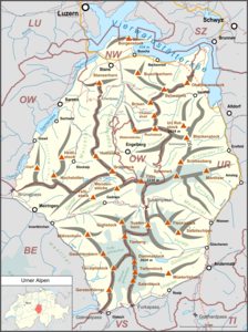
The Brunnihütte is a refuge of the Swiss Alpine Club (SAC) at 1860 m above sea level. M. am Härzlisee in Brunni in the municipality of Engelberg in the canton of Obwalden in Switzerland .
The hut was built in 1932 with 35 seats, whereby it was still assumed that the hut was located at an altitude of 1900 meters (a wooden sign on today's hut still shows this height). It is probably the only SAC hut with its own chairlift station. Since 2000, the hut has also been located on a lake, the Härzlisee, a storage facility for making snow on the ski slopes in the Brunni area.
Via ferratas on the Rigidalstock
A total of four via ferrata routes start from the Brunnihütte. The two via ferratas Rigidalstockwand (K3-4) and Rigidalstockgrat (K3) run in the west and south flanks of the Rigidalstock at an altitude of 2593 m . Another via ferrata for beginners is the Brunnistöckli via ferrata (K2). The Zittergrat is the most difficult via ferrata (K4) starting at Brunnihütte.
| Via ferrata | level | scale | Approach | Ascent | descent | Total |
|---|---|---|---|---|---|---|
| Brunnistöckli | light | K2 or B | 15 minutes | 45 min | 20 min | 1 h 20 min |
| Rigidalstock ridge | medium | K3 or B / C | 90 min | 60 min | 90 min | 4-4.5 h |
| Rigidalstock wall | difficult | K3-4 or C | 90 min | 90 min | 90 min | 4.5-5 h |
| Quiver ridge | very difficult | K4 or C / D | 5 min | 35 min | 20 min | 1 h |
See also
Web links
- Website of the Brunnihütte
- Website of the Brunni-Bahnen
- Your mountains : Brunnihütte - mountaineering & hiking portal


