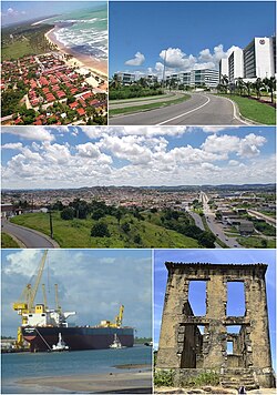
Cabo de Santo Agostinho
| Município de Cabo de Santo Agostinho "Terra do Descobrimento do Brasil"
Cabo de Santo Agostinho
|
|||
|---|---|---|---|
|
|
|||
| Coordinates | 8 ° 17 ′ S , 35 ° 2 ′ W | ||
 Location of the municipality in the state of Pernambuco Location of the municipality in the state of Pernambuco
|
|||
| Symbols | |||
|
|||
|
Motto "Hinc natum Brasilia" Here Brazil was born |
|||
| founding | February 15, 1812 (town charter) (age 208) | ||
| Basic data | |||
| Country | Brazil | ||
| State | Pernambuco | ||
| ISO 3166-2 | BR-PE | ||
| Metropolitan area | Recife metropolitan area | ||
| height | 29 m | ||
| Waters | Atlantic Ocean | ||
| climate | tropical, As | ||
| surface | 445.3 km² | ||
| Residents | 185,025 (2010) | ||
| density | 415.5 Ew. / km² | ||
| estimate | 207,048 (July 1, 2019) | ||
| Parish code | IBGE : 2602902 | ||
| Post Code | 54510-000 | ||
| Telephone code | (+55) 81 | ||
| Time zone | UTC −3 | ||
| politics | |||
| City Prefect | Lula Cabral (2017-2020) | ||
| economy | |||
| GDP | 9,964,401 thousand R $ 48,689 R $ per person (2017) |
||
| HDI | 0.686 (medium) (2010) | ||
Cabo de Santo Agostinho , officially Município de Cabo de Santo Agostinho , is a city in the Brazilian state of Pernambuco and belongs to the metropolitan area of Recife .
Sons and daughters
- Ricardo Brennand (1927–2020), billionaire, entrepreneur, engineer, museum founder and art collector
- Emanuela de Paula (* 1989), model
- Antônio Fernando Saburido (* 1947), Roman Catholic religious priest, Archbishop of Olinda e Recife
Web links
Commons : Cabo de Santo Agostinho - collection of images, videos and audio files
- City Prefecture website , Prefeitura Municipal (Portuguese)
- City Council website , Câmara Municipal (Brazilian Portuguese)
- Instituto Brasileiro de Geografia e Estatística (IBGE): Pernambuco: Cabo de Santo Agostinho , statistical information (Portuguese)


