Charing Cross
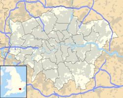
Location of Charing Cross in Greater London |
Charing Cross is a historic crossroads in the center of the British capital, London . The name comes from the small village of Charing, where King Edward I had a memorial cross built in 1290 . Charing Cross is officially the center of London, but is not in the old city center , but in the City of Westminster directly south of Trafalgar Square . The streets The Mall , beach , Whitehall and Cockspur Street intersect at the point.
history
Edward I had the cross erected to commemorate his late wife Eleanor of Castile . Charing Cross was the last of twelve places where Eleanor's coffin was kept overnight during the funeral procession from Lincolnshire to Westminster , about half a mile north of the final resting place. Eduard had an Eleanor cross erected at each location, three of which have survived to this day. The cross that stands in front of London Charing Cross station is a Victorian-style copy made in 1863 by the architect Edward Middleton Barry , which is much larger and more richly decorated than the original, which was destroyed in 1647. The original cross was originally located a few hundred meters away by the village of Charing at the top of Whitehall and south of Trafalgar Square . A statue of King Charles I by Hubert Le Sueur has stood there since 1675 .
In 1554 Charing Cross was the site of the final battle of Wyatt's Rebellion when Thomas Wyatt tried to overthrow Queen Mary I of England and replace it with Lady Jane Gray. Because several bridges were closed, the route of Wyatt's army from Kent led via St. Martin's Lane to Whitehall. 1000 men under Sir John Gage successfully defended Charing Cross.
It used to be assumed that the name Charing came from the French chère reine ("beloved queen"). Today it is certain that the name comes from the old English cearring (cf. Kehre ), which means a river bend; at the old village of Charing, the Thames bends 90 degrees to the east.
Official center
Distances to other locations are usually measured from the point where the original Eleanor's Cross was once erected. Various laws were passed in the 19th century defining Charing Cross as the center of the scope. For example, in 1828 it was decided that the newly formed Metropolitan Police would be responsible for all areas within a twelve-mile radius of Charing Cross; this area was expanded another three miles in 1839. The building zone regulations issued in 1845 also defined a radius of twelve miles.
Since the founding of Greater London in 1965 at the latest , Charing Cross has been completely out of use as a reference point. The only exception is the taxi license exam: aspiring taxi drivers must memorize all streets within a six-mile radius of Charing Cross.
traffic
Nearby underground stations:
Nearby train stations:
Web links
Individual evidence
Coordinates: 51 ° 30 '26 " N , 0 ° 7' 39" W.


