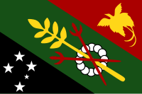
Chimbu Province
| Chimbu | |
|---|---|

|
|
| geography | |
| Country: | Papua New Guinea |
| Waters: | Pacific Ocean |
| Islands: | ( located in New Guinea ) |
| Geographical location: | 6 ° 26 ′ S , 145 ° 0 ′ E |
| Basic data | |
| Surface: | 8476 km² |
| Residents: | 376.473 |
| Population density: | 44 inhabitants / km² |
| Capital: | Kundiawa |
| Situation map | |
Chimbu (also Simbu ) is one of the 21 provinces of Papua New Guinea . This province is 8,476 km² in size, making it the smallest of the highland provinces. With its 376,473 inhabitants in 2011, it is also the most densely populated. The capital is Kundiawa with 10,833 inhabitants.
geography
Chimbu has a landscape rich in contrasts that many have described as attractive: wild, high mountain ridges, many forests and wide fertile valleys with terraced gardens and coffee plantations . The highest mountain is Mount Wilhelm and is part of the Bismarck Mountains . The mountain was named in 1888 by the German journalist and explorer Hugo Zöller after Wilhelm von Bismarck, a son of Reich Chancellor Otto Fürst von Bismarck. At 4509 meters, it is the highest mountain in Papua New Guinea.
history
Due to tribal wars and hostilities against European conquerors, Chimbu was a forbidden territory for Europeans for a long time. It wasn't until 1957 that the ban was lifted, and in 1966 Chimbu became a separate province and split off from Eastern Highlands .
The neighboring provinces are Eastern Highlands in the east, Madang in the north, Jiwaka in the west and the Gulf and Southern Highlands in the south.
population
Chimbu is mainly home to two ethnic groups, the Kuman and the Chimbu , who are related to them and after whom the province was named. When Europeans first came to the area in 1933, the locals kept shouting the word Chimbu to them, an expression of joy, astonishment and approval similar to hurray .
The Chimbu are small and stout and were described in older literature as semitic -looking because of their facial features and long, sharp noses .
Districts and LLGs
Chimbu Province is divided into six districts. Each district consists of one or more "areas at the local administrative level", Local Level Government (LLG) Areas , which are divided into Rural (rural) or Urban (urban) LLGs.
| District | Administrative center | Designation of the LLG areas |
|---|---|---|
| Chuave district | Chuave | Chuave Rural |
| Elimbari Rural | ||
| Siane Rural | ||
| Gumine District | Gumine | Bomai-Kumai Rural |
| Gumine Rural | ||
| Mount Digine Rural | ||
| Karimui-Nomane District | Karimui | Karimui Rural |
| Nomane rural | ||
| Salt Rural | ||
| Kerowagi District | Kerowagi | Gena-Waugla Rural |
| Kerowagi Rural | ||
| Kup Rural | ||
| Kundiawa-Gembogl District | Kundiawa | Kundiawa Urban |
| Mount Wilhelm Rural | ||
| Niglkande Rural | ||
| Waiye Rural | ||
|
Sina Sina-Yonggomugl District (Sinasina-Yonggomugl District) |
Yonggomugl | Sinasina Rural |
| Suwai Rural | ||
| Yonggomugl Rural |
literature
- Heiner Wesemann: Papua New Guinea. Niugini. Stone Age Cultures on the Way to the 20th Century. DuMont, Cologne 1985, ISBN 3-7701-1322-5 ( DuMont culture travel guide in the series DuMont documents ).

