Coney Island (Bermuda)
| Coney Island | ||
|---|---|---|
|
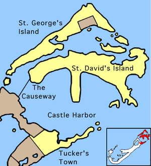
Location of Coney Island in St. George's Parish (center, far left). |
||
| Waters | Atlantic Ocean | |
| Archipelago | Bermuda | |
| Geographical location | 32 ° 21 '30 " N , 64 ° 42' 55" W | |
|
|
||
| length | 250 m | |
| width | 230 m | |
| surface | 6 ha | |
| Highest elevation | 1 m | |
| Residents | uninhabited | |
Coney Island is an island of Bermuda , located on the western edge of Castle Harbor between the southwest tip of Saint George's Island and the northeast tip of Grand Bermuda , the main Bermudian island.
From Grand Bermuda a 200 meter long roadway , interrupted by a narrow bridge ( Groto Bay Bridge ), leads to small Coney Island. Since the old railway bridge to Saint George's Island has been destroyed, the islands to the east in Saint George's Parish can only be reached by water from here . An alternative is the continuous road The Causeway , which is 800 meters east of Coney Island and leads to the airport on Saint David's Island .
The island's name is derived from Coney , the English name for the Caribbean jeweled perch ( Cephalopholis fulva ), a species of Cephalopholis fish from the group of groupers , which is found in large numbers in the area around Coney Island.


