
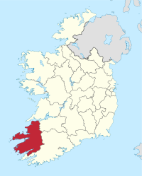
County Kerry
| map | |
|---|---|
  |
|
| Basic data | |
| Country: | Ireland |
| Administrative headquarters: | Tralee |
| Province: | Muenster |
| Irish name: | Ciarraí |
| Surface: | 4735 km² |
| Residents: | 147,554 (2016) |
| License Plate: | KY |
Kerry ( Irish County Kerry ) is a county ( county ) in the southwest of the province of Munster in the Republic of Ireland .
The Irish name of Kerry is derived from Ciar . This legendary Ciar was a son of Fergus , King of Ulster . According to legend, the descendants of Ciar settled in this part of Munster . Unofficially, Kerry is also known as The Kingdom ( An Ríocht ), the capital (County Town) is Tralee .
geography
The scenic character of Kerry is largely determined by the Atlantic coast . It is characterized by many peninsulas, small bays and offshore islands. The most important peninsulas are the Dingle Peninsula , Iveragh Peninsula and the Beara Peninsula , which is largely part of Cork . The most important offshore islands include the Blasket Islands , the Skelligs with the largest island Skellig Michael and Valentia Island . In Kerry is the Carrantuohill , at 1041 meters the highest mountain in Ireland. It is part of the Macgillycuddy's Reeks mountain range on the Iveragh Peninsula. The 952 meter high Mount Brandon north of Dingle is also one of the highest mountains in Ireland.
history
The first human traces in the area of the county date back to the Bronze Age , around 2500 BC. It is clear, however, that the area was settled earlier. Mining was already practiced in the mountains in pre-Christian times. From the 5th century, Christianity spread to Kerry. About one hundred monasteries, hermitages and prayer houses have been documented for the 6th and 7th centuries. Many of these early Christian sites are still preserved as ruins. Among the most famous are the island of Skellig Michael and the ruins of the monastery of Ardfert and Kilmalkedar . Before the county system was established between the 13th and 16th centuries, Kerry consisted of clan territories, the Tuaithe (sing. Tuath ). In ancient times the area was divided among the clans Ciarraige, Corcu Duibne, Uí Cairpri Luachra and Éoganacht Locha Lein. In the early Middle Ages, there were small kingdoms that were under the sovereignty of the Kingdom of Munster , based in Cashel in County Tipperary . After the Anglo-Normans arrived in the late 12th century, O'Connor held the northern Kerry, the O'Moriaritys the center and O'Sullivan, O'Donoghues and O'Mahonies the south. The O'Falvays and O'Sheas controlled the Iveragh and Dingle Peninsulas .
In the early 13th century, the Norman Fitzgerald family, the Earls of Desmond, established fortified bases in the Castleisland and Tralee areas , such as Carrigafoyle Castle . They brought English settlers to Kerry. Until the end of the 16th century, the Desmonds retained a certain degree of independence. It ended with the centralization efforts of the late Elizabethan epoch. After unsuccessful rebellions , the last Earl of Desmond lost his life and land. As a result, the county was created in its current boundaries in 1606. The last Irish families lost their political and economic influence in the wars of the 17th century. At the end of the 18th century, Irish Catholic families began the political struggle for their equality. The most famous representative of this fight was Daniel O'Connell , who is from the Iveragh Peninsula. Due to the great famine of the 1840s and the ensuing waves of emigration, the county lost nearly two-thirds of its population. During the 19th century, Kerry was one of the few sanctuaries where the Irish language, literature and music were preserved.
The Legend of Kerry
According to the legend, which roughly reflects the chronological sequence correctly, the first clan was around 500 BC. The Ciarraige, a Pictish tribe who came from Sligo and Roscommon , settled in Kerry . According to the same legend, however, they are descended from Ciar, the son of Queen Medb . Ciarraige means "royalty of those of Ciar". They established their headquarters in Castleisland . Despite their largely autonomous position, the Ciarraige paid tribute to the King of Munster , who had his seat in Cashel . A subclan of the Ciarraige was exiled to Connacht between 555 and 577 AD . Similar banishes followed more than 1000 years later by Oliver Cromwell . According to this legend, the Firbolg came later than the Ciarraige to the region. The group that settled in Nordkerry came to be known as the Corcu Duibne. You were artistically gifted and are believed to be responsible for developing the Ogham script. Ogham stones once stood all over the Dingle Peninsula . You can still see some examples on site: Ballintaggart , Tullygarran or Chute Hall, Gallarus Oratory , Kilmalkedar Church and Ratass. The Corcu Duibne also had impressive architectural skills. They built the spectacular Promontory Forts Caherconree and Dunbeg Fort . The Milesians were the third group to settle in the region. According to legend, they are said to be Ireland around 100 BC. Have conquered. The last historically documented immigration took place in 2500 BC. By the people of the bell beaker culture . After landing at Waterville , the Milesians fought several battles against the mythical Túatha Dé Danann , culminating in the Battle of Sliabh Mis , which the Milesians won. Her Queen Scota was killed and buried in a valley above Tralee. The area is now known as Glen Scota, and the Queen's tomb is believed to be under ancient stones.
economy
Kerry's economy is still dominated by agriculture today. The land is mainly used as pastureland. In the lowlands between the Tralee and the Shannon estuary, you will find mainly cattle and dairy farming. Sheep are mainly raised on the mountainous peninsulas and in the southeast. In addition to animal husbandry, fishing plays a major role. By far the most important fishing port is Dingle . In addition, Castlegregory , Fenit and Valentia Island have a certain meaning. Approximately 8% of Ireland's catch is landed in Kerry. In the confluence of the Kenmare River and Tralee Bay, shellfish breeding is practiced on a large scale.
The county's few industrial operations are concentrated in the capital Tralee (approx. 23,000 inhabitants) and in Killarney, which is about half the size . The best-known company with headquarters in Tralee is the Kerry Group , one of the largest producers of food worldwide. The newly created Kerry Technology Park in Tralee in the immediate vicinity of the Tralee Institute of Technology is intended to attract promising technology companies.
Overall, however, Kerry is still one of the poorest Irish counties. In 2003, the average disposable income per person was only 86% of the national average. This means the penultimate place among all counties.
However, Kerry has also benefited from the Irish economic boom over the past twenty years and tourism in particular is playing an explosively increasing role in Kerry's economic strength.
politics
The distribution of seats in Kerry County Council after the local elections on May 23, 2014:
| Political party | Seats |
|---|---|
| Fine Gael | 9 |
| Fianna Fáil | 9 |
| Sinn Féin | 5 |
| Labor Party | 2 |
| South Kerry Independent Alliance | 1 |
| Non-party | 7th |
Kerry sends five MEPs to the Irish Parliament ( Dáil Éireann ); In the last election in 2016, Fianna Fáil, Fine Gael and Sinn Féin each won one seat. The brothers Michael Healy-Rae and his older brother Danny Healy-Rae were elected as independent candidates. Danny Healy-Rae was first elected to Parliament in 2016, Michael Healy-Rae was re-elected. Her late father, Jackie Healy-Rae, was a farmer in Kilgarvan and also a member of parliament.
Cities
- Tralee
- Killarney
- Listowel
- Killorglin
- Castleisland
- Kenmare
- Ballybunion
- Cahersiveen
- Dingle
- Kilcummin
- Rathmore
- To Coireán
- Tarbert

Attractions


The many attractions make Kerry one of the main attractions for tourists in Ireland. Killarney (start of the Kerry Way ) is a center of Irish tourism and has the highest number of beds in the country after Dublin . The main attractions include:
- prehistoric monuments ( Cahergal , Caherconree , Cahermore , Cashelkeelty , Cathair an Lóthair , Cathair Crobh Dearg , Coom , Dromagorteen , Dunbeg Fort , Eightercua , Kenmare , Leacanabuaile , the Lissyviggeen , Loher Fort and Staigue Fort ),
- various beehive huts , castles , forts , high crosses , churches and monasteries ( Kilmalkedar , Raingiléis and Reask ), menhirs , ( Ballineetig ) ogham stones , round towers , rock carvings ( Derrynablaha ) and basements ,
- the Dingle Peninsula with Connor Pass and Inch Beach
- the Iveragh Peninsula with the Ring of Kerry and the McGillycuddy's Reeks , Ireland's highest mountains,
- the Killarney National Park is home to the oldest oak forests of Ireland,
- the Derrynane National Historic Park ,
- the Ring of Beara , the smaller brother of the Ring of Kerry ,
- Skellig Michael is because of his medieval monastery one of the UNESCO recognized World Heritage Site ,
- the Crag Cave ,
- the Blasket Islands , Ross Island , Beginish Island
- the Promontory Fort Binn na bPórt ,
- the Gallarus Oratory , Ballymorereagh
traffic
The two main road links to and from Kerry are the N21 from Limerick and the N22 from Cork. They both end in Tralee. The N70, largely identical to the famous Ring of Kerry coastal road , circles the Iveragh Peninsula from Kenmare and leads via Killorglin to Cork. The N71 connects Killarney to West Cork. The N72 is a cross connection from Killorglin via Killarney to north Cork. The bus connections between the larger towns are operated by Bus Éireann ; Killarney and Tralee are central transfer points.
Of the once extensive rail network in Kerry, only the route from Tralee via Killarney to Mallow in County Cork remains. From there there are connections to Dublin and Cork. The remaining connections were shut down between 1950 and 1970. There used to be rail connections from Tralee via Listowel to Limerick or from Farranfore to Valentia. The Dingle Peninsula was connected to the rail network with a narrow-gauge railway. A small section of this route between Tralee and Blennerville was operated for tourists until around 2010.
Since 1989, County Kerry has also been accessible via Kerry Airport ( IATA code “KIR”), which is 20 kilometers north of Killarney near Farranfore . From Germany there several times a week flights from Hahn and from Berlin-Schoenefeld with Ryanair . Other destinations are London Luton , London Stansted and Dublin .
From Tarbert , on the N69 from Tralee to Limerick, there is a ferry service across the Shannon to Killimer in County Clare . It saves the approximately 140 km detour via Limerick.
Individual evidence
- ↑ For the mythical warrior king Fergus see also Ulster cycle
- ^ From the pub straight to the parliament, in: NZZ, March 26, 2016, p. 7.
- ^ From the pub straight to the parliament, in: NZZ, March 26, 2016, p. 7.
- ^ From the pub straight to the parliament, in: NZZ, March 26, 2016, p. 7.
literature
- Thomas M. Charles-Edwards: Early Irish and Welsh Kinship . Oxford University Press 1993, ISBN 0-19-820103-6 .
Web links
- County Kerry (English)
- Kerry Airport (english)
- Killarney National Park (English)
- Travel in Western Ireland
- Map of Kerry and Cork (can be enlarged)
- All about Kerry
Carlow |
Cavan |
Clare |
Cork |
Cork (City) ** |
Donegal |
Dublin * |
Dublin (City) ** |
Dún Laoghaire-Rathdown ** |
Fingal ** |
Galway |
Galway (City) ** |
Kerry |
Kildare |
Kilkenny |
Laois |
Leitrim |
Limerick |
Longford |
Louth |
Mayo |
Meath |
Monaghan |
Offaly |
Roscommon |
Sligo |
South Dublin ** |
Tipperary |
Waterford |
Westmeath |
Wexford |
Wicklow
* historic county, ** newly created county
Coordinates: 52 ° 8 ′ N , 9 ° 40 ′ W