Devon Island
| Devon Island | |
|---|---|
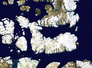
| Satellite photomontage of Devon Island | |
| Waters | Arctic Ocean |
| Archipelago | Queen Elizabeth Islands |
| Geographical location | 75 ° 8 ′ N , 87 ° 52 ′ W |
| surface | 55,247 km² |
| Highest elevation |
Devon Ice Cap in the Treuter Mountains 1920 m |
| Residents | uninhabited |
| main place | Dundas Harbor (historic) |
| US map sheet from 1976 | |
Devon Island is the second largest of the Queen Elizabeth Islands . Like most of the Canadian archipelago, it belongs to the Nunavut Territory .
Geography, geology and climate

The island is separated from Ellesmere Island to the north by Jones Sound and from Baffin Island to the south by Lancastersund . It is bordered by Baffin Bay to the east and the Wellington Channel and Penny Strait to the west . With an area of 55,247 km², it is the largest uninhabited island on earth. Geologically, the island consists mainly of siltstone and slate , which in the east dates back to the Precambrian period .
Most of the island is a 300–500 m high plain, which consists mainly of permafrost . The average annual temperature there is −16 ° C. Only on the northeast coast of the island is a narrow strip with a warmer climate, the Truelove Lowland , which is free of snow for around 45–50 days and has produced highly polar tundra vegetation made of mosses and lichens. In addition to lemmings , you can also find musk ox there all year round . Temperatures of 4–8 ° C are reached there in the summer months.
There are also several mountain ranges of the Arctic Cordillera on the island, including the Treuter Mountains , the Haddington Range and the Cunningham Mountains . The eastern third of the island is covered by an approximately 14,000 km² large ice cap , the Devon Ice Cap , which is up to 880 m thick (according to another source about 500-700 m). There is also the highest point on the island at 1,920 m.
Devon Island is also known for the Haughton Crater ( ⊙ ), which was formed by the impact of a meteorite about 38 ± 2 million years ago and has a diameter of about 20 km.
history
Traces of Paleo-Eskimos have been found on the island, dating back to around 2,500 BC. Were dated. For centuries the island was visited by hunting Inuit.
In modern times, the west coast of the island was discovered in 1616 by William Baffin , who may also have gone ashore. Two years later she was sighted by John Ross . William Edward Parry initially named the island North Devon in 1819 , after the English county of Devon , from which its deputy in command, Matthew Liddon, came. He made the first secure landing on the island.
From 1924 to 1933 and from 1945 to 1951, the Royal Canadian Mounted Police operated an outpost on Dundas Harbor ( ⊙ ). From 1934 to 1936 this was used by the Hudson's Bay Company .
Research projects
The Arctic Institute of North America of the University of Calgary operates a research station on the northeast coast of the island (since 1960 ⊙ ).
The Mars Society leads to the island by a project for which a Mars - Habitat in Canada's cold wilderness was built. The Flashline Mars Arctic Research Station was built near Haughton Crater . The conditions on the island are similar to those on Mars.
Web links
Individual evidence
- ↑ a b c Devon Island. The Canadian Encyclopedia, accessed September 17, 2015 .
- ↑ JA Dowdeswell, TJ Benham, MR Gorman, D. Burgess, MJ Sharp: Form and flow of the Devon Island Ice Cap, Canadian Arctic (PDF; 1.4 MB) . In: J. Geophys. Res. , 109, 2004, F02002, doi : 10.1029 / 2003JF000095 (English)
- ^ Lunar and Planetary Science XXXVI (2005). (PDF; 294 kB) 2005, accessed on July 31, 2009 (English).
- ^ Earth Impact Database. University of New Brunswick, accessed July 31, 2009 .
- ↑ James W. Helmer: The Palaeo-Eskimo Prehistory of the North Devon Lowlands . In: Arctic . tape 55 , December 1991, pp. 301–307 ( Online [PDF; 3.1 MB ; accessed on June 13, 2019]).
- ^ A b c William James Mills: Exploring Polar Frontiers: A Historical Encyclopedia . tape 2 . ABC-CLIO, 2003, ISBN 1-57607-422-6 , pp. 186 f . ( limited preview in Google Book search).


