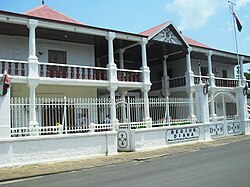
Diana (region)
| Diana | ||
|---|---|---|
 Diana (red) is in northern Madagascar |
||
| Symbols | ||
|
||
| Basic data | ||
| Country | Madagascar | |
| Capital | Antsiranana | |
| surface | 20,942 km² | |
| Residents | 719,000 (2014) | |
| density | 34 inhabitants per km² | |
| founding | 2004 | |
| ISO 3166-2 | MG | |
| The administrative seat of the region | ||
Coordinates: 12 ° 16 ' S , 49 ° 17' E
Diana is one of 22 regions ( Faritra ) of Madagascar in the northern tip of the island and is located on the Mozambique Strait . In 2014, 719,800 people lived in the region. The 22 regions of Madagascar were founded in June 2004. On April 4, 2007, Marc Ravalomanana held a referendum on an amendment to the constitution, which established a new administrative structure without provinces from October 2009. The regions thus became the first administrative unit.
The name of the region was formed from the first letters of the five districts, with the first two letters of the old French name Diego Suarez being used for Antsiranana I and II .
geography
The Diana region has an area of 20,942 km², which is around 3.6% of the island's area. The capital is Antsiranana , which also forms the Antsiranana I district at the same time . Diana borders the Sava region to the east and Sofia to the south . To the west of Diana lies the Mozambique Strait ; in the northeast of the Indian Ocean . The Tsaratanana massif forms the southern border with Sofia with an average altitude of 2200 m. The mountains Maromokotro , at 2876 meters the highest mountain in Madagascar, Tsaravosy (2516 m), Marivorahona (2236 m) are located in this massif. The island of Nosy Be lies in the west off the coast of Diana.
traffic
The route nationale 6 (RN 6) runs through Diana from south to north via Ambanja and Ambilobe to Antsiranana . At Ambilobe, the Route nationale 5a (RN 5a) branches off from the RN 6 in an easterly direction to Vohémar .
nature
The national parks Lokobe , Montagne d'Ambre , Tsaratanana and the nature reserve Manongarivo are located in Diana . The region has a protected forest area of 461,000 hectares. That is 22% of the total area of the region. Half of the area is in the Ambilobe district . Antsiranana II is the second district and has the largest area. There are two primate species from the group of lemurs that have only been seen in Diana so far:
climate
In general, the region has a tropical climate , which is characterized by a cool and dry season from May to November and a wet and hot season from December to April. The average annual temperatures in the region are relatively high all year round. For cities by the sea, the annual average values for Ambanja are between 25 ° C and Antsiranana between 20 ° C and 26 ° C. The coolest months are July and August. There the temperatures in Ambanjabei are 23.5 ° C and in Antsiranana 25.1 ° C. The hottest months are March and April. During these months a temperature of 27.1 ° C in Ambanja and 28.3 ° C in Antsiranana is reached.
Precipitation increases from north to south. The average is 987 mm in Antsiranana and 1295 mm in Nosy Ankao in the east of the region. In Ankarana there is 1500 mm of precipitation while further south in Ambanja there is 2171 mm of precipitation. The dry season in the region becomes shorter the further south you go.
Administrative division
The region is divided into five districts ( Fivondronana ):
Web links
- Information about Diana on the website of the Ministère de l'Economie et du Plan (French)
- Diana Region website ( Memento of March 28, 2010 in the Internet Archive )


