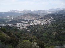
Drymalia
|
Drymalia parish Δημοτική Ενότητα Δρυμαλίας (Δρυμαλία) |
||
|---|---|---|
|
|
||
| Basic data | ||
| State : |
|
|
| Region : |
South Aegean
|
|
| Regional District : | Naxos | |
| Municipality : | Naxos and Lesser Cyclades | |
| Geographic coordinates : | 37 ° 4 ′ N , 25 ° 29 ′ E | |
| Height above d. M .: | 0–1,001 m Aegean – Zas |
|
| Area : | 302.828 km² | |
| Residents : | 5,204 (2011) | |
| Population density : | 17.2 inhabitants / km² | |
| Code No .: | 670203 | |
| Structure: |
1 city district 10 local communities |
|
| Located in the municipality of Naxos and Lesser Cyclades and in the regional unit of Naxos | ||
Drymalia ( Greek Δρυμαλία ( f. Sg. )) Was from 1998 to 2010 a municipality on the Greek island of Naxos within the prefecture of the Cyclades (Νομός Κυκλάδων). The administrative seat was Chalki. With the administrative reform in 2010 , Drymalia was merged with five other municipalities to form the municipality of Naxos and Lesser Cyclades , in which it has since formed a municipality.
location
The municipality of Drymalia occupies about 70% of the island area of the island of Naxos in the north, east and south. The rest of the area is in the municipality of Naxos in the west of the island.
structure
The administrative reform of 1997 following the Ioannis Kapodistrias program led to the formation of the two municipalities of Naxos and Drymalia on December 31, 1998 . The municipality of Drymalia in the east of the island accounted for 302.828 km², just over 70% of the total area.
The Drymalia district is divided into 11 localities, which correspond to the former municipal districts.
The municipality of Drymalia is subdivided into one municipality and ten local communities, which correspond to the former municipal districts.
| District local community |
Greek name | code | Area (km²) | Residents | Settlements (residents) |
|---|---|---|---|---|---|
| Chalkio | Τοπική Κοινότητα Χαλκείου | 67020301 | 9,623 | 543 | Chalki (Χαλκί ( n. Sg. )), 368 Zoodochos Pigi (Ζωοδόχος Πηγή ( f. Sg. )), 174 Rachi (Ράχη ( f. Sg. )), 1 |
| Aperathos | Δημοτική Κοινότητα Απεράθου | 67020302 | 67,956 | 904 |
Aperathos (Απέραθος ( m. Sg. )), 722 Azalas (Αζάλας ( m. Sg. )), 29 Kanaki (Κανάκι ( n. Sg. )), 14 Klido (Κλειδώ ( f. Sg. )), 24 Lygaridia ( Λυγαρίδια ( n. Pl. )), 23 Moutsouna (Μουτσούνα ( f. Sg. )), 84 Panermos (Πάνερμος ( m. Sg. )), 8 |
| Damarionas | Τοπική Κοινότητα Δαμαριώνος | 67020303 | 32.274 | 507 | Damarionas (Δαμαριώνας ( m. Sg. )), 333 Agiassos (Αγιασσός ( f. Sg. )), 83 Vouvouria (Βουρβουριά ( f. Sg. )), 11 Damalas (Δαμαλάς ( m. Sg. )), 32 Pyrénées Πυργάκι ( n. Sg. )), 48 |
| Danakos | Τοπική Κοινότητα Δανακού | 67020304 | 9,848 | 68 | Danakos (Δανακός ( n. Sg. )), 68 |
| Keramoti | Τοπική Κοινότητα Κεραμωτής | 67020305 | 5.575 | 58 | Keramoti (Κεραμωτή ( f. Sg. )), 58 |
| Coronis | Τοπική Κοινότητα Κορωνίδος | 67020306 | 42.310 | 594 | Koronis (Κορωνίς ( f. Sg. )), 279 Agia (Αγιά ( f. Sg. )), 31 Apollonas (Απόλλωνας ( m. Sg. )), 129 Kambos (Κάμπος ( m. Sg. )), 31 Myrsis ( Μυρίσης ( m. Sg. )), 55 Taxiarchis (Ταξιάρχης ( m. Sg. )), 22 Faraklo (Φαρακλό ( n. Sg. )), 5 Chilia Vrysi (Χίλια Βρύση ( f. Sg. )), 42 |
| Koronos | Τοπική Κοινότητα Κορώνου | 67020307 | 21.720 | 647 | Koronos (Κόρωνος ( f. Sg. )), 526 Argokiliotissa (Αργοκοιλιώτισσα ( f. Sg. )), 26 Atsipati (Ατσιπάπη ( f. Sg. )), 15 Lionas (Λιώνας ( m. Sg. )), 80 |
| Mesi | Τοπική Κοινότητα Μέσης | 67020308 | 6,900 | 97 | Mesi (Μέση ( f. Sg. )), 97 |
| Moni | Τοπική Κοινότητα Μονής | 67020309 | 6.475 | 216 | Moni (Μονή ( n. Sg. )), 216 Sifones (Σίφωνες ( f. Pl. )), Uninhabited |
| Skando | Τοπική Κοινότητα Σκαδού | 67020310 | 7.574 | 83 | Skando (Σκαδό ( n. Sg. )), 83 |
| Filoti | Δημοτική Κοινότητα Φιλοτίου | 67020311 | 92.573 | 1,487 | Filoti (Φιλότι ( n. Sg. )), 1.477 Kalandos (Καλαντός ( m. Sg. )), 10 |
| total | 670203 | 302.828 | 5,204 | ||
Web links
- ΔΑΦΝΗ - Δίκτυο Αειφόρων Νήσων του Αιγαίου, Νάξος , Greek (.pdf 3.3 MB)
Individual evidence
- ↑ Νάξος - Naxos, 1: 40,000 (Map 311) . ΣΚΑΪ, Nea Ionia , Athens 2009.
- ↑ Results of the 2011 census, Greek Statistical Office (ΕΛ.ΣΤΑΤ) ( Memento from June 27, 2015 in the Internet Archive ) (Excel document, 2.6 MB)


