El Meco
Coordinates: 21 ° 12 ′ 40 " N , 86 ° 48 ′ 14" W.
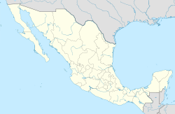
El Meco is a Maya ruin site in the Mexican state of Quintana Roo on the east side of the Yucatán Peninsula on the Caribbean coast.
geography
The ruins of El Meco are located about eight kilometers north of downtown Cancun at 2.7 kilometers directly on Carretera Puerto Juárez – Punta Sam . The road cuts through the archaeological site.
The ruins of El Meco are located on the mainland part of the municipality Isla Mujeres, directly opposite the island of Isla Mujeres .
The original Maya name of the settlement is unknown. The name El Meco is said to be derived from the owner of a coconut plantation.
The place was of great importance for shipping, especially as a point of orientation for coastal navigation and inland lagoon navigation, and also because of its strategically favorable location directly opposite Isla Mujeres. It is very likely that El Meco was also the port of communication with the island.
history
The settlement of the site very likely already took place in the early Maya Classical period (250–600 AD), as can be deduced from cultural remains below structure 2. The place was probably a small fishing village, possibly under the influence of Cobá . The site was abandoned by 600 AD and remained so until 1000 or 1100 AD. After the resettlement in the post-classical period (900–1500 AD), there were very likely close ties to Chichén Itzá , later to I paa .
From around AD 1200, against the background of the decline of the large inland cities, coastal trade began to develop increasingly. El Meco benefited from its strategically extremely favorable port and the rich resources of the region. The place gained increasing political and economic importance.
Within the coastal trade network, El Meco became one of the most important ports on the Caribbean coast, along with the south-facing towns of Xcaret , Xel Há , Tancah / Tulum and Muyil . In addition to its position as a trading center, it developed into an important religious center. With the arrival of the Spanish in the 16th century, the site was quickly abandoned by the Maya.
El Meco is associated with Belma , a place that the Spaniard named Montejo and where he lived for several months in 1528. It has not yet been clarified whether this is one and the same place.
archeology
During the archaeological excavations, 14 structures with a main temple were uncovered. The so-called Castillio is a five-tier pyramid and with a height of 17 m it is the largest Mayan building in the region. The buildings are part of the religious area of El Meco. Most of them are in good condition.
During the excavations, ceramic shards were found on a historical rubbish heap underneath Structure 2, dating from 400 to 600 AD and from around 1000 AD.
The remains of the port facility on the other side of the street are said not to have been systematically excavated.
See also
literature
Peter J. Schmidt: Excavación de la estructura 1 y de los altares A y B de El Meco . In: Antonio P.Andrews, Fernando Robles Castellanos (ed.): Excavaciones arqueológicas en El Meco, Quinatan Roo, 1977 . Mexico, INAH 1986. ISBN 968-6038-48-5
Web links
- Main page of the INAH Instituto Nacional de Antropología e Historia (Spanish).
- INAH - Mapa de localisación : Interactive map of the archaeological sites of Mexico with information about the site, accessed on May 18, 2011 (Spanish).
Individual evidence
- ↑ INAH description of El Meco , accessed on May 18, 2011 (Spanish)
- ↑ Tsubasa Okoshi Harada, Lorraine A. Williams-Beck, Ana Luisa Izquierdo (ed.): "Nuevas perspectivas sobre la geografía política de los mayas." México DF, UNAM, 2006, p. 88. on Google Books, accessed on September 11, 2009 (English / Spanish).


