Entraigues (Puy-de-Dôme)
| Entraigues | ||
|---|---|---|
|
|
||
| region | Auvergne-Rhône-Alpes | |
| Department | Puy-de-Dôme | |
| Arrondissement | Riom | |
| Canton | Aigueperse | |
| Community association | Riom Limagne et Volcans | |
| Coordinates | 45 ° 53 ' N , 3 ° 16' E | |
| height | 307-341 m | |
| surface | 9.72 km 2 | |
| Residents | 661 (January 1, 2017) | |
| Population density | 68 inhabitants / km 2 | |
| Post Code | 63720 | |
| INSEE code | 63149 | |
| Website | http://www.entraigues63.fr/ | |
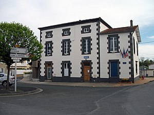
 Mairie |
||
Entraigues is a French municipality with 661 inhabitants (at January 1, 2017) in the department of Puy-de-Dôme in the region Auvergne Rhône-Alpes . It belongs to the arrondissement of Riom and the canton of Aigueperse . The name of the municipality is derived from the location between the two rivers Ambène and Bedat , which surround the place. Entraigues is located in Limagne , a flat to slightly hilly landscape whose fertile soil is ideal for agriculture.
history
Entraigues was owned by the Balzac family (Balzac d'Entragues).
Population development
- 1962: 402
- 1968: 407
- 1975: 370
- 1982: 474
- 1990: 563
- 1999: 566
- 2011: 625
Web links
Commons : Entraigues - collection of images, videos and audio files
