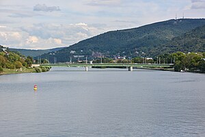
Ernst Walz Bridge
Coordinates: 49 ° 24 ′ 38 " N , 8 ° 40 ′ 36" E
| Ernst Walz Bridge | ||
|---|---|---|
| Ernst Walz Bridge from the west | ||
| use | Road bridge, tram, pedestrian and bike path | |
| Crossing of | Neckar , B 37 | |
| place | Heidelberg | |
| construction | Girder bridge | |
| overall length | 217.00 m | |
| width | 27.00 m | |
| Longest span | 69.00 m | |
| completion | 1928/1950 | |
| location | ||
|
|
||
The Ernst-Walz-Brücke is the third of the central Neckar bridges in Heidelberg, after the Karl-Theodor-Brücke ( "Old Bridge" ) and the Theodor-Heuss-Brücke , formerly Friedrichsbrücke. It connects the districts of Bergheim and Neuenheim .
history
The Ernst Walz Bridge was opened to traffic on April 14, 1928 as the third road bridge over the Neckar near Heidelberg. Originally it was supposed to connect the planned central cemetery in Neuenheimer Feld , but later this area was used for other purposes. It is named after the former mayor of Heidelberg, Ernst Walz (1859–1941). From 1933 to 1945 it was called the Hindenburg Bridge . Like the other bridges in Heidelberg, it was blown up by the Wehrmacht on March 29, 1945 on their retreat, the day before the American 63rd Infantry Division marched into the city, and rebuilt in 1950.
location
The bridge is about 1200 m below the Theodor-Heuss-Brücke and is the southern approach to Neuenheimer Feld with the faculties of Heidelberg University and parts of the university hospital .
It is located on an important north-south traffic axis, which comes from Berliner Straße in the north and continues on Mittermaierstraße in the south .
The Wieblingen weir and the beginning of the Wieblingen side canal are located about 600 m downstream .
Web links
- Erst-Walz-Brücke , www.brueckenweb.de
- Ernst Walz Bridge. In: Structurae
| Upstream | Crossing the Neckar | Downstream |
| Theodor Heuss Bridge | Ernst Walz Bridge |
Weir Wieblingen |

