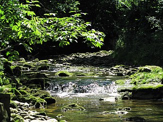
Eyach (bunting)
| Eyach | ||
|
The Eyach near the village of Eyach |
||
| Data | ||
| Water code | EN : 16414 | |
| location | Bavaria , Germany | |
| River system | Danube | |
| Drain over | Ammer → Amper → Isar → Danube → Black Sea | |
| origin | Confluence of Röthenbach and Dorfbach , east of Böbing 47 ° 45 ′ 13 ″ N , 11 ° 0 ′ 5 ″ E |
|
| Source height | approx. 730 m above sea level NN | |
| muzzle | in the Ammer , near Oberhausen Coordinates: 47 ° 47 '2 " N , 11 ° 6' 27" E 47 ° 47 '2 " N , 11 ° 6' 27" E |
|
| Mouth height | approx. 575 m above sea level NN | |
| Height difference | approx. 155 m | |
| Bottom slope | approx. 11 ‰ | |
| length | 13.9 km | |
The Eyach is an approximately 14 km long right tributary of the Ammer in the Weilheim-Schongau district in Upper Bavaria .
course
The Eyach is created by the confluence of the Dorfbach and Röthenbach east of Böbing . After the union of the two source streams, the Eyach initially turns east and flows through the hamlet of Ajamühle. It continues to flow in a south-easterly direction and turns to north-east after about 7 km. It meanders further north and flows into the Ammer near Oberhausen .
Tributaries
- Dorfbach (left source stream)
- Röthenbach (right source stream)
- Kohlbach (left)
- Schustergraben (left)
- Vogelbach (right)
- Kühgraben (right)
Individual evidence
- ↑ GeoFachDatenAtlas and water services of the Bavarian State Office for the Environment
