
Finow
| Finow | ||
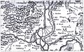
 Finowfließ, in the background the Great Samithsee near Finowfurt |
||
| Data | ||
| Water code | DE : 696264 | |
| location | Brandenburg , Germany | |
| River system | Or | |
| Drain over | Finow Canal → Alte Oder → Hohensaaten-Friedrichsthaler Wasserstraße → Oder → Stettiner Haff | |
| source | as an outflow of the Regesesees west of Biesenthal 52 ° 45 ′ 45 ″ N , 13 ° 36 ′ 47 ″ E |
|
| Source height | 41 m | |
| muzzle | west of Finowfurt in the Finow Canal Coordinates: 52 ° 50 '43 " N , 13 ° 38' 56" E 52 ° 50 '43 " N , 13 ° 38' 56" E |
|
| Mouth height | 32 m | |
| Height difference | 9 m | |
| Bottom slope | about 0.66 ‰ | |
| length | about 13.7 km | |
| Discharge at the Biesenthal gauge, Wehrmühle UP A Eo : 138 km² Location: 11.1 km above the mouth |
NNQ (06.10.1999) MNQ 1966–1999 MQ 1966–1999 Mq 1966–1999 MHQ 1966–1999 HHQ (05.08.1974) |
118 l / s 354 l / s 783 l / s 5.7 l / (s km²) 2.55 m³ / s 6.21 m³ / s |
| Drain |
MQ |
3 m³ / s |
| Left tributaries | Boggy Pregnitz flow | |
| Right tributaries | Sydower Fliess | |
| Small towns | Biesenthal | |
| Communities | Schorfheide | |
The Finow [ ˈfiːnoː ] is an approximately 14 km long remnant of an originally approximately 45 km long left tributary to the Oder in northeast Brandenburg . It ends today at Finowfurt , from where the next part to Niederfinow was expanded to become the Finow Canal and given its name. There are only a few old river parts left parallel to the canal. They and the lower, partially drained, approximately 9 km long remainder to the Oder-Havel Canal near Oderberg are still called Alte Finow .
course
The Finow has its beginning west of Biesenthal in the Barnim district as an outflow of the Regesesees , whose tributaries are the Hellmühler Fliess and the Rüdnitzer Fliess . It is about 13.7 kilometers long and flows into the Finow Canal west of Finowfurt . The length of the longest flow path (with Hellmühler Fließ) is around 21 kilometers.
The watercourse from the preserved upper course and Finow Canal is also known as the Finow River , which gives the region its name for the water and soil association .
Original course
The Finow originally flowed east of Niederfinow into the Oder. After the Oder Canal was built in the middle of the 18th century, the Oder no longer flowed around the island of Neuenhagen . The Finow now flows into an oxbow lake of the Oder, which was added to the Finow after a few generations and is still called Alte Finow today. The mouth was thus on the Oderberger See (also an oxbow lake) between Liepe and Oderberg .
Its lower course was canalized between 1603 and 1620 and became part of the Finow Canal. Between the former brass works harbor and below the Heegermühler lock, parts of the first Finow Canal and the brass works ditch in the former river bed of the Finow have been preserved.
Another part of the Alte Finow has been preserved in Niederfinow south of the Finow Canal, and a longer section further east at the Liepe pumping station .
Glacial valley
The Finow leads past the Biesenthal military mill and reaches the Eberswalde glacial valley a little north of the city . As a special feature, the river uses the glacial valley against the original flow direction. It flows east; the glacial stream flowed west. The cause is the very low-lying Oderbruch , which attracted the drainage, as well as dead ice blocks in the urban area of Eberswalde , which created basins with their damming, which also diverted the river to the east.
tourism
A very well developed cycle path ( towpath ) makes it possible to follow the course of the Finow and get an impression of the landscape and nature.
photos

The former Finow at the Heegermühler Schleuse (today Finow Canal)
The Finow in the 17th century

Railway bridge over the Finow

The Alte Finow at the Liepe pumping station


literature
in order of appearance
- Rudolf Schmidt : The Finow Canal. On the history of its development (= messages from the Eberswalde Association for Local History Association , 11th year 1938).
- Ernst Badstübner : Brandenburg. Between the Elbe and the Oder - art and history of the north German interior . DuMont Buchverlag, Cologne 1993.
- Ilona Rohowski: Monument topography Federal Republic of Germany. Monuments in Brandenburg - Barnim district - Eberswalde town . Wernersche Verlagsgesellschaft, Worms am Rhein, 1997, ISBN 3-88462-136-X .
- Carsten Seifert, Harald Bodenschatz, Werner Lorenz: The Finowtal in Barnim. Cradle of the Brandenburg-Prussian industry . Published by the city of Eberswalde. Transit, Berlin 1998, ISBN 3-88747-136-9 .
- Karin Friese: Paper mills in the Finowtal. The history of the paper mills and paper mills from the 16th to the 20th century . Booklet accompanying the special exhibition as part of the “Kulturland Brandenburg 2000” project (= local history articles , published by the Eberswalde City and District Museum, issue 5). Museum in the Adler pharmacy, Eberswalde 2000.
Web links
Individual evidence
- ↑ a b c d Measured with Google Earth
- ^ German Hydrological Yearbook Elbe Region, Part II 1999 Brandenburg State Environment Agency, p. 207, accessed on November 3, 2018, at: lugv.brandenburg.de (PDF, German).
- ^ Establishing the continuity at barrages of federal waterways ( Memento from January 20, 2013 in the Internet Archive ) Federal Institute for Hydrology; Koblenz; 2010; On: bafg.de; accessed on January 25, 2013 (PDF, German, 2.47 MB)
- ^ New hydrographic lexicon for the German states (from 1833) on: books.google.de