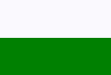
Garhwal
| Garhwal गढ़वाल |
|
|---|---|
| State : | Uttarakhand |
| Coordinates | 30 ° 30 ′ N , 78 ° 30 ′ E |
| Administrative headquarters : | Pauri |
| Area : | 32,449 km² |
| Residents : | 5,857,294 |
| Population density : | 181 inhabitants / km² |
| Districts : | 7th |


Garhwal ( Hindi : गढ़वाल [ ɡʌɽʱʋaːl ], formerly anglicized Gurwal ) is a region in the Indian state of Uttarakhand .
It occupies the western part of the state in the Himalayas and borders on Tibet in the north, the Kumaon region in the east, Uttar Pradesh in the south and Himachal Pradesh in the west . Administratively, Garhwal is one of two divisions of Uttarakhand and is divided into the districts of Chamoli , Dehradun , Haridwar , Pauri Garhwal , Rudraprayag , Tehri Garhwal and Uttarkashi . The administrative headquarters of the Garhwal division is Pauri , the largest city is Dehradun .
Surname
Garhwal is believed to get its name from 52 Garhs, 52 small principalities, each of which had its own fortress (garh).
geography
The region consists almost entirely of rugged mountain ranges running in all directions, separated by narrow valleys and in some cases deep gorges. The only plain is a narrow strip of waterless forest between the southern slopes of the hills and the fertile plains of Rohilkhand . The highest mountains are in the north, the most important are the Nanda Devi ( 7816 m ), the Kamet (7756 m), the Chaukhamba (7138 m), the Trishul (7120 m), the Dunagiri (7066 m) and the Kedarnath (6831 m). The Alaknanda river , the left source river of the Ganges , drains the entire region with its tributaries. At Devprayag , the Alaknanda unites with the Bhagirathi, which is almost a third smaller but longer, to form the Ganges. Agriculture is mainly limited to the immediate vicinity of rivers where irrigation is possible.
history
Nearly 500 years ago, Ajai Pal brought the area's smaller principalities under his rule and established the Garhwal Kingdom . He and his successors ruled Garhwal and the neighboring state of Tehri-Garhwal in an unbroken line until 1803, when Gurkhas invaded Kumaon and Garhwal and drove the Garhwal ruler into the plains. The Gurkhas ruled the country with an iron hand for twelve years until a series of incursions from British territory led to the Gurkha War in 1814 . Thereafter, Garhwal and Kumaon were converted into British districts while the Tehri principality was restored and bequeathed to a son of the previous ruler. The British district of Garhwal belonged to the Kumaon Division of the United Provinces of Agra and Oudh and had an area of 14,580 km². After the annexation, Garhwal grew rapidly, in 1901 it already had 429,900 inhabitants. Two battalions of the Indian Army (39th Garhwal Rifles) were recruited in the district. Grain and clothing were exported and salt , borax , food and wool were imported. Trade with Tibet was considerable. The administrative center was the place Pauri , the largest city Srinagar .
language
The Garhwali language (गढ़वाली भाषा ( Devanagari ) ) is a central Pahari language and belongs to the northern zone of the Indo-Aryan languages .
Garhwali is one of the 325 recognized languages of India and is spoken by 2,267,314 people in the Tehri Garhwal , Pauri Garhwal , Uttarkashi , Chamoli , Dehradun , Haridwar and Rudraprayag districts of Uttarakhand . Garhwali is also spoken in other parts of India such as Himachal Pradesh , Delhi , Haryana , Punjab , Uttar Pradesh, and Bihar .
UNESCO rates Garhwali as a language with uncertain existence and considers constant efforts to preserve it to be necessary. (UNESCO status English vulnerable )
population
The inhabitants of Garhwals are called Garhwali , as is their language. The majority live from agriculture and tourism. In the absence of infrastructure and employment opportunities, there is constant flight to urban regions. Garhwal is mostly mountainous so industry does not settle. Furthermore, there is a lack of fertility in this region. Basic problems are illiteracy, poverty and shortages in medical care. Villages in Garhwali often form groups called "Patti".
Individual evidence
- ↑ http://www.hindikids.com/india_language.html
- ↑ http://www.censusindia.gov.in/Census_Data_2001/Census_Data_Online/Language/Statement1.aspx | title = Census Data Online
- ↑ http://www.ethnologue.com/show_language.asp?code=gbm
- ↑ UNESCO Atlas of the World's Languages in Danger - ISO 639-3 gbm - Garhwali , 2010
- ↑ The Guardian - Endangered languages: the full list , April 15, 2011
- ↑ Multitree - The Garhwali Language


