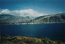
Gulf of Corinth
The Gulf of Corinth ( Greek Κορινθιακός Κόλπος , Korinthiakós Kólpos ) is an elongated bay of the Ionian Sea between Roumelia (central Greece) in the north and the Peloponnese in the south. It is bounded in the east by the Isthmus of Corinth and in the west by the strait of Rio-Andirrio (Στενό Ρίου-Αντίρριου), which has been bridged by the Rio-Andirrio Bridge since 2004 . It is named after the important port and trading city of Corinth . Its length is 127 kilometers, its width 8.4 to 32 kilometers and its depth up to 910 meters.
geology
The Gulf of Corinth was created by the westward shift of the Anatolian plate compared to the Eurasian plate , which both move against each other at 10 mm per year. As a result, earthquakes are relatively frequent in this area.
Web links
Footnotes
- ↑ Sea depth 910 m
- ↑ Ambraseys, NN & Jackson, JA 1997. Seismicity and strain in the Gulf of Corinth (Greece) since 1694. Journal of earthquake engineering, 1, 433-474
Coordinates: 38 ° 13 ' N , 22 ° 33' E


