Golub-Dobrzyń
| Golub-Dobrzyń | ||
|---|---|---|

|
|
|
| Basic data | ||
| State : | Poland | |
| Voivodeship : | Kuyavian Pomeranian | |
| Powiat : | Golub-Dobrzyń | |
| Area : | 7.50 km² | |
| Geographic location : | 53 ° 7 ' N , 19 ° 3' E | |
| Height : | 51 m npm | |
| Residents : | 12,563 (Jun. 30, 2019) |
|
| Postal code : | 87-400 to 87-401 | |
| Telephone code : | (+48) 56 | |
| License plate : | CGD | |
| Economy and Transport | ||
| Next international airport : | Bydgoszcz | |
| Gmina | ||
| Gminatype: | Borough | |
| Surface: | 7.50 km² | |
| Residents: | 12,563 (Jun. 30, 2019) |
|
| Population density : | 1675 inhabitants / km² | |
| Community number ( GUS ): | 0405011 | |
| Administration (as of 2015) | ||
| Mayor : | Mariusz Piątkowski | |
| Address: | Plac Tysiąclecia 25 87-400 Golub-Dobrzyń |
|
| Website : | www.golub-dobrzyn.pl | |
Golub-Dobrzyń [ 'gɔlub' dɔbʒɨɲ ] ( German Gollub , located north of the Drewenz; Dobrzyn (1939–1945 Dobrin on the Drewenz), located south of the river) is a town in the Polish Kuyavian-Pomeranian Voivodeship .
Geographical location
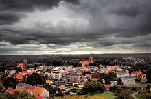
The small town is located in the former West Prussia on the Drwęca ( German Drewenz ), about 30 kilometers (as the crow flies) northeast of Toruń German Thorn and 45 kilometers south-southeast of Grudziądz German Graudenz .
history

The oldest written mention of Gollub ( villa golube ) can be found in a document from 1258. Since the Teutonic Order took possession of the Kulmer Land in 1230, the Drewenz river formed the border between Prussian or German and Polish areas with interruptions until 1920. The southern Dobrin also partially belonged to the area of the order.
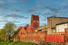
To secure the river crossing, a castle was built by the Teutonic Order from 1296 to 1306.
The settlement lying next to it received from Landmeister Konrad sack the Chelmno city charter . The exact date of the town elevation is not known, as the original document was lost. In 1421 the town charter was confirmed by the Grand Master of the Teutonic Order .
The city had already developed well, but in 1414 it got caught up in the dispute between the Kingdom of Poland and the Teutonic Order , which in 1422 led to the so-called "Gollubian War". After the Second Peace of Thorn Gollub was in 1466 part of the autonomous, under the auspices of the Polish crown standing Royal Prussia . The city began to flourish again, especially when King Sigismund III. Wasa temporarily resided in Gollub in 1623. The city suffered severe setbacks during the wars with Sweden 1626–1629 and 1655–1660 and during the Seven Years' War 1756–1763.
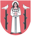
With the first partition of Poland-Lithuania in 1772, Gollub came under Frederick II to the Kingdom of Prussia . In the 17th and 18th centuries, the village of Dobrin ( Dobrzyń in Polish ) on the opposite bank of the Drewenz , which was already mentioned in the Middle Ages, but remained only a small village until then, had grown. In 1684 the place received important privileges, although it was called a "suburb" of Gollub. In 1721 and 1740 these privileges were confirmed. In 1769 the town was granted city rights and its own coat of arms. With the second partition of Poland-Lithuania in 1793, Dobrzyń, which had previously belonged to the Teutonic Order, fell to Prussia.
During the French era , both cities became part of the Duchy of Warsaw (1809 Grand Duchy) in 1807 , which was ruled in personal union by the King of Saxony, but was dependent on Napoleon. At the Congress of Vienna in 1815, the Drewenz was again established as the border between Prussia and the new Kingdom of Poland ( "Congress Poland" ), which was linked to Russia in a personal union. Gollub became Prussian again, while Dobrin remained Polish. In 1870 Dobrin lost its city status and was only able to regain it after the end of the First World War in 1919. In 1900 Gollub received a train station on the line from Strasburg to Schönsee , in 1999 passenger traffic was discontinued and the line was later closed.
Until 1920 Gollub belonged to the circle Briesen in marienwerder the province of West Prussia of the German Reich .
Due to the provisions of the Versailles Peace Treaty , parts of West Prussia, including Gollub, had to be ceded to Poland without a referendum to establish the Polish Corridor in 1919/20 after the end of the First World War . After the attack on Poland in 1939, Gollub was annexed by the German Reich in violation of international law and was now assigned to the Briesen district in the Reichsgau Danzig-West Prussia , to which it belonged until 1945.
Towards the end of the Second World War , the Red Army occupied the region in the spring of 1945 and the city came back to Poland. Where German citizens had not fled, they were in the period that followed sold .
In 1951 the two cities were united under the common name Golub-Dobrzyń . In 1956 the city became the seat of its own powiat . This was dissolved in 1975 and added to the newly established Toruń Voivodeship . In the administrative reform of January 1, 1999, the powiat Golub-Dobrzyń ( powiat golubsko-dobrzyński ) was restored.
Population numbers
| year | Residents | Remarks |
|---|---|---|
| 1783 | 766 | including 57 hussars , mostly Poles and Catholics |
| 1831 | 1,750 | partly German, partly Polish |
| 1875 | 2,701 | |
| 1880 | 2,893 | |
| 1890 | 2,738 | of which 644 Protestants, 1,729 Catholics and 354 Jews (1,000 Poles) |
Rural community
The rural community of Golub-Dobrzyń, to which the city of Golub-Dobrzyń itself does not belong, has an area of 197.5 km², on which (as of June 30, 2019) 8734 people live.
literature
- Johann Friedrich Goldbeck : Complete topography of the Kingdom of Prussia . Part II: Topography of West Prussia , Marienwerder 1789, page 44, no. 2.).
- August Eduard Preuss : Prussian country and folklore . Königsberg 1835, p. 438, no.47.
Web links
Individual evidence
- ↑ a b population. Size and Structure by Territorial Division. As of June 30, 2019. Główny Urząd Statystyczny (GUS) (PDF files; 0.99 MiB), accessed December 24, 2019 .
- ^ Johann Friedrich Goldbeck : Complete topography of the Kingdom of Prussia . Part II: Topography of West Prussia , Marienwerder 1789, p. 44, no. 2.
- ^ August Eduard Preuss : Prussian country and folklore . Königsberg 1835, p. 438, no.47.
- ^ A b c Michael Rademacher: German administrative history from the unification of the empire in 1871 to the reunification in 1990. dan_briesen.html. (Online material for the dissertation, Osnabrück 2006).


