Great Zschand

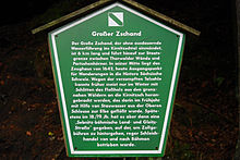
The Große Zschand is the longest dry valley in Saxon Switzerland and runs for around 6 km from Neumannmühle in Kirnitzschtal to Roßmaulwiese in Bohemian Switzerland . The Große Zschand has no continuous water flow; At the time of the snowmelt or after heavy rainfall , individual, locally delimited watercourses or small marshy areas form.
history
The Great Zschand was used as a trade connection between Bohemia and Saxony even before the development of Saxon Switzerland . At the armory , a customs station was located. Until the current federal highway 172 from Schmilka via Hřensko to Děčín was continuously expanded , the Great Zschand was used as a transport link from Bad Schandau . Salt licks and bear trapping pits are evidence of the hunting use of the area.
geology
The northern part of the Great Zschandes intersects clammy like the surrounding rocks and has a moist, cool cellar climate. The southern part, from the Zeughaus, is a somewhat wider valley with wooded ( spruce monoculture ) slopes and rock formations ( Thorwalder walls and Partschenhorns ). Deeply cut, narrow side valleys, so-called gorges, branch off from the Großer Zschand on both sides. Due to the large-scale stratification of the sandstone, the rock faces and the climbing rocks in the Großer Zschand often have a height of over 50 meters. Overhangs have often formed at the intermediate layers of the sandstone layers, as well as the second largest cave in Saxon Switzerland, the Hickel Cave . This typical layer joint cave is located in the southern part of the Großer Zschand in the Thorwalder walls.
Economical meaning
In addition to the historical trade connection between Saxony and Bohemia and the hunting industry, the forests of the Großer Zschand were used for wood extraction and for transporting wood into the Kirnitzschtal valley until the 1980s. In individual side gorges, path reinforcements and path extensions for the removal of wood are still visible today. The parking lot at Neumannmühle used to be a washing-out area for rafting on the Kirnitzsch.
National park
The Große Zschand is located entirely in the Saxon Switzerland National Park and from the Zeughaus in the specially protected core zone. For the opening of the national park, it was planned to open a pedestrian border crossing in the Grosser Zschand into the Bohemian Switzerland National Park, which was only proclaimed ten years later . This has not yet been set up. As part of the path conception in the national park from 2000, the Große Zschand was closed from the Hickel Gorge and a pedestrian border crossing is no longer possible. The pond below the Teichstein at the Zeughaus has existed again since autumn 2012.
Others
The Flößersteig educational trail , which runs parallel to the Kirnitzsch to Bad Schandau , begins at the Neumannmühle . In the northern part of the Großer Zschand there is a cavity closed with an iron door under a rock overhang, which was used as a gunpowder chamber at the end of the Second World War . The black powder was used to blast the roots of cleared trees.
Web links
Individual evidence
- ^ Gunnar Saft: Dispute over legal hiking trails. In: Saxon newspaper. September 11, 1998, accessed December 3, 2013 .
- ↑ Saxon Switzerland hiking map - Großer Zschand, 1:10 000, Rolf Böhm
Coordinates: 50 ° 54 ′ 31.2 " N , 14 ° 17 ′ 55.9" E


