
Hüttwilen
| Hüttwilen | |
|---|---|
 |
|
| State : |
|
| Canton : |
|
| District : | Frauenfeld |
| BFS no. : | 4821 |
| Postal code : | 8536 Hüttwilen 8537 Nussbaumen 8537 Uerschhausen |
| Coordinates : | 707 392 / 273 123 |
| Height : | 455 m above sea level M. |
| Height range : | 426–662 m above sea level M. |
| Area : | 17.66 km² |
| Residents: | 1729 (December 31, 2018) |
| Population density : | 98 inhabitants per km² |
| Website: | www.huettwilen.ch |
 Hüttwilen seen from the south |
|
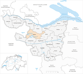
| Location of the municipality | |
  |
|
Hüttwilen is a village and a political municipality in the Frauenfeld district in the Swiss canton of Thurgau . The political municipality, which has existed since 1997, was formed from the former municipal municipality of Hüttwilen, which existed until 1996. It comprised the three former local communities Hüttwilen, Nussbaumen and Uerschhausen , which were separated from the municipal community of Eschenz in 1851 .
geography

Hüttwilen is located in the Seebachtal, north of Frauenfeld , and consists of the three villages Hüttwilen, Nussbaumen and Uerschhausen.
The Hüttwilersee has an area of one square kilometer and lies together with the neighboring Hasensee and Nussbaumersee in a nature reserve.
history

Finds and stray finds indicate a settlement of the Seebach valley since the Mesolithic . Ruins of the Roman estate Stutheien, which was partially excavated in 1928, are evidence of Roman settlement. Hutewiler was first mentioned in a document in 1255 . Hüttwilen was a Habsburg lower court that came under the rule of the Ittingen Charterhouse in 1466 . Until 1798, the monastery exercised the majority of the minor judicial rule over the village.

The parish of Hüttwilen was closely connected to the rulership. In 1466 the church charter from Hüttwilen came to the Ittingen Charterhouse. With the Reformation in 1529, the village changed to the new faith. The Catholic judge succeeded in reintroducing mass in 1551. Until 1961 the church was used by both denominations. In 1962 the new Reformed Church was built , and in 1964 that of the Catholic Church of St. Francis . Uesslingen has been a branch of the reformed parish of Hüttwilen since 1551 .
Towards the end of the 19th century, in addition to wine, arable and fruit growing, livestock and dairy farming emerged. Hand embroidery was carried out in Hüttwilen around 1900 and peat was extracted until the 20th century . The Seebach correction took place from 1857 to 1862, the amelioration from 1943 to 1949. Agriculture as an important branch of business lost its importance from 1960 and was increasingly replaced by commercial enterprises. The largest employer in Hüttwilen is the grandstand and scaffolding company Nüssli Group . In 2005 it employed 130 people in Hüttwilen and 250 worldwide. After the natural and cultural landscape of the Seebachtal was placed under nature protection in 1966, the Seebachtal Foundation has been trying since 1994 to maintain or restore the original landscape.
→ see also section history in article Nussbaumen TG
→ see also section history in article Uerschhausen
coat of arms
Blazon : A red bar in white accompanied by three black vine leaves (2/1).
The coat of arms of the former municipality of Hüttwilen shows the shield of Austria with swapped colors, accompanied by three black vine leaves, because Hüttwilen is characterized by viticulture. Black and white are the colors of the Ittingen Charterhouse. After the political community of Hüttwilen was founded, it always used the three coats of arms of the former local communities of Hüttwilen, Nussbaumen and Uerschhausen on its printed matter. In 2012, in the restored government building of the canton of Thurgau in Frauenfeld, the coat of arms of the former local community of Hüttlingen was used as the coat of arms for the political community of Hüttlingen.
population
 |
| 1850 | 1900 | 1950 | 1990 | 2000 | 2010 | 2018 | |
|---|---|---|---|---|---|---|---|
| Political community | 1398 | 1496 | 1726 | ||||
| Municipal parish | 1143 | 1054 | 1084 | 1330 | |||
| Local parish | 529 | 568 | 588 | 775 | |||
| source | |||||||
Of the 1726 inhabitants in the municipality of Hüttwilen in 2018, 173 or 10.0% were foreign nationals. 828 (47.10%) were Protestant Reformed and 375 (21.7%) were Roman Catholic. The village of Hüttwilen had 1077 residents at that time.
economy
In 2016, Hüttwilen offered 544 jobs (converted to full-time positions). Of these, 14.0% were employed in agriculture and forestry, 32.1% in industry, trade and construction and 53.9% in the service sector.
Attractions


Near Nussbaumen is the Steinegg Castle , a building built in 1866 in neo-renaissance style. Integrated into it are parts of an original castle from the 13th century, which was built by the Lords of Steinegg. It burned down in 1517. From 1583–1798 it was the seat of the Obervogte in Zurich. Today, Steinegg Castle is privately owned. Helfenberg Castle is in Uerschhausen .
Above Hüttwilen, the Cistercian convent Mariazell zu Kalchrain ("Our Lady Cell of Kalchrain") was founded in the 13th century . The monastery survived several fire disasters, the Reformation and earthquakes until it was finally lifted by the Thurgau government in 1848. In the empty monastery buildings, a cantonal forced labor facility was set up in 1849, and since 1942 it has been called a labor education institute. In 2013 it was renamed “Kalchrain Measures Center”. Today it is used for the training of criminal young male adults.
The Hüttwilen Protestant Church, built in 1963, was built according to plans by the architect Adolf Kellermüller . The Catholic Church of St. Franziskus , inaugurated in 1966, was built by Justus Dahinden , one of the most important representatives of Swiss post-war architecture. During its construction, preserved frescoes from the medieval church of Hüttwilen were installed, which was used equally from 1551 . It was removed in 1964.
→ see also the Sights section in the article Nussbaumen TG
→ see also the Sights section in the Uerschhausen article
Personalities
- Albert Johann Bachmann (1863–1934), Germanist
- Toni Hagen (1917–2003) geologist
literature
- Alfons Raimann, Peter Erni: The art monuments of the canton of Thurgau. Volume VI: The Steckborn District. Edited by the Society for Swiss Art History GSK. Bern 2001 (= Art Monuments of Switzerland. Volume 98), ISBN 3-906131-02-5 .
Web links
Individual evidence
- ↑ Permanent and non-permanent resident population by year, canton, district, municipality, population type and gender (permanent resident population). In: bfs. admin.ch . Federal Statistical Office (FSO), August 31, 2019, accessed on December 22, 2019 .
- ↑ a b Thurgau in figures 2019 . On the website of the Statistical Office of the Canton of Thurgau (PDF file; 1.8 MB), accessed on April 28, 2020.
- ↑ Swiss land use statistics. Completed on July 1, 1912. Published by the Federal Statistical Bureau. ( Memento from April 12, 2016 in the Internet Archive )
- ↑ a b Localities and their resident population. Edition 2019 . On the website of the Statistical Office of the Canton of Thurgau (Excel table; 0.1 MB), accessed on April 28, 2020.
-
↑ a b c d e f
Verena Rothenbühler: Hüttwilen. In: Historical Lexicon of Switzerland .
These sections are largely based on the entry in the Historical Lexicon of Switzerland (HLS), which, according to the HLS's usage information, is under the Creative Commons license - Attribution - Share under the same conditions 4.0 International (CC BY-SA 4.0). - ↑ a b c municipal coat of arms . On the website of the State Archives of the Canton of Thurgau, accessed on December 8, 2019
- ↑ a b Population development of the municipalities. Canton Thurgau, 1850–2000 and resident population of the municipalities and change from the previous year. Canton of Thurgau, 1990–2018. On the website of the Statistical Office of the Canton of Thurgau (Excel tables; 0.1 MB each), accessed on April 28, 2020.
- ↑ Kalchrain Monastery ( Memento from December 19, 2015 in the Internet Archive )
Basadingen-Schlattingen | Berlingen | Diessenhofen | Eschenz | Felben-Wellhausen | Frauenfeld | Gachnang | Herdern | Homburg | Hüttlingen | Hüttwilen | Mammers | Matzingen | Muellheim | Nine-shape | Pfyn | Schlatt | Steckborn | Stettfurt | Thundorf | Uesslingen book | Wagenhausen | Warth-Weiningen
Former municipalities: Basadingen | Book near Frauenfeld | Dettighofen | Eschikofen | Fahrhof | Felben | Gerlikon | Gündelhart-Hörhausen | Harenwilen | Herten | Horgenbach | Huben | Islikon | Kaltenbach | Kefikon | Kurzdorf | Langdorf | Langenhart | Lance neunforn | Lustdorf | Mett-Oberschlatt | Mettendorf | Niederneunforn | Niederwil | Walnut trees | Oberneunforn | Oberwil | Rheinklingen | Salen-Reutenen | Schlattingen | Uerschhausen | Uesslingen | Subdivision | Warth | Weiningen | Wellhausen | Wetzikon | Wilen bei Neunforn | Willisdorf
Canton of Thurgau | Districts of the Canton of Thurgau | Municipalities of the Canton of Thurgau