
Hasanlu
Coordinates: 37 ° 0 ′ 17 ″ N , 45 ° 27 ′ 31 ″ E

Hasanlu Tepe or Tappeh Hassanlu ( Persian تپه حسنلو) is a settlement mound in the Iranian province of West Azerbaijan and is located south of the nearby Lake Urmi . The settlement mound contains, among other things, an ancient, perhaps Mannean city. This was established by Urartu in the late 9th century BC. Destroyed, probably under Išpuini or Menua .
Location and appearance of the hill
Hasanlu Tepe is the largest place in the valley of the Gadar River and dominates the small Sulduz plain. The place consists of a 25 m high "citadel hill" with massive fortifications and paved streets, surrounded by an outer city, which is still 8 m above the plain. The entire place was much larger, but local agricultural and construction activities made it smaller, so that it is now 600 m in diameter. The citadel has a diameter of more than 200 m.
The Tell has several layers of settlement, the oldest of which dates from the 6th millennium BC. BC. It is famous for its gold mug , which a University of Pennsylvania team under Robert Dyson found here in 1958.
As part of the excavations, another tell ( Hadschi Firuz Tepe ), where the oldest signs of viticulture can be found, were explored very close to Hasanlu. At the same time, Dalmā Tepe was also researched.
Excavations

Hasanlu was founded around 2100 BC. . Chr founded. The city was at the intersection of several important trade routes. The early layers show Hurrian influence, later Iranian and then Assyrian influences predominate. The layers of Hasanlu IV from the 10th and 9th centuries are characterized by a gray ceramic, which is called Mannean. Liverani considers the city to be part of Gilzanu at this point .
At that time the settlement was unfortified, only the acropolis , on which the seat of the local ruler and the temples were, was surrounded by a 3 m thick mud brick wall on a stone foundation, which had towers at regular intervals. Their height is estimated at 9 m. The type of fortification is reminiscent of Urartian systems. The citadel contained a palace, a temple and a treasure house ("pearl house"), in which numerous pearls made of carnelian , white glass and sea shells were found. Elongated open courtyards with porticos on one or both sides are typical of Mannaean architecture. In Hasanlu IV, poplar pillars stood on stone bases . In these buildings some researchers see the models of the Achaemenid palaces.
Finds
Most of the finds are dominated by the Assyrian influence ("Assyrian mixed style"), which can also be found in Ziwiye , among other places .
Ceramics
In Hasanlu there is a monochrome gray pottery, which is also found in the Medes region in the 8th and 7th centuries (Iron Age I according to Cuyler-Young). The characteristic spherical jugs with long spouts ("teapots") are stylistically reminiscent of Central Asia. Böhmer (1986) was able to identify a characteristic incised Mannean pottery.
chronology
The dating of the end of Hasanlu IV depends on the identification of the place and the connection with historically transmitted events. Medvedskaya (1988) assumes that Hasanlu was 714 BC. Was destroyed by the Urartians. Dyson assumes that Hasanlu IV was destroyed by Menua around 800 , which Kleiss (1994) doubts. In the entrance area of the citadel building, interpreted as a temple, lay the skeletons of 40 women who may have been slain during the conquest.
After a hiatus , Hasanlu was repopulated in the 8th century (building layer IIIB). The buildings are often considered to be Urartian . In the Middle Ages, a fortress was built on the citadel.
| phase | Dating | Shifts in Hasanlu |
|---|---|---|
| middle Ages | - | I. |
| - | - | II |
| Iron Age III | 800-600 | IIIB |
| Iron Age II | 1000-800 | IV |
| Iron Age I. | 1250-1000 | V |
Hasanlu provided a number of 14 C data .
ID
Miroslav Salvini wants to equate Hasanlu with Mešta .
Dyson et al. see Hasanlu as the capital of Mannai , a view that Miroslav Salvini strongly contradicts. He points out that the stele Stele of Karagündüz around 815 mentions Mešta and Paršua as the target of a campaign, but does not mention Mannai. He advocates a location for Hasanlu outside of Mannai without a previously known "ethnic-national identity", but considers ascribing it to a Persian tribe.
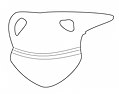
gallery
Jug, Hasanlu IV, gray goods
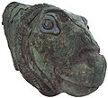
Bronze drinking vessel in the shape of an animal head

Crescent-shaped plate with animal and human motifs


literature
- Robert H. Dyson : Hasanlu and early Iran. Archeology 13, 1960, pp. 118-129.
- Robert H. Dyson / Oscar Muscarella , Constructing the chronology and historical implications of Hasanlu IV. Iran 27, 1989, 1-27.
- I. Medvedskaja, Who destroyed Hansalu IV? Iran 26, 1988, 1-15.
Web links
- Hasanlu Publication Project
- Hasanlu . In: Ehsan Yarshater (Ed.): Encyclopædia Iranica (English, including references)
Individual evidence
- ↑ a b c The Cambridge History of Iran (ed. By WB Fischer, Ilya Gershevitch, Ehsan Yarshster). Cambridge University Press, 1993. ISBN 0-521-20091-1 . Pp. 57-58, 138.
- ^ Paul Zimansky, Urartian Material Culture As State Assemblage: An Anomaly in the Archeology of Empire. Bulletin of the American Schools of Oriental Research 299/300, 1995, 104
- ^ Wolfram Kleiss, Notes on the chronology of Urartian defensive architecture. In: Altan Çilingiroǧlu / DH French (ed.), Anatolian Iron Ages 3, British Institute of Archeology at Ankara Monograph 3 (Ankara 1994), 131
- ↑ a b c Miroslav Salvini: The influence of the Urartu empire on the political conditions on the Iranian plateau. In: Ricardo Eichmann / Hermann Parzinger (eds.), Migration und Kulturtransfer (Bonn 2001) 350