
Rabbit Moor
| coat of arms | Germany map | |
|---|---|---|

|
Coordinates: 53 ° 54 ' N , 9 ° 59' E |
|
| Basic data | ||
| State : | Schleswig-Holstein | |
| Circle : | Segeberg | |
| Office : | Kaltenkirchen-Land | |
| Height : | 27 m above sea level NHN | |
| Area : | 17.77 km 2 | |
| Residents: | 766 (Dec. 31, 2019) | |
| Population density : | 43 inhabitants per km 2 | |
| Postal code : | 24640 | |
| Area code : | 04195 | |
| License plate : | SE | |
| Community key : | 01 0 60 036 | |
| LOCODE : | DE HS5 | |
| Office administration address: | Schmalfelder Strasse 9 24568 Kaltenkirchen |
|
| Website : | ||
| Mayor : | Klaus-Wilhelm Schümann ( CDU ) | |
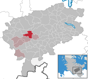
| Location of the municipality of Hasenmoor in the Segeberg district | ||
  |
||

Hasenmoor is a municipality in the Segeberg district in Schleswig-Holstein . Fuhlenrüe, Hegebuchenbusch, Jabbob, Tannenhof, Wiesenhof and Wolfsberg are in the municipality.
Geography and traffic
Hasenmoor is about 6 km east of Bad Bramstedt on the federal highway 206 from Itzehoe to Lübeck . The federal motorway 7 runs to the west from Hamburg to Schleswig .
history
Hasenmoor was first mentioned in the old Kiel city register from 1264 to 1289 as a group of houses "Wolfesberch" (today Wolfsberg). The first sheep farms were mentioned towards the end of the 16th century.
Since 1870, Hasenmoor has been part of a municipality with the current district of Fuhlenrüe.
Due to the considerable proportion of heather and moorland areas, Hasenmoor offered its inhabitants a good opportunity to keep sheep in addition to farming until the beginning of the 20th century. Large areas were obtained after 1900 by new agricultural techniques as arable land or meadows, or even reforested with trees (firs).
politics
Community representation
Of the nine seats in the municipal council has CDU 2008, five seats and at the municipal Wählergemeinschaft reached AWV four.
After the dissolution of the AWV for the local elections in 2013, the CDU has all 9 seats in the local council. The community representatives are supported by 8 civil members in the committees.
coat of arms
Blazon : “Divided diagonally by green and gold on the left. Above a sitting golden hare, below five black tufts of grass. "
economy
The municipal area is predominantly agricultural, but there are also some businesses.
The Hartenholm airfield, known from the Werner race, is located in the municipality. The land on the federal road was expanded into a public airfield by the landowner, tree nursery owner Lüth, in the 1950s and operated by his company, Nordflug GmbH, which he founded for this purpose. Very soon, Nordflug had a private flight school and an airport restaurant and later, when the company had changed shareholders several times, also an aircraft agency along with trade and workshop.
nature
The Königsmoor ( FFH area Hasenmoor ).
Web links
Individual evidence
- ↑ North Statistics Office - Population of the municipalities in Schleswig-Holstein 4th quarter 2019 (XLSX file) (update based on the 2011 census) ( help on this ).
- ↑ Schleswig-Holstein topography. Vol. 4: Groß Sarau - Holstenniendorf . 1st edition Flying-Kiwi-Verl. Junge, Flensburg 2004, ISBN 978-3-926055-75-0 , p. 150 ( dnb.de [accessed on May 2, 2020]).
- ↑ Schleswig-Holstein's municipal coat of arms
Alveslohe | Armstedt | Bad Bramstedt | Bad Segeberg | Bahrenhof | Bark | Bebensee | Bimöhlen | Blunk | Boostedt | Bornhöved | Borstel | Bühnsdorf | Daldorf | Damsdorf | Dreggers | Ellerau | Fahrenkrug | Föhrden-Barl | Fredesdorf | Fuhlendorf | Geschendorf | Glasau | Gönnebek | Groß Kummerfeld | Gross Niendorf | Groß Rönnau | Great Aspen | Hagen | Hardebek | Hartenholm | Hasenkrug | Rabbit Moor | Heidmoor | Heidmühlen | Henstedt-Ulzburg | Hitzhusen | Högersdorf | Hüttblek | Itzstedt | Kaltenkirchen | Kattendorf | Kayhude | Kisdorf | Klein Gladebrugge | Klein Rönnau | Krems II | Kükels | Latendorf | Leezen | Lentföhrden | Mönkloh | Mözen | Near | Negro Bay | Take | Neuengörs | Neversdorf | Norderstedt | Use | Oering | Oersdorf | Pronstorf | Rickling | Rohlstorf | Schackendorf | Sheer | Schmalensee | Narrow field | Schwissel | Seedorf | Seth | Sievershütten | Stipsdorf | Stocksee | Strukdorf | Struvenhütten | Stuvenborn | Sülfeld | Tarbek | Tensfeld | Fields of death | Trappenkamp | Travenhorst | Traventhal | Wahlstedt | Wakendorf I | Wakendorf II | Weddelbrook | Weede | Wensin | Westerrade | Wiemersdorf | Winsen | Wittenborn
Non-parish area in the Segeberg
forest district of Buchholz