Heyerode
|
Heyerode
Rural community of Südeichsfeld
|
|
|---|---|
| Coordinates: 51 ° 9 ′ 50 ″ N , 10 ° 19 ′ 12 ″ E | |
| Height : | 344 m above sea level NN |
| Area : | 5.68 km² |
| Residents : | 2426 (Oct 23, 2012) |
| Population density : | 427 inhabitants / km² |
| Incorporation : | December 1, 2011 |
| Postal code : | 99988 |
| Area code : | 036024 |
|
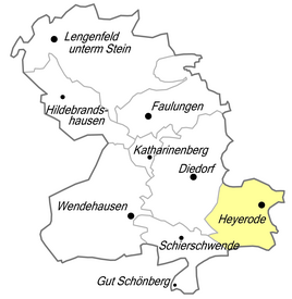
Location of Heyerode in Südeichsfeld
|
|
|
In the local situation
|
|
Heyerode is a village in the Unstrut-Hainich district in Thuringia . Since December 1, 2011, the formerly independent municipality has been part of the rural municipality of Südeichsfeld .
geography
In the west of Heyerode is Katharinenberg , in the north the Mühlhäuser Stadtwald , in the east Oberdorla and in the south Hallungen . Together with Wendehausen , Heyerode is the southernmost town in the Eichsfeld .
The Sengelsberg is located northwest of Heyerode .
history
Heyerode was probably founded around 1250. The first documentary mention as Hoiginrade was finally in 1356. It was followed in 1363 by the second documented mention as Heigenrade and a third a few years later in 1367 as Heygenrode . The border house was built around 1400. The upper mill was first mentioned in 1546. The border house was destroyed in the Thirty Years War and rebuilt in 1630. In 1681 the plague cross was erected and consecrated in Heyerode. In 1800 the parish of Heyerode was established. The first cigarette factory started operations in 1892, and the first knitting factory in 1906.
According to a statistical study (around 1840) the village had 950 Catholic and 10 Protestant inhabitants. 137 residential buildings, 99 stables and barns, four parish halls, a school, four village mugs (taverns), two mills with two grinders each and three breweries were named. At that time, the population was mainly engaged in textile production: 25 looms for woolen and semi-woolen fabrics were counted, another seven looms were part of the business. Two tailors, four shoemakers, a blacksmith, two house butchers , two cattle dealers, a wholesaler and five grocer (victual dealers) were also listed. The livestock consisted of 32 horses, 137 cattle, 71 sheep, 44 goats and 50 pigs. The village corridor comprised 2107 acres , the agricultural area comprised 1400 acres of arable land, 35 acres of garden land, 57 acres of meadows and 4 acres of pasture. Furthermore, 462 acres of community forest and 149 acres of fallow land were named. The yield of the fields was assessed as poor to mediocre. The fruit growing mainly supplied cherries and plums which were preserved as dried fruit .
On December 1, 2011, the municipality of Heyerode merged with the three other municipalities to form the new rural municipality of Südeichsfeld.
mayor
- 1791–1823: Schulze Huhnstock
- 1823–1852: Schulze Hahn
- 1852–1864: Wilhelm Gutmann
- 1864-1892: Wilhelm Henning
- 1892–1900: Alois Gutmann
- 1900–1906: Johann-Michael Hentrich
- 1906–1912: Johann-Michael Henning
- 1912-1913: Louis Zengerling
- 1913–1914: Karl Hentrich
- 1914–1915: Louis Zengerling
- 1915–1915: Alois Uthe
- 1915–1918: Wilhelm Ochsenfahrt
- 1918–1923: August Laufer
- 1923–1945: Franz Huhnstock
- 1945–1945: Anton Henning
- 1945–1945: Karl Hentrich
- 1945–1946: Paul Hohlbein
- 1946–1958: Josef Böhm
- 1958–1959: Wilhelm Henning
- 1959–1960: the position was filled by an honorary mayor
- 1960–1961: Heinrich Vondran
- 1961–1983: Erhard Vogt
- 1983–2002: Wendelin Henning
- since 2002: Andreas Henning
Community partnerships
The municipality of Neuenkirchen in the northern Münsterland is the partner municipality of Heyerodes.
coat of arms
Blazon : "Split by red and silver and divided to the right, a silver mill iron at the top , a six-spoke silver wheel at the bottom, a black-rooted green oak stylized from leaves with a surrounding bench (in natural colors)." - The municipality's flag is green and white -split, covered with the municipal coat of arms.
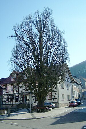
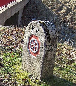
Declaration of coat of arms: The mill iron stands for the centuries-old mill tradition (lower and upper mill), the silver wheel for the long affiliation to Kurmainz and the stylized oak for the towering oak on the Anger .
economy
Road traffic
The traffic connection is in the direction of Mühlhausen and Wanfried via the B 249 which can be reached in Katharinenberg via the 2104 road. The L 2107 (Heyerode - Hallungen - Nazza) and the L 1016 between Mühlhausen and Eisenach lead in a southerly direction . In an easterly direction you can reach Oberdorla via the 2104 road.
Rail transport
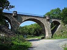
From 1911 to 1969 Heyerode had a connection to the more than Vogteier Bimmel known railway Mulhouse Treffurt which linked the away Mühlhäuser pool with the Werra over the Hainich. Today the connection takes place via the train stations in Eisenach and Mühlhausen.
Transportation
The bus line L-28 of the Verkehrsgesellschaft Wartburgkreis mbH runs to Heyerode on the Eisenach - Mihla - Nazza - Hallungen - Heyerode route.
In addition to its importance for the transport of schoolchildren, bus transport is also important as a feeder to the train station and for the surrounding communities, which are oriented towards hiking tourism.
Bike paths
The Haineck cycle path, which is currently under construction, connects the towns around Heyerode with the cycle path networks of the Werra Valley, the city of Mühlhausen and the southern Eichsfeld region .
Culture and sights
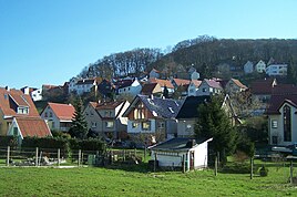
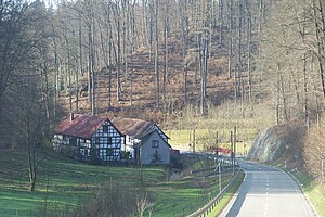
The place has a relatively closed ensemble of half-timbered houses and courtyards. Field crosses are located at prominent points in the hallway on the way to Breitloh . At the former state border, for example on the local connection road to Hallungen, you can still find striking border and coat of arms stones with the Mainz bike .
Buildings
The historic border house is located on the eastern edge of the village , it is the southern end point of the Mühlhausen Landgraben and in the Middle Ages was initially a customs post on the old road from the imperial city of Mühlhausen and from Oberdorla to the Werra Valley near Wanfried and Treffurt . It later served as a forester's house. The Grenzhaus is now privately owned and serves as a studio for a landscape painter. The specialty of the building is that the street runs through the ground floor of the house, originally this part of the building was probably a gate tower.
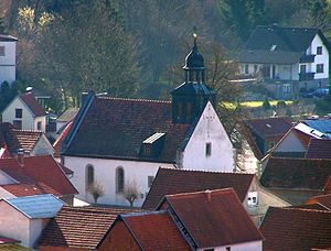
In the local area there are two churches, the Catholic Church and the old village church, also called Marienkirche . The Obermühle mills located on Lempertsbach on the boundary of Hallungen (in operation until the 1960s) and the lower mill, which can be verified since 1548 (in operation until 1938), are representative half-timbered buildings. At the upper mill you can still find the overshot mill wheel. The water is supplied via a wooden channel set on stilts. The still functioning mill is designated as a technical monument . Above the mill, on a mountain spur sloping to the west, is the remains of the Sommerstein castle .
The former train station in Heyerode is still preserved and reminds of the Bimmel Vogteier. From 1911 to 1969 Heyerode had a train station, it was on the Mühlhausen – Treffurt railway line, known as Vogteier Bimmel , which connected the Mühlhausen basin with the Werra valley across the Hainich.
Regular events
"Rock am Bahnhof" has been taking place once a year since 1996, an open-air festival at which famous bands such as Revolverheld have performed. Well- known singers such as Stefan Mross and Oliver Thomas performed at the annual Heyeröder Kirmes .
Personalities
Heyerode commemorates the work of Pastor Theodor Helbig , who despite the ban held services for Polish forced laborers and had to endure Gestapo imprisonment on the Petersberg in Erfurt in 1940 .
sons and daughters of the town
- Alf Zengerling (1884–1961), German film director and screenwriter
Others
As evidence of coarse folk humor, neck names and nicknames that characterize the particular village often emerged centuries ago . According to this, the Heyröder Huppenmannerchen lived here in the village - from Huppe = pacifier, baby pacifier - cigars were made in Heyerode, which is why, in the old days , many men with cigar stubs in their mouths were found on the street in the town.
As a result of the railway routing, a 500 m long cut into the limestone rock near Heyerode was necessary. For geologists, this provides a valuable basis for studying the structure of the Hainich mountains.
literature
- Raymund Falk: The desert of Reichensachsen near Heyerode and the settlement of the Hainich low mountain range . In: Eichsfeld. Yearbook . tape 1 , 1993, p. 127-160 .
- Raymund Falk: The settlement of Heyerode. UE 1 (1992), pp. 146-160.
- Municipality of Heyerode (ed.): Heyerode 1356-2006. Where the Eichsfeld begins and the Hachelborn runs. Duderstadt 2005, 172 pages, numerous black-and-white and color images
Web links
Individual evidence
- ^ Edgar Rademacher: The places Arenshausen, Geismar, Katharinenberg, Diedorf and Heyerode in the mirror of statistics around 1840. In: Eichsfelder Heimathefte. Vol. 28, No. 2, 1988, ISSN 0232-8518 , p. 175.
- ↑ StBA: Area changes from January 1st to December 31st, 2011
- ↑ Verkehrsgesellschaft Wartburgkreis mbH - timetable.
- ^ H. Stade (text): RadTouren im Hainich. Plus adjacent regions . Artifex Kartenverlag , Bad Langensalza 2003, ISBN 3-932071-12-3 .
- ^ Volker Große, Klaus Herzberg: Obermühle / Untermühle Heyerode. In: Volker Große, Klaus Herzberg: Mills in the Obereichsfeld. A compendium. Eichsfeld-Verlag, Heiligenstadt, 2008, ISBN 978-3-935782-13-5 , pp. 180-182.
- ↑ Michael Köhler: Thuringian castles and fortified prehistoric and early historical living spaces . Jenzig-Verlag Köhler, Jena 2001, ISBN 3-910141-43-9 , p. 233-234 .
- ↑ Thuringian Association of the Persecuted of the Nazi Regime - Association of Antifascists and Study Group of German Resistance 1933–1945 (Ed.): Local history guide to sites of resistance and persecution 1933–1945. Volume 8: Thuringia. VAS - Verlag für Akademische Schriften, Frankfurt am Main 2003, ISBN 3-88864-343-0 , p. 306.
- ↑ Rolf Aulepp: Nicknames of the places and their residents in the Mühlhausen district. In: Eichsfelder Heimathefte. Vol. 27, No. 1, 1987, pp. 78-83.
- ^ Roland Geyer, Gerald Patzelt, Daniela Schäfer: Experience geology. Geological route through the natural park . Published by VDF - Association of Friends of the Eichsfeld-Hainich-Werratal Nature Park and the Hainich National Park eV FW Cordier, Heiligenstadt 2003, ISBN 3-929413-63-9 , p. 8 .

