Terry lace
| Terry lace | ||
|---|---|---|
|
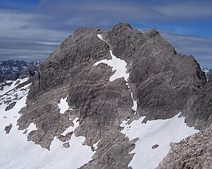
The Hochfrottspitze from the ascent to the Mädelegabel |
||
| height | 2649 m | |
| location | Border Bavaria , Germany / Tyrol , Austria | |
| Mountains | Central main ridge , Allgäu Alps | |
| Dominance | 2.3 km → High light | |
| Notch height | 203 m ↓ Socktalscharte | |
| Coordinates | 47 ° 17 '50 " N , 10 ° 17' 37" E | |
|
|
||
| rock | Main dolomite | |
| First ascent | 1869 by Hermann von Barth | |
|
Postcard from 1929 with the high terry lace in the middle |
||
The Hochfrottspitze is a 2649 meter high rock mountain in the Allgäu Alps near Oberstdorf and at the same time the highest German peak in the Allgäu Alps and Swabia . Geologically, like the surrounding peaks, it is made up of the brittle, rubble-rich main dolomite . The border between Germany and Austria runs over the ridge . The Hochfrottspitze, together with the neighboring peaks Trettachspitze and Mädelegabel, form the famous triumvirate on the Allgäu main ridge. The heavily frequented Heilbronner Weg leads past 100–150 meters below the summit to the south and east .
Ascent
The first ascent was made in 1869 by Hermann von Barth . In contrast to the Mädelegabel and the Trettachspitze, the Hochfrottspitze is rarely climbed.
You leave the Heilbronner Weg at the Bockkarscharte and climb on weak tracks through fragile rubble and craggy terrain on the southwest ridge with climbing points up to UIAA I to the start at the vertical summit drop, which you overcome with exposed climbing up to UIAA II +. The access via the northeast ridge is much less problematic: A simple rubble area with a short rock rib (I) leads from the Schwarzmilzferner into the gap between the Mädelegabel and Hochfrottspitze. The following ridge is initially bypassed on the south side on tracks, after overcoming a rock step (II-) you follow the ridge with a few climbing points (I) to the main summit. The slightly lower south summit can be reached in another five minutes after a short descent and exposed crossing. The third alternative is the west-side ascent from the Waltenberger-Haus : Follow the climb to the Bockkarscharte, which you leave after 20 minutes to climb the ridge of the Mountains of Good Hope over steep gullies (climbing to UIAA I) . Over the rubble-rich western ridge you can get to the summit partly without a path over steps, bands and climbing areas to UIAA I. Furthermore, there is also the possibility of climbing the summit from the Mädelegabel, whereby one climbs very exposed (up to II +) into the notch to the Hochfrottspitze, in order to then enter the northeast ridge described above.
literature
- Thaddäus Steiner : Allgäu mountain names . Kunstverlag Josef Fink, Lindenberg 2007, ISBN 978-3-89870-389-5 .
- Dieter Seibert: AVF Allgäu Alps . 16th edition. Bergverlag Rudolf Rother, Munich 2004, ISBN 3-7633-1126-2 .
- Alpine Club Map 1: 25,000, sheet 2/1, Allgäuer-Lechtal Alps, West
Web links
- Hochfrottspitze , on oberstdorf-online.info


