High Rannach
| High Rannach | ||
|---|---|---|
|
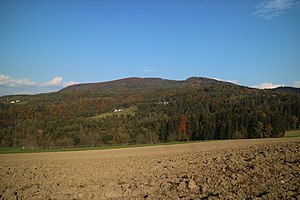
Hohe Rannach from the southwest |
||
| height | 1018 m above sea level A. | |
| location | Styria , Austria | |
| Mountains | Grazer Bergland , foothills east of the Mur | |
| Dominance | 2.14 km → Loregg | |
| Notch height | 285 m ↓ liver | |
| Coordinates | 47 ° 10 '23 " N , 15 ° 24' 2" E | |
|
|
||
| rock | Dolomites , limes | |
| Age of the rock | Devon | |
The Hohe Rannach is 1018 m above sea level. A. high mountain in the southern Grazer Bergland in the Austrian state of Styria . Located a few kilometers southwest of the Schöckl , it is easily visible from the Graz city area. The village of the same name Rannach is located on a southern branch of the mountain.
Location and surroundings
The Rannach mountain range is distributed roughly evenly between the communities of Gratkorn and Stattegg . The municipal boundary runs exactly over the summit. The largely forested mountain is bounded in the north by Rötschgraben and Rannachgraben, in the east by the Leber and in the southeast by the Stattegger Tal, while it slopes gently to the south and west to the Mittlerer Murtal . The smaller villages of Rannach and Jasen are located on the south and west slopes. The Fuchskogel (approx. 940 m ), Geierkogel ( 946 m ), Schöberlkogel ( 863 m ), Rannachbauerkogel ( 842 m ) and Marxenkogel ( 811 m ) elevations upstream of the Hohen Rannach leave the mountain as a long ridge, especially from the east appear. The southernmost foothills of the mountain are Kanzelkogel and Admonter Kogel on the Graz city limits.
Geology and geomorphology
The Rannach is eponymous for a facies area of the Graz Paleozoic , which continues south to the Florianiberg . On the right bank of the Mur, mountains such as the Pleschkogel or the Generalkogel also belong to this stratigraphic type. The Mur breakthrough ensures a geographical separation of the geological unit. In the east the liver disorder (also liver hernia) separates the Rannach from the Schöcklkalk or clay slate facies. The dominant rocks are light and dark gray dolomites as well as fossil-rich barrandeikalk and the locally occurring pulpit limestone. In between, Eggenberger Breccia was added .
The 700 m above sea level A. Tevings that occur are assigned to the Hochstradener level and today offer space to settlements such as Rannach. Also noticeable are some dips south of the Hohen Rannach, which go back to west-east-directed disturbances . The Hohe Rannach is less karstified than the neighboring Schöcklkalk areas, but still has a few typical features. There are several small karst springs on the south-eastern slope , which for a long time secured the water supply of the Graz Regional Hospital , which is almost 10 km away , and which are still used today - even if only sporadically.
Ascent
The Rannach is especially popular with mountain bikers . A section of the UEC - Mountain Bike Marathon European Championships 2003 and 2018 as well as a section of the UCI World Championships 2009 run there. In terms of hiking, the Rannach is in the shadow of the neighboring Schöckl, but can be reached from three sides easily and in a short walking time. Numerous forest roads complete the network of hiking trails. The former Rannach refuge, which is now privately owned, is located near the summit marked with a stone man.
Starting points
- Gasthaus Martinelli on the Leber (Steinmetzwirt, 733 m ): 1 hour.
- Höchwirt, Freßnitzviertel ( 610 m ): 1¼ hours
- Eh Wirtshaus Geierkogel, Rannach ( 690 m ): 1¼ hours
- Huberwirt, Stattegg-Hub ( 433 m ): 1 hour.
- Sankt Stefan , Gratkorn ( 394 m ): 2¾ hours
- St. Veit (Graz) ( 376 m ): 2¾ hours
Web links
Individual evidence
- ↑ Digital Atlas of Styria. Geology & Geotechnics. Office of the Styrian Provincial Government, accessed on February 18, 2016 .
- ↑ Helmut wing : The geology of the Grazer Bergland. In: Communications from the Department of Geology, Paleontology and Mining at the Landesmuseum Joanneum , Graz 1975, p. 225. Online PDF , accessed on May 28, 2019.
- ^ Fritz Stehlik: Time travel through Stattegg. Stattegg municipality 2013, ISBN 978-3-200-03239-2 , p. 12.
- ^ W. Scholz: The Styrian state, healing and care institutions. Fritz Lindner Verlag, Düsseldorf 1930, p. 69.


