Cape Cutcha
| Cape Cutcha | ||
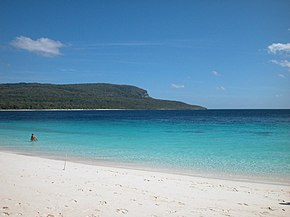
 Cape Cutcha from Jaco Island in the dry season |
||
| Geographical location | ||
|
|
||
| Coordinates | 8 ° 24 ′ S , 127 ° 18 ′ E | |
| coast | East point of Timor | |
| Waters | Wetar Strait | |
| Waters 2 | Timor Sea | |
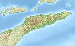
 Map of the Tutuala Administrative Office with Cape Cutcha |
||
The Cape Cutcha ( Portuguese Cabo Cutcha ) is located in the far east of the island of Timor in the East Timorese Suco Tutuala .
The north coast of the island makes a sharp turn to the south and forms the east coast of Timor for a short distance, which also includes the beach of Valu . In front of the coast is the island of Jaco . To the north lies the Wetar Strait and the Timor Sea to the south of Jaco .

