
Klaus head
| Klaus head | ||
|---|---|---|
 |
||
| height | 384 m above sea level NN | |
| location | Donnersbergkreis , Rhineland-Palatinate , Germany | |
| Mountains | Palatinate Forest | |
| Coordinates | 49 ° 33 '3 " N , 7 ° 59' 52" E | |
|
||
| rock | Zechstein in the Palatinate Mountains ( Stauf layers ) | |

The Klauserkopf is a 384 meter high mountain in the stump forest , the northern part of the Palatinate Forest , 2 km northwest of Ramsen in the Donnersbergkreis in Rhineland-Palatinate . The Clauserhof is located at its southwestern foot.
Geographical location
The Klauserkopf is completely wooded. The state road 396 passes within sight of the summit area.
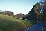
Klauserkopf, seen from the eastern exit of Ripperterhof

Wooded summit Klauserkopf


Individual evidence
- ^ State Office for Geology and Mining Rhineland-Palatinate: Geological overview map of Rhineland-Palatinate . Retrieved January 8, 2015
- ↑ Landscape information system of the nature conservation administration: map service . Retrieved January 8, 2016