Koile
Koile ( ancient Greek Κοίλη Koílē "valley floor") was one of the most densely populated demes of the city of Athens in antiquity . After the reforms of Kleisthenes it belonged first to the Phyle Hippothontis , in this to the Trittys ("third") asty ("city") Peiraeus and was partly inside and outside the Themistoclical city walls west of the Acropolis . From 307/6 BC Until 201/0 BC He was assigned to the Phyle Demetrias before he returned to the Hippothontis. The Demos provided three members for the Council of 500 ( Bule ).
location
Herodotus reports that on Koile Street ( ancient Greek διὰ Κοίλης = hollow way ) at the Dipylon gate, above the gates in Diateichisma, was the tomb of Kimon , as part of the so-called Kimoneia . Opposite him, his steeds, with which he won the ancient Olympic Games three times in a row , are said to be buried. Thucydides was later buried in his grave . The road led from the entrance to the Acropolis to the west between the Muses' Hill and the Pnyx through the Dipylon gate above the gates . From here the road followed the valley cut between the Muses Hill and the Nymphs Hill . Once on the plain, it led through a gate in the Themistoclical city wall and led between the long walls to Piraeus . It was the most important trade route in Athens, which thanks to the Long Wall was also available in times of war. The Demos Koile extended from the Dipylon gate above the gates along Koile Street to the gate in the Themistoclical city wall. In the northeast was the Demos Melite , in the east the Demos Kollytos and in the north the Demos Keiriadai .
description
To the west of the tomb of Kimon, the road has been excavated for about 500 m. The road is carved into the rock and partly has ruts to guide the wagons and small gutters to drain away the rainwater. It was between 8 and 12 m wide and at times widened to 21 m in the lower part. On both sides of the street foundations carved into the rock were found for public buildings, houses and shops, as well as artificial channels to drain the rainwater. Because of the stairs sunk into the rock, the area was also called Skalakia ( Greek Σκαλακία = small stairs ). At the western end of the street Antaiou in Athens district Asyrmatos they found an ancient monumental fountain. It is believed that the gate in the Themistoclical city wall was near it.
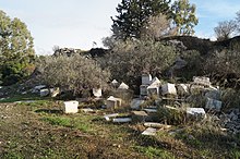
Koile flourished from the Archaic to the Classical Period (6th – 4th centuries BC). After the Diateichisma was built around 330 BC. The demos was outside the city walls and was abandoned by its inhabitants over the years. During the Hellenistic period , the road was narrowed and graves were built on the roadside. In the following Roman era, the street was narrowed further and more grave monuments were erected. Crate graves carved into the rock from both epochs are visible today. In the 19th century the old naval school was built in the valley. In 1922 a refugee settlement for Greek refugees from Antalya was built here. The settlement was named Asyrmatos ( Greek Ασύρματος = radio system ) after the radio antenna that stood here . In 1939, under the dictatorship of Ioannis Metaxas, construction of an approximately 100 m wide theater based on the ancient model began in the lower area of the valley. However, the construction of the so-called Bastia Theater was interrupted by the Second World War and so it was never completed. In 1998–2004 excavations were carried out in the valley between the Nymphs and Muses' hills and the natural area was restored by dismantling. In 2001 the ruins of the Bastia Theater were torn down.
literature
- Hans Lohmann : Koile. In: The New Pauly (DNP). Volume 6, Metzler, Stuttgart 1999, ISBN 3-476-01476-2 , Sp. 630.
Web links
Individual evidence
- ↑ Herodotus, Histories 6,103.
Coordinates: 37 ° 58 ′ 7 ″ N , 23 ° 42 ′ 59 ″ E


