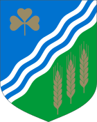
Jõgeva County
| coat of arms | map |
|---|---|

|
|
| Basic data | |
| ISO code : | EE-49 |
| Administrative headquarters : | Jõgeva ( Laisholm ) |
| Area : | 2604 km² |
| Residents : | 31,145 (January 1, 2014) 1 |
| Population density : | 14 inhabitants per km² |
| Circle structure: | 3 municipalities |
| Website : | jogeva.maavalitsus.ee |
| politics | |
| Governor : | Viktor Svjatõšev since 2009 |
|
1 Estonia Statistics Office, database request, September 12, 2014 |
|
The Jõgeva County (Estonian Jõgeva maakond or Jõgevamaa ) is a county (maakond) in Estonia .
geography
It is located in the east of the country and borders in the north-east on Ida-Viru County , in the north on Lääne-Viru , in the north-west on Järva , in the south-west on Viljandi , and in the south on Tartu County . In the east the circle is bounded by Lake Peipus , through which the common border with Russia runs.
Landscape image
There are two nature reserves in Jõgeva County (Estonian looduskaitseala , LKA for short ), the Endla nature reserve in the north and the Alam Pedja nature reserve in the southwest. The Pedja Nature Reserve is a wetland of international importance. It is one of the areas protected by the Ramsar Convention .
In the center of the district is the Vooremaa, a drumlin landscape . There are many elongated lakes between the Drumlins, the largest being Saadjärv (Saadsee) and Kaiavere järv (Kaiaveresee). The east of the district connects to Lake Peipus (Estonian Peipsi järv ), the fourth largest lake in Europe.
In addition, flow through the Jõgeva County, two of the largest rivers of Estonia, the river Põltsamaa (estn. Põltsamaa Jõgi and the river Pedja) (estn. Pedja Jõgi ).
The highest point in the district is the Laiuse Mountain (Estonian Laiuse mägi ) with a height of 144 m.
Infrastructure
The Tallinn-Tartu main road (Estonian Tallinn-Tartu maantee ), the most important road in Estonia, runs through the west of the district, and the Tartu-Jõhvi main road (Estonian Tartu-Jõhvi maantee ), another of the country's main arteries, runs through the east .
On the north-south line runs through the center of the district - also Jõgeva - the Piibe main street (Estonian Piibe maantee ). It connects Tartu with Rakvere .
The Tallinn-Tapa-Tartu railway runs parallel to the Piibe maantee and is used for passenger transport (see Edelaraudtee ) as well as for oil and goods transport.
politics
The district administration ( maakonnavalitsus ) is headed by a governor ( maavanem ) who is appointed by the Estonian government for a period of five years.
cities and communes
Since the administrative reform in 2017, the district has been made up of 3 rural communities ( vallad ).
Municipalities :
history
In the period 7000–6000 BC The first people, fishermen, settled on Lake Peipus . From the 13th century the area of the district belonged to the Livonian Order , which built its order castle in Laiuse in the 14th and 15th centuries to secure the eastern borders. This order castle was used by the Swedish King Karl XII. in winter 1700/1701, during the Great Northern War , as winter quarters.
From 1570 to 1577 the Livonian king Duke Magnus , brother of the Danish king, sat in Põltsamaa. The first settlement on the site of today's Jõgeva did not exist until 1876, on the important Tartu-Tapa-Tallinn railway line. In 1949 the Jõgeva County was founded, which was renamed in 1950 by the Russian occupation forces in the "Jõgeva Region" and in 1962 was given today's county border. In 1990 the Jõgeva region was renamed Jõgeva County again.
Web links
Coordinates: 58 ° 44 ′ 38.4 " N , 26 ° 23 ′ 49.2" E


