
Kronstorf
|
market community Kronstorf
|
||
|---|---|---|
| coat of arms | Austria map | |
 |
|
|
| Basic data | ||
| Country: | Austria | |
| State : | Upper Austria | |
| Political District : | Linz Land | |
| License plate : | LL | |
| Surface: | 21.31 km² | |
| Coordinates : | 48 ° 9 ' N , 14 ° 28' E | |
| Height : | 277 m above sea level A. | |
| Residents : | 3,552 (January 1, 2020) | |
| Population density : | 167 inhabitants per km² | |
| Postal code : | 4484 | |
| Area code : | 07225 | |
| Community code : | 4 10 11 | |
| NUTS region | AT312 | |
| Address of the municipal administration: |
Brucknerplatz 1 4484 Kronstorf |
|
| Website: | ||
| politics | ||
| Mayor : | Christian Kolarik ( ÖVP ) | |
|
Municipal Council : (2015) (25 members) |
||
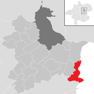
| Location of Kronstorf in the Linz-Land district | ||
  |
||
| Source: Municipal data from Statistics Austria | ||

Kronstorf is a market town in Upper Austria in the Linz-Land district in the central area with 3552 inhabitants (as of January 1, 2020).
geography
Kronstorf is located on the south-eastern edge of the Upper Austrian central area in the Lower Ennstal . The extension is 8.4 km from north to south and 6 km from west to east. The total area is 21.3 km², making Kronstorf the eighth largest municipality in the district. 72 percent of the area is used for agriculture, 14 percent forested, 5 percent gardens, 3 percent water and 0.9 percent building land. There is also around 6 percent other space.
Neighboring communities
.svg)
Community organization and settlement structure
The local area of Kronstorf has a closed development structure. In the peripheral areas, however, the municipality is characterized by the intensive, agricultural use of the scattered homesteads of the farms. There are hardly any commercial settlements. The community is characterized by a moderate settlement pressure from a moderate urban sprawl.
The community consists of three cadastral communities , Schieferegg in the north with 629.47 hectares, Kronstorf in the center with 577.44 hectares and Stallbach in the south with 926.96 hectares. The districts Thaling, Schieferegg, Unterhaus and Schmieding (from north to south) are in the cadastral community of Schieferegg. The Thaling settlement ( 265 m above sea level ) comprised 211 buildings and 678 inhabitants in 2001. It was the second largest settlement in the municipality. The Schieferegg Rotte, which also includes Schieferegg Castle , had eleven buildings and 44 residents. The Unterhaus settlement ( 280 m above sea level ) had 142 buildings with 440 inhabitants in 2001, with the Haider farmhouse also being part of the Unterhaus. The southernmost part of the cadastral community was the village of Schmieding with 34 buildings and 102 inhabitants. In the north of the cadastral community of Kronstorf lies the market of the same name and to the west of it the village of Kronstorfberg. In 2001 the market had 302 buildings and 1,231 residents. It was the largest district. Kronstorfberg, on the other hand, only had 13 buildings and 48 residents and had already grown together with the market. To the south of Kronstorf are the district of Grub, which, in addition to the village of Plaik ( 290 m above sea level ) consists of the village of Grub to the north and the Plaik settlement to the north. In addition, the Enns power plant Mühlrading belongs to the district, which in 2001 comprised a total of 82 buildings and 269 residents. The largest cadastral municipality of Kronstorf, Stallbach, is also the most sparsely populated region of the municipality. None of the five districts has a three-digit population. To the west of the cadastral community is the scattered settlement Teufelsgraben with the Saxlgut. The district had 17 buildings and 55 residents in 2001. To the east of this is the district of Stallbach, which is divided into the Rotte Oberstallbach ( 311 m above sea level ) and the hamlet of Unterstallbach ( 307 m above sea level ). To the north of Unterstallbach is the district of Dörfling. In 2011, Stallbach had 18 buildings and 63 residents, the hamlet Dörfling three buildings and 12 residents. Further to the east are the Rotte Pühring with 12 buildings and 35 residents and the scattered settlement Winkling with 18 buildings and 25 buildings.
The municipality includes the following localities (population in brackets as of January 1, 2020):
- Dörfling (8)
- Kronstorf (1680)
- Kronstorfberg (37)
- Plaik (253)
- Poehring (32)
- Slanting Regg (31)
- Blacksmithing (139)
- Stallbach (67)
- Devil's Trench (39)
- Thaling (789)
- House of Commons (455)
- Winkling (22)
Counting areas are Kronstorf-Plaik for the core area, Thaling for the north, and Kronstorf-Umgebung for the rest of the municipality.
landscape
The municipality of Kronstorf is largely located in the Lower Enns and Steyrtal area . This includes the share of the community on the Enns itself as well as the adjoining stage. In addition to near-natural alluvial forests, however, the outcrop is also used for agriculture. The adjacent low terrace is both agricultural and characterized by the densely populated settlement area of Kronstorf and Thaling. Here, too, are the hillside forests on the edge of the terrace. In the west of the municipality are the agriculturally used high terraces and a small part of the agriculturally characterized hill country. While the former is still assigned to the Lower Enns and Steyrtal spatial unit, the hill country is part of the Traun-Enns-Riedelland spatial unit . There are also some forest areas in the hill country.
Floors
Analogous to the different landscape levels, there are different types of soil in the municipality. In the Austufe there are gray and brown soils, loose sediment brown soils and rendsina . The soils of the valley floor are moderately moist and in some cases at risk of flooding, in small areas there is gleying due to the influence of the groundwater . The soils in this section are used as fields and medium to high quality meadows. In the landscape area of the lower terrace, loose sediment brown soils predominate. Depending on the water supply, the brown earth soils represent medium-quality to high-quality arable land. The loose sediment brown earth with calcareous and lime-free facies also prevails on the high terraces. With loess or predominantly loamy top layers, the well-watered soils represent high-quality arable land. In the area of the Traun-Enns-Riedelland there is predominantly clay, while gravel only occurs in erosion areas. As a result, well-supplied to moderately moist, pseudo-gleyed, lime-free loose sediment brown soils formed on the wide, gentle slopes. On the other hand, the pseudogley comes to the fore on planed areas.
vegetation
In the municipal area there are colline (200 to 300 meters) and submontane (300 to 550 meters) altitudes. In the area of the Enns and the Ausstufe there are near-natural alluvial forest areas and hillside forests. The lower terrace is home to large, species-rich mixed deciduous forests in the area of the Winkling and Thaling settlements. Furthermore, there are several grasslands and semi-arid grass along the edge of the terrace. On the high terrace there are scattered coniferous forests as well as the riparian wood at the Stallbach, in the hill country several large-scale coniferous and deciduous forest stands. All types of landscape are used intensively for agriculture and a few have small orchards and rows of fruit trees.
climate
The municipality of Kronstorf is located in the Central European climatic area, whereby the sub-oceanic climate in the southern part of the Northern Alpine Foreland ensures rain-rich weather with relatively mild winters. In contrast to the Upper Austrian Alpine region, the temperatures are constantly above the European average. It is a tempered humid zone with a pronounced but rather short cold season. The highest precipitation values are measured in the summer months from June to August. The following long-term mean values were measured at the nearest measuring station in Linz between 1971 and 2000. The annual precipitation was 832.4 l / m², the mean annual temperature 9.4 ° C. The mean January temperature was −0.7 ° C, the mean July temperature 19.1 ° C (long-term daily mean).
history
In 834 Kronstorf appears for the first time in a document as "Granesdorf". The social structure of the Middle Ages was shaped by the manorial rule . In Kronstorf the nobility and clergy were among the landlords. The bishops of Passau owned estates here and in the 13th century they were subject to several fiefs in Kronstorf. Originally located in the eastern part of the Duchy of Bavaria, the place belonged to the Duchy of Austria since the 12th century. In the following years, Kronstorf was repeatedly threatened by enemies.
From 1485 to 1490 the Hungarians undertook raids from Ernsthofen into the area around Kronstorf and captured Schieferegg Castle . Since 1490 it has been assigned to the Principality of Austria ob der Enns .
During the Napoleonic Wars , the place was occupied several times.
Since 1918 the place has belonged to the newly founded federal state of Upper Austria. After the annexation of Austria to the German Reich on March 13, 1938, the place belonged to the Gau Oberdonau . After 1945 the restoration of Upper Austria took place.
Kronstorf was the location of the broadcast station Kronstorf for medium wave from 1950/52 to 1995 . Erected by the occupying power of the USA with 3 transmitter masts, the 274 m high mast was the tallest structure ever in Austria . This large one (and one of the smaller ones) was dismantled in 1956 and rebuilt somewhat shortened as a transmitter Bisamberg near Vienna. The last remaining transmission mast was felled on January 25, 1995.
October 12, 1981, the community was raised to the market.
population
Population structure
In 2013, 3,192 people lived in the Kronstorf community, placing Kronstorf in the middle of the 22 communities in the district. Also in terms of population density, Kronstorf was in the middle range of these communities. At the end of 2001, 95.5 percent of the population were Austrian citizens (Upper Austria 92.8 percent, Linz-Land district 91.4 percent); by the beginning of 2013, the value fell slightly to 93.5 percent (Upper Austria 91.1 percent, Linz district -Land 89.0 percent). A total of 209 foreigners were counted in the municipality in 2013, 95 percent of whom came from Europe. The largest contingent was made up of people with citizenship from the former Yugoslavia (excluding Slovenia), who alone made up 45 percent of all foreigners. Seven percent of the foreigners came from Turkey. Of the Kronstorfer population, 373 were born abroad in 2013. In 2001, 84.2 percent of the population committed to the Roman Catholic Church (Upper Austria: 79.4 percent), 3.6 percent were Protestant, 7.4 percent without a denomination and 3.0 percent of Islamic faith.
The average age of the community population in 2001 was slightly below the national average. 20.0 percent of the residents of Kronstorf were younger than 15 years (Upper Austria: 18.8 percent), 62.2 percent between 15 and 59 years old (Upper Austria: 61.6 percent). The proportion of residents over 59 years of age was 17.8 percent, slightly below the national average of 20.2 percent. The average age of the population of Kronstorf changed as a result in all segments. The proportion of people under the age of 15 fell sharply to 14.6 percent on January 1, 2013, while the proportion of people between 15 and 59 years of age increased significantly to 68.7 percent. The proportion of people over 59 years of age, however, fell to 16.6 percent. According to their marital status, in 2001 41.6 percent of the residents of Kronstorf were single, 48.1 percent married, 5.9 percent widowed and 4.5 percent divorced.
Population development
The municipality of Kronstorf recorded only a slight population growth of around 10 percent between the late 19th century and 1939, with the increase being below that of the district and the province of Upper Austria. After 1939, Kronstorf experienced a strong increase in population with significantly higher growth rates than the average for Upper Austria, with the population of Kronstorf almost tripling between 1939 and 2013. Nevertheless, the growth rates remained below the average for the Linz-Land district. The municipality recorded particularly strong increases between 1939 and 1951, when the population rose by 37 percent. In the 1950s and 1960s Kronstorf grew again by around 15 percent each, after which growth flattened significantly between 1971 and 1991. There was another strong influx in the community in the 1990s, when the population rose by 24 percent. In the 1970s, the population development benefited from a surplus of births, while at the same time there was a slight emigration. The birth surplus rose in the 1980s, while the migration balance turned positive in contrast to the decade before. The birth surplus also rose in the 1990s, while immigration increased extremely. Three quarters of the population growth in the 1990s was due to immigration. However, immigration subsequently declined; in the period between 2006 and 2012, immigration and emigration were even balanced. The birth balance, however, has also been positive since the turn of the millennium.

politics
The community belongs to the judicial district of Steyr . It was part of the Enns judicial district until January 1, 2014 .
Municipal council
The municipal council consists of 25 members and, since the municipal council election in 2009, has consisted of mandataries from the following parties:
- 13 Austrian People's Party
- 9 Social Democratic Party of Austria
- 2 Freedom Party of Austria
- 1 The Greens Upper Austria
mayor
- 1955 Florian Bauer (SPÖ)
- 1956 Josef Gruber (ÖVP)
- 1961–1991 Adalbert Gruber (SPÖ) - Survey on market community on October 12, 1981
- 1991 Franz Hintersteiner (SPÖ)
- 1991–2002 Josef Heiml (ÖVP)
- 2002–2009 Wilhelm Zuderstorfer (ÖVP)
- since 2009 Christian Kolarik (ÖVP)
coat of arms
|
|
Blazon : “ Divided ; Above in red a silver deer pole , below in silver three red flames rising from the base of the shield . "
The community colors are red and white |
Town twinning
Economy and Infrastructure
Workplaces and employees
In 2001 Kronstorf housed a company with more than a hundred employees and five companies with 20 or more employees. In total, the census of workplaces carried out as part of the census showed 92 workplaces with 642 employees (excluding agriculture), 88 percent of which were employees. The number of workplaces had risen by 38 (plus 70 percent) compared to 1991, and the number of employees by as much as 335 people (plus 110 percent). The most important branch of the economy in 2001 was the real estate / business services sector with 10 companies and 217 employees (34 percent of all employees), followed by manufacturing with 12 workplaces with 112 employees (17 percent) and retail with 26 workplaces and 108 employees (17 percent). 38 percent of the employees in Eggendorf were salaried employees or civil servants, 48 percent blue-collar workers and 11 percent business owners.
Of the 1,630 economically active persons living in Kronstorf in 2010, only 3.1 percent were unemployed. Of the 1,579 people in employment, 346 were employed in manufacturing (22 percent), 304 in retail (19 percent) and 134 in health and social services (9 percent). Other important industries were construction and services. 4.1 percent of the population was still employed in agriculture and forestry. Of the 1,548 employed people from Kronstorf (excluding residents temporarily absent from work), only 266 people were employed in Kronstorf in 2010. 1,282 or 83 percent had to commute to work. Of the out-commuters, 32 percent had their place of work in the Linz-Land district and 25 percent in Linz. The most important commuter communities besides Linz were Enns and Steyr. In return, 387 people commuted to Kronstorf, many of whom came from the districts of Steyr, Steyr-Land and Amstetten.
Established businesses
The Mühlrading Enns power station owned by Verbund AG is located in Kronsdorf .
At the end of 2008 it became known that the Google group wanted to build a data center in Kronstorf. In addition, a 70 hectare plot of land was purchased, of which 20 hectares were sold again in 2018. Due to the proximity of the Enns one expects a cheap energy supply.
traffic
- Public transport
- The nearest train station is in Ernsthofen , around 2.5 kilometers from the center of Kronstorf. There are trains of the ÖBB (formerly Rudolfsbahn ) to Linz (via Sankt Valentin with connection to the Westbahn ) and to Kleinreifling via Steyr .
Post buses run on the Steyr-Linz route. Bus stops in the districts: Thaling, Unterhaus, Schmieding, Kronstorf, Mühlrading, Plaik
- Street
- Kronstorf is cut through by the L571 in a north-south direction. Another north-south connection is the B309 "new". The connection to the West Autobahn A1 near Enns is around 7 kilometers from Kronstorf.
- Bike path
- The Enns cycle path R7 runs through Dietach . This leads from the Gasthofalm near Flachau to Enns , where there is a connection to the Danube Cycle Path .
Culture and sights
- Kronstorf parish church
- In the former school house where Anton Bruckner was a school assistant, a small museum was opened in 1989 and stores Anton Bruckner's violin, Kronstorf compositions, and a chest from the time of the famous composer.
- The Mitterndorfer inn has beautiful stucco ornamentation on the facade from the first half of the 18th century.
- The Steinleitner inn shows Joseph in Egypt from the beginning of the 19th century in a painted Empire facade .
Sports
- Golf: Metzenhof Golf Park
- Soccer: SC Kronstorf
- Sailing: Kronstorf sailing club
- Tennis: UTC Kronstorf
- Riding: Cavaletti riding school
Personalities
- Florian Födermayr (1877–1960), farmer and politician
- Josef Hamberger (1884–1962), trade unionist and politician
- Rudolf Kirchschläger spent his childhood and youth in Kronstorf and was therefore made an honorary citizen in 1974.
literature
- Klaus Petermayr: Kronstorf. In: Oesterreichisches Musiklexikon . Online edition, Vienna 2002 ff., ISBN 3-7001-3077-5 ; Print edition: Volume 3, Verlag der Österreichischen Akademie der Wissenschaften, Vienna 2004, ISBN 3-7001-3045-7 .
Web links
- Website of the market town of Kronstorf
- 41011 - Kronstorf. Community data, Statistics Austria .
- Further information about the municipality of Kronstorf can be found on the geographic information system of the federal state of Upper Austria .
Individual evidence
- ↑ a b c d e Province of Upper Austria: Mapping of natural areas in Upper Austria. Landscape survey of the municipality of Kronstorf. Final report. Kirchdorf an der Krems 2009 ( PDF (3.2 MB) on ZOBODAT ).
- ^ Statistics Austria: Ortverzeichnis Oberösterreich 2005 , p. OA
- ↑ Statistics Austria: Population on January 1st, 2020 by locality (area status on January 1st, 2020) , ( CSV )
- ↑ a b Population levels in Upper Austria in comparison by citizenship ( Memento from November 29, 2014 in the Internet Archive )
- ↑ Statistics Austria: Population by religion and federal states 1951 to 2001 (accessed on October 2, 2013)
- ↑ a b c d Statistics Austria municipality data from Kronstorf
- ↑ a b Resident population in Upper Austria compared by age group ( Memento from October 29, 2013 in the Internet Archive )
- ↑ Google sells space that is intended for a data center in Upper Austria. https://futurezone.at , September 11, 2018, accessed on November 11, 2018 .

Allhaming | Ansfelden | Branches | Eggendorf im Traunkreis | Enns | Hargelsberg | Hofkirchen im Traunkreis | Hörsching | Kematen an der Krems | Kirchberg-Thening | Kronstorf | Leonding | Neuhofen an der Krems | Niederneukirchen | Oftering | Pasching | Piberbach | Pucking | St. Florian | St. Mary's | Traun | Wilhering
Cadastral communities: Kronstorf | Schieferegg | Stallbach
Locations: Dörfling | Kronstorf | Kronstorfberg | Plaik | Pühring | Schieferegg | Schmieding | Stallbach | Devil's Trench | Thaling | House of Commons | Winkling
Market place: Kronstorf | Villages: Grub • Kronstorfberg • Plaik • Schmieding | Hamlet: Dörfling • Unterstallbach | Rotten: Oberstallbach • Pühring • Schieferegg | Settlements: Plaik • Thaling • Lower House | Scattered houses: Teufelsgraben • Winkling | Other locations: Enns power station Mühlrading • Schieferegg Castle
Counting district: Kronstorf - Plaik | Thaling | Kronstorf area