Lac Saint-Charles
| Lac Saint-Charles | ||
|---|---|---|

|
||
| Geographical location | Quebec , Canada | |
| Tributaries | Rivière des Hurons | |
| Drain | Rivière Saint-Charles | |
| Location close to the shore | Quebec | |
| Data | ||
| Coordinates | 46 ° 56 '38 " N , 71 ° 23' 19" W | |
|
|
||
| Altitude above sea level | 150 m | |
| surface | 3.6 km² | |
| length | 5.5 km | |
| width | 600 m | |
| Maximum depth | 17.5 m | |
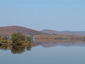
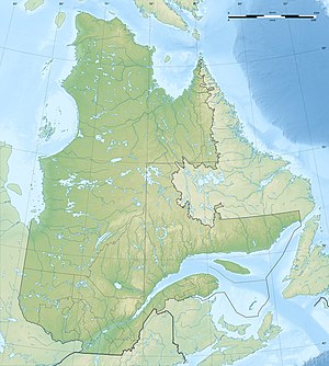
The Lac Saint-Charles is a lake in the administrative region of Capitale-Nationale the Canadian province of Quebec . Most of it lies in the provincial capital Québec (Arrondissement La Haute-Saint-Charles ) and to a lesser extent in the neighboring parishes of Lac-Delage and Stoneham-et-Tewkesbury . The 5.5 km long and up to 600 m wide lake is located on the northern outskirts between the foothills of the Laurentine Mountains .
The most important tributaries are the Rivière des Hurons and the Lac Delage, which lies immediately to the north-west. The 35 km long Rivière Saint-Charles , a tributary of the Saint Lawrence River, flows out of the lake . A peninsula divides the lake into two roughly equal sized basins. Lac Saint-Charles is both an important recreational area and an important element of the city's drinking water supply, which is why strict environmental regulations are in place. At the southern end of the lake, the Cyrille-Delage dam regulates the outflow and the water level. It was built in 1934 and replaced by a new building in 1948.
Web links
- Protection Association of Lac Saint-Charles and the Marais du Nord (French)
- Lac Saint-Charles , Commission de toponymie du Québec (French)
