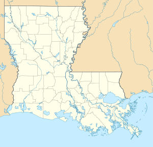
Lake Pontchartrain
| Lake Pontchartrain | ||
|---|---|---|

|
||
| Lake Pontchartrain, seen from the east. | ||
| Geographical location | Southeast Louisiana (USA) | |
| Tributaries | Mississippi River | |
| Drain | Rigolets to Lake Borgne | |
| Places on the shore | New Orleans | |
| Data | ||
| Coordinates | 30 ° 10 ′ N , 90 ° 8 ′ W | |
|
|
||
| surface | 1 839 km² | |
| Maximum depth | 4.26 m | |
| Middle deep | 3.65 m | |
|
particularities |
Brackish water lake |
|
The Pontchartrain Lake ( English Lake Pontchartrain [ leɪkˈpɑːntʃətɹeɪn ]) in southeast Louisiana is a brackish lake and the second largest salt water lake in the United States after the Great Salt Lake .
The lake is largely oval with an east-west extension of about 64 km, a north-south extension of 38 km, an area of 1839 km² and an average depth of 3.65 m to 4.26 m (on shipping routes partially artificially deepened). It is about three times the size of Lake Constance . To the south lies New Orleans , in the north of Mandeville and Madisonville , northeast Slidell . In the west, Lake Pontchartrain is connected to Lake Maurepas by a canal; to the east over the Rigolets with Lake Borgne , a lagoon in the Gulf of Mexico . The salinity of the lake varies - depending on the location - from "negligible" to half the normal ocean salinity.
In some Native American languages , Lake Pontchartrain was called Okwata ("Broad Water"). The lake was given its current name in 1699 by the French explorer Pierre Le Moyne d'Iberville in honor of Louis Phélypeaux de Pontchartrain , who was the French naval minister and chancellor at the time .
The Pontchartrain Lake is actually not a lake or a reservoir , but a lagoon . The lower-lying city of New Orleans is protected from flooding by the lake by levees up to six meters high .
The Pontchartrain Lake and other lakes form the mouth of the Mississippi River . This drains the Pontchartrain Basin, an area of 12,000 km² on the eastern (left) side of the river. A third of the population of Louisiana lives in this basin. The lake serves as a diverse recreational area. A 40 km long double bridge crosses the lake and has been connecting New Orleans with Covington since 1956 . The newer of the two bridges, Lake Pontchartrain Causeway II, opened in 1969. The bridge is the tenth longest bridge in the world.
On 25 February 1964 a traffic type machine crashed Douglas DC-8 of the Eastern Air Lines flight 304 into the lagoon. All 58 inmates were killed, including the singer and actor Kenneth Spencer and the French suffragette Marie-Hélène Lefaucheux .
Lake Pontchartrain gained worldwide fame when several levees broke during Hurricane Katrina on August 30, 2005 and flooded New Orleans. One of the dyke breaches happened directly on the lake shore, others on several canals (Industrial, 17th Street and London Street Canal) that connect the lake with the city center. The length of the dike breach was initially given as 50–60 m, later as 91 m. Only about a week later could the leaks be closed by the United States Army Corps of Engineers , the army's pioneer corps.
environment and nature
More than 125 species of marine and aquatic life live in the lake - including anchovies , sharks and alligators . The surrounding wetland is inhabited by otters , wild boars , ducks and eagles .
Until 1991 raw materials for cement and asphalt were dredged from the lake bed.
Lake Pontchartrain has long suffered from environmental pollution, with large amounts of polluted water spilling into the lake when the city of New Orleans was pumped out after Hurricane Katrina.

