Linter
|
Linter
City of Limburg an der Lahn
|
|
|---|---|
| Coordinates: 50 ° 22 ′ 10 ″ N , 8 ° 5 ′ 33 ″ E | |
| Height : | 181 (181-195) m above sea level NHN |
| Area : | 3.38 km² |
| Residents : | 3165 (Sep 2019) |
| Population density : | 936 inhabitants / km² |
| Incorporation : | July 1, 1974 |
| Postal code : | 65550 |
| Area code : | 06431 |
|
Linter as a district of Limburg
|
|
Linter is a district of the district town of Limburg an der Lahn in the central Hessian district of Limburg-Weilburg .
geography
Linter is located around three kilometers southeast of the city center of Limburg on the B 417 ( Hühnerstraße ). The old town center has the typical, elongated shape of a street village , although in the meantime new development areas have been added, especially in the northwest. Linter itself is at an altitude of 180 meters. The district is largely flat ("Linterer Platte" in the Limburg Basin ) and only rises slightly to the south, up to 195 meters. The small "Linterer Wäldchen" on the northern edge of the village is located in the Eschhofen district. Outside of the buildings, the Linter district itself consists almost exclusively of agricultural land.
The semicircular to the north arched area borders in the northwest to the core city of Limburg. Lindenholzhausen and Eschhofen follow to the east . In the south Linter borders the Hünfeldener district Mensfelden . The western boundary of the district also forms the state border to Rhineland-Palatinate , where the local community of Holzheim adjoins.
history
The oldest human traces are barrows in the Linter forest, which date back to 1550 to 1200 BC. To be dated.
The place was mentioned for the first time in 1195 in a list of properties of the Eberbach monastery . Reports of one or even two robber barons' castles in Linter, which are said to have been destroyed by the Limburg citizens, can no longer be verified today.
In the Middle Ages Linter belonged to the County of Diez (at the latest in 1406 in the Flacht office ), from 1564 to Nassau-Dillenburg , so it was "foreign" for the neighboring city of Limburg. For the first time in 1433 a Heimberger was named as community leader, later the mayors took over this function, which were initially only subordinate community computers. From 1586 there was a town hall. In 1643 Linter was completely depopulated because of the Thirty Years War . The field name "im Altendorff", which was guaranteed in 1596, indicates a desolation in the district, which has not yet been proven archaeologically.
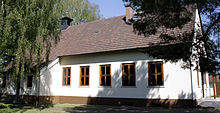
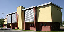
In terms of denomination, Linter changed several times between the Lutheran and the Calvinist creed after the Reformation in 1529. Kirchdorf and thus also the school location was the neighboring Mensfelden from 1433 at the latest. Both places still belong to the same Protestant parish today. In 1725 a separate school was started in the back house (demolished, location between today's houses Mittelgasse 4 and Langgasse 3). Before 1750, the first school house was built (today Langgasse 14), which also housed a prayer room and the mayor's office. In 1873 the second school was built, which also served temporarily as the mayor's seat. In 1981 today's primary school was completed.
Not until 1817 was a separate cemetery laid out for Linter. From 1885, services were held in the school's prayer room and the church was consecrated in 1952, followed by community rooms and a kindergarten in the following year. Before that, there had been a kindergarten since 1933. With the influx of expellees after the Second World War , Linter again received a significant proportion of the Catholic population, for whom a church was built in 1960 and a community center was built in 1993. In addition, there was an older community building, which was demolished in 1968, and a syringe house next to the bakery, which was demolished in the 1960s.
The current course of the road from Limburg to Linter was only laid out in 1780. Before that, the road passed the village to Diez . In 1900 there was the first telephone in Linter.
On April 24, 1910, the Zeppelin Z II had to make an emergency landing near Linter. The next day the airship broke loose and finally crashed into a rock near Weilburg . During the Second World War, there was a small military airfield with an anti-aircraft battery near Linter.
1 July 1974 at Linter was in the course of administrative reform in Hesse powerful state law in the district town of Limburg an der Lahn incorporated .
In 1998 the primary school was expanded, and in 1999 a second kindergarten was built. In 2003 the old gymnasium was torn down to make way for a more modern village community center. This community center has been the focus of Linter club life since 2004. The neighboring indoor pool was closed in the same year and is now used as a bowling alley.
The place name was based on the Lint brook , which used to meander through the village and has now dried up. The stream, which gave the city of Limburg its name, is named after the Celtic name for a body of water. A frog can be seen on the Linter coat of arms , as the stream was very rich in amphibians . The nickname for the inhabitants is therefore "frogs".
Territorial history and administration
The following list gives an overview of the territories in which Linter was located and the administrative units to which it was subordinate:
- before 1806: Holy Roman Empire , County of Nassau-Diez
- from 1806: Duchy of Nassau , Limburg Office
- from 1816: German Confederation , Duchy of Nassau, Limburg Office
- from 1849: German Confederation, Duchy of Nassau, Limburg District Office
- from 1854: German Confederation, Duchy of Nassau, Limburg Office
- from 1867: North German Confederation , Kingdom of Prussia , Province of Hessen-Nassau , Administrative Region of Wiesbaden , Unterlahnkreis
- from 1871: German Empire , Kingdom of Prussia, Province of Hessen-Nassau, administrative district of Wiesbaden, Unterlahnkreis
- from 1886: German Empire , Kingdom of Prussia, Province of Hesse-Nassau, District of Wiesbaden, District of Limburg
- from 1918: German Empire, Free State of Prussia , Province of Hesse-Nassau, District of Wiesbaden, District of Limburg
- from 1944: German Empire, Free State of Prussia, Nassau Province , Limburg District
- from 1945: American zone of occupation , Greater Hesse , Wiesbaden district, Limburg district
- from 1949: Federal Republic of Germany , State of Hesse , Wiesbaden district, Limburg district
- from 1968: Federal Republic of Germany, State of Hesse, administrative district Darmstadt , district Limburg
- from 1974: Federal Republic of Germany, State of Hesse, administrative district Darmstadt, district Limburg-Weilburg
- on July 1, 1974 Linter was incorporated as a district in the city of Limburg.
- from 1981: Federal Republic of Germany, State of Hesse, Gießen district, Limburg-Weilburg district
population
Population development
Linter is the fastest growing part of Limburg; the number of inhabitants has tripled since 1970. This makes it the third largest district after the core city and Lindenholzhausen. Linter currently houses 56 nationalities (as of 2007) with a proportion of foreigners of around eleven percent.
In historical times, the first surviving population census dates to 1532 with eleven fireplaces. In 1607 25 men were counted. After the complete depopulation through the Thirty Years War, the number of households did not rise permanently to over ten until shortly before the end of the 17th century. In 1750 there were 85 inhabitants, in 1818 there were 161 inhabitants.
| Linter: Population from 1834 to 2014 | ||||
|---|---|---|---|---|
| year | Residents | |||
| 1834 | 239 | |||
| 1840 | 264 | |||
| 1846 | 302 | |||
| 1852 | 314 | |||
| 1858 | 307 | |||
| 1864 | 334 | |||
| 1871 | 378 | |||
| 1875 | 399 | |||
| 1885 | 416 | |||
| 1895 | 419 | |||
| 1905 | 445 | |||
| 1910 | 473 | |||
| 1925 | 491 | |||
| 1939 | 505 | |||
| 1946 | 754 | |||
| 1950 | 768 | |||
| 1956 | 734 | |||
| 1961 | 756 | |||
| 1967 | 897 | |||
| 1970 | 1,021 | |||
| 1974 | 961 | |||
| 1987 | 1,746 | |||
| 1994 | 2,746 | |||
| 2014 | 3,093 | |||
| Data source: Historical municipality register for Hesse: The population of the municipalities from 1834 to 1967. Wiesbaden: Hessisches Statistisches Landesamt, 1968. Other sources: | ||||
Religious affiliation
Source: Historical local dictionary
| • 1885: | 386 Protestant (= 92.79%), 30 Catholic (= 7.21%) residents |
| • 1961: | 585 Protestant (= 77.38%), 169 Catholic (= 22.35%) residents |
Culture and sights
Cultural monuments
societies
TuS Linter 1879, with its football, table tennis, gymnastics, carnival and tennis departments, is the largest club in town with around 800 members. Other associations are the Kirmesgesellschaft, the rural women’s association, the Linter primary school support association, the pedigree poultry breeding association founded in 1930, which has a 2.2 hectare breeding facility, and the Linter volunteer fire brigade founded in 1935 (with youth fire brigade since November 18, 1970 and from 7 May 2011 with the children's fire brigade).
Public facilities
- Evangelical Community Center Christ Church
- Protestant day care center "Under the Rainbow"
- Linter volunteer fire brigade (since November 18, 1970 with the youth fire brigade and since May 7, 2011 with the children's fire brigade ), which was named “Fire Brigade of the Month” in June 2008 by the Hessian Ministry of the Interior and for Sports .
- Linter primary school
- Youth room in the community center
- Catholic Church / Community Center St. Johannes Nepomuk
- Kindergarten St. Therese
Web links
- Internet presence of the city of Limburg
- History of Linter. Local history, information. In: franz-karl-nieder.de. Private website
- Linter, Limburg-Weilburg district. Historical local dictionary for Hessen. In: Landesgeschichtliches Informationssystem Hessen (LAGIS).
- Literature about Linter in the Hessian Bibliography
Individual evidence
- ↑ Budget statute - budget year 2013. (PDF) Limburg ad Lahn, accessed in December 2018 .
- ↑ Limburg in Numbers , accessed in January 2020.
- ↑ Law on the restructuring of the Limburg and Oberlahn districts (GVBl. II 330-25) of February 6, 1974 . In: The Hessian Minister of the Interior (ed.): Law and Ordinance Gazette for the State of Hesse . 1974 No. 5 , p. 101 , § 5 ( online at the information system of the Hessian state parliament [PDF; 809 kB ]).
- ^ Federal Statistical Office (ed.): Historical municipality directory for the Federal Republic of Germany. Name, border and key number changes in municipalities, counties and administrative districts from May 27, 1970 to December 31, 1982 . W. Kohlhammer, Stuttgart / Mainz 1983, ISBN 3-17-003263-1 , p. 369-370 .
- ↑ a b c Linter, Limburg-Weilburg district. Historical local dictionary for Hessen. (As of March 23, 2018). In: Landesgeschichtliches Informationssystem Hessen (LAGIS).
- ^ Michael Rademacher: German administrative history from the unification of the empire in 1871 to the reunification in 1990. State of Hesse. (Online material for the dissertation, Osnabrück 2006).


