
List of highways in Turkey

The Turkish motorway network ( Turkish Otoyol ) comprised a length of 2155 km including feeders at the end of 2016. The numbering is roughly based on their location, so the highways in the greater Istanbul area are single-digit, in the Adana area double-digit with a leading five. In Turkey there is a speed limit of 120 km / h on motorways, all motorways have at least six lanes and are partially illuminated.
history
Turkey's highways are relatively new. In 1980 there was only 27 km of motorway in Turkey , these were concentrated in Istanbul.
The expansion of the highways stalled after 2002 in favor of the two-lane expressways ("duble yol") of the Erdoğan government . Large investments since 2002 in the construction of the two-lane expressways resulted in a network length of 1499 km in urban areas and 19 790 km in extra urban areas.
Since 2009 great efforts have been made to expand the motorway network. In the first stage, around 4773 km of route will be built. Of these, the Gebze-Orhangazi-Izmir motorway and the Nordmarmara motorway are currently under construction. Most of the remaining projects are still in the planning stage, with some waiting for the order placement process.

toll
Six Turkish motorways are toll roads. A distance-dependent toll must be paid on this. Tunnels and expensive structures except for the two Bosporus bridges in Istanbul are not subject to a toll. With the exception of a general motorway toll, there are no other charges on Turkish roads; Expressways are toll-free.
Toll revenue in 2001 was approximately $ 203 million and increased to approximately $ 542 million by 2012. The Bosporus bridges used 150 million vehicles in 2012 and the other toll roads over 210 million vehicles.
International roads
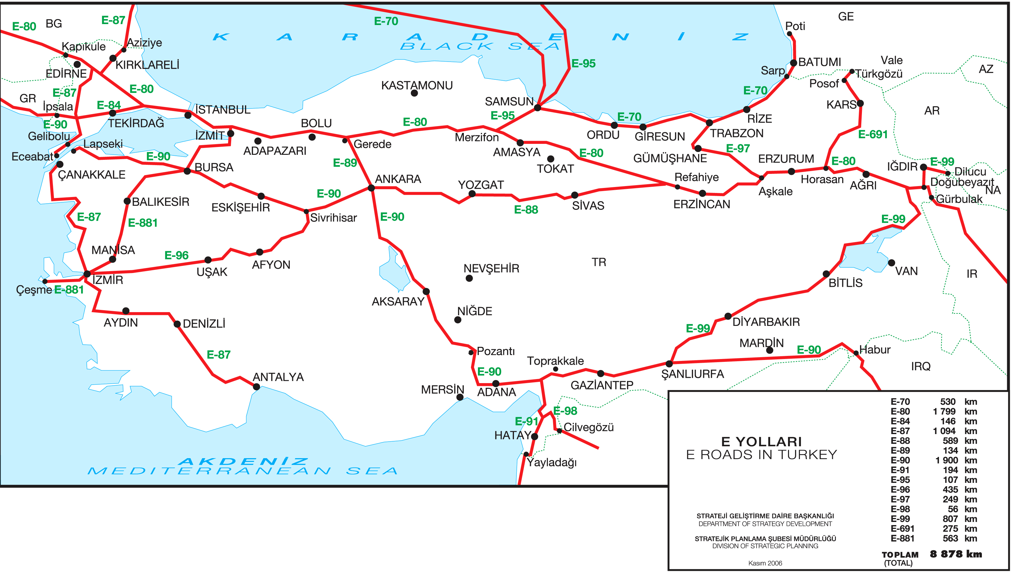
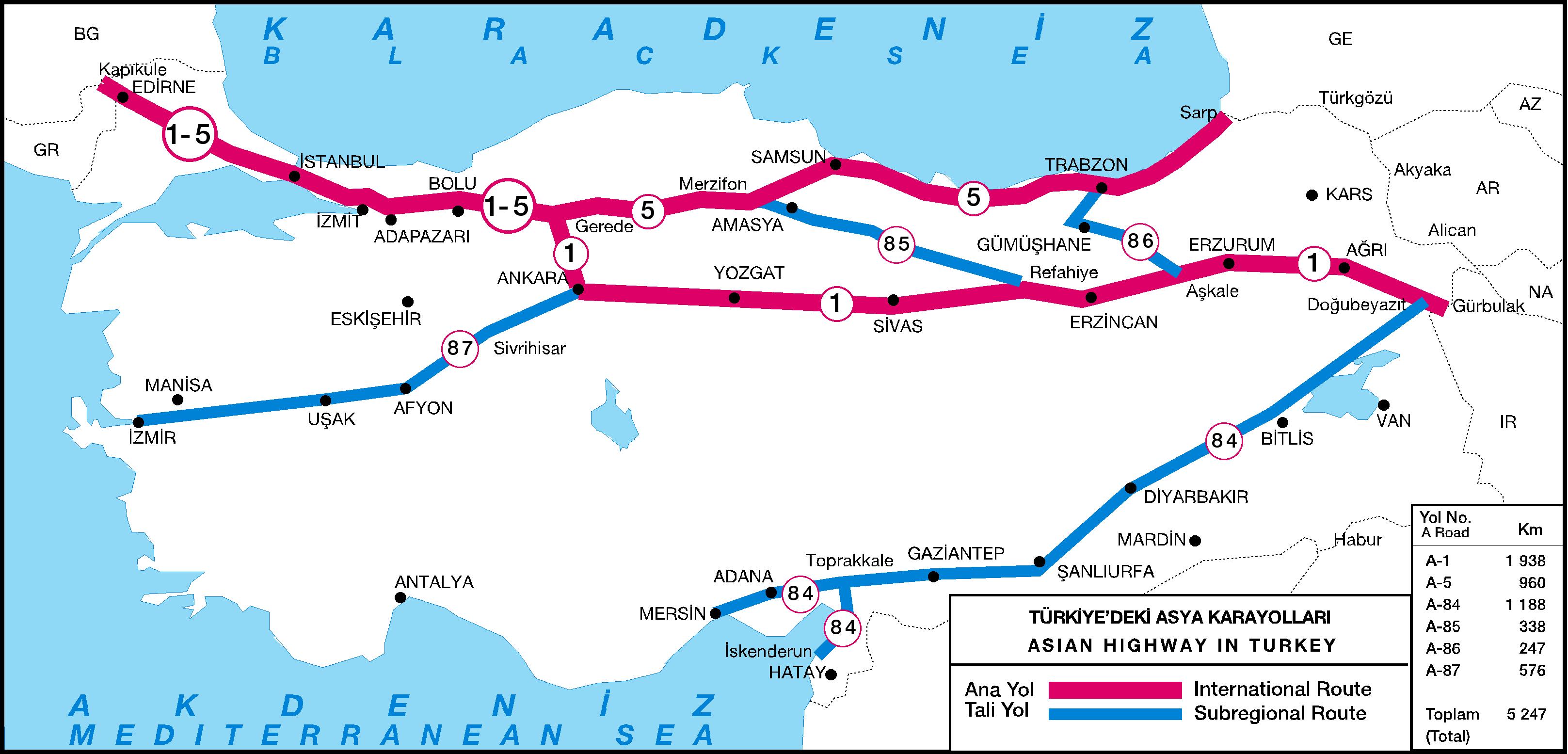
In Turkey, the network of European roads overlaps with that of the Asian trunk road project . For example, the O-2 is Asian Highway 1 , Europastraße 80 and Otoyol 2 on almost the entire route , but mostly only the O and E numbers are shown on the highways. In total, Turkey's e-road network covers over 8,800 km, the AH road network over 5200 km.
Furnishing
The motorways are illuminated at exits, rest stops, parking lots and more dangerous sections. Outside of cities, exits are almost always implemented by means of a feeder.
Signage
The signage has a green background. The Highway Gothic font , which is also used in the USA, is used.
When entering a motorway, the driver's attention is first drawn to the start of the motorway using the motorway sign that is typical for Europe. Usually there is another sign right next to it, which indicates with the appropriate signs that bicycles, horse-drawn carriages, pedestrians and tractors are prohibited from using the motorway. Shortly after the end of the acceleration lane, there is usually a sign on the right-hand side of the lane, which indicates the minimum and maximum speed (40 or 120 km / h) and indicates that there is no stopping or turning. About 100 meters later there is a sign that uses a graphic to explain the intended use of the respective lanes for continuous driving or for overtaking and, in the broadest sense, reminds of the right-hand drive requirement.

Start of the Autobahn
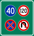
Speeds, no turning back and no stopping

Distance table

Sign showing important telephone numbers (emergency call, road office, gendarmerie and police)

Sign explaining the use of the tracks


List of highways
| No. | Surname | length | course | map |
|---|---|---|---|---|
|
|
İstanbul 1. Çevre Yolu (Istanbul Ring Road No. 1) |
23 km |
Istanbul - |

|
|
|
İstanbul 2. Çevre Yolu (Istanbul Ring Road No. 2) |
38 km |
|

|
|
|
Avrupa Otoyolu (European motorway) |
231 km |
|

|
|
|
Anadolu Otoyolu (Asia Highway) |
379 km |
Istanbul - |

|
|
|
İstanbul - Izmir Otoyolu (İstanbul-Bursa Highway) |
407 km |
Istanbul - |

|
|
|
Ankara Çevre Otoyolu (Ankara ring road) |
110 km |
|

|
|
|
Tarsus-Ankara-Otoyolu (Tarsus-Ankara Highway) |
162 km |
Tarsus - |

|
|
|
Bursa-Sivrihisar Otoyolu (Bursa-Sivrihisar Highway) |
34 km |
|

|
|
|
İzmir Çevre Otoyolu (Izmir ring road) |
51 km |
|

|
|
|
İzmir - Aydın Otoyolu (Izmir-Aydın Highway) |
106 km |
Izmir - |

|
|
|
İzmir - Çeşme Otoyolu (Izmir-Çeşme Highway) |
79 km |
Izmir - |

|
|
|
Kuzey Ege Otoyolu (North Aegean Highway) |
76 km |
|

|
|
|
Adana Otoyolu (Adana Highway) |
23 km |
|

|
|
|
Adana - Mersin Otoyolu (Adana-Mersin Highway) |
88 km |
|

|
|
|
Adana - Şanlıurfa Otoyolu (Adana-Sanliurfa Highway) |
365 km |
|

|
|
|
Toprakkale - İskenderun Otoyolu (Toprakkale-İskenderun Highway) |
75 km |
|

|
|
|
Gaziantep Çevre Otoyolu (Gaziantep Ring Highway) |
35 km |
|

|
List of planned and under construction highways:
| status | Surname | length | course | map |
|---|---|---|---|---|
| under construction (section in operation) |
Kuzey Marmara Otoyolu (North Marmara Highway) |
398 km |
Kınalı - |

|
| in the procurement | Ankara-Kırıkkale-Delice Otoyolu (Ankara-Kırıkkale-Delice Highway) |
119 km |
Ankara - |

|
| in planning | Yalova-İzmit Otoyolu (Yalova-İzmit Highway) |
70 km |
Yalova - |

|
| in planning | Afyon-Antalya-Alanya Otoyolu (Afyon-Antalya-Alanya highway) |
450 km |
Kırka - Afyonkarahisar - Şuhut - Keçiborlu - Burdur - |

|
| in planning | Ankara-İzmir Otoyolu (Ankara-İzmir Highway) |
500 km |
Ankara - |

|
| in planning | Viranşehir-Diyarbakır Otoyolu (Viranşehir-Diyarbakır Highway) |
90 km |
Viranşehir - |

|
| in planning | Delice-Samsun Otoyolu (Delice-Samsun-Autobahn) |
280 km | Delice - Çorum - Merzifon - Samsun |

|
| in planning | Bafra-Ünye Otoyolu (Bafra-Ünye motorway) |
160 km | Bafra - Samsun - Ünye |

|
| in planning (section under construction) |
Kınalı-Tekirdağ-Çanakkale-Balıkesir Otoyolu (Kınalı-Tekirdağ-Çanakkale-Balıkesir Highway) |
321 km |
Kınalı - |

|
| in planning | Gerede-Merzifon Otoyolu (Gerede-Merzifon-Autobahn) |
300 km |
Talk - |

|
| in planning | Merzifon-Gürbulak Otoyolu (Merzifon-Gürbulak-Autobahn) |
850 km | Merzifon - Amasya - Tokat - Reşadiye - Suşehri - Refahiye - Erzincan - Pülümür - Erzurum - Horasan - Ağrı - Gürbulak |

|
Web links
- kgm.gov.tr Website of the highway operator Karayolları Genel Müdürlüğü (Turkish, English)
- Toll requirement in Turkey
Individual evidence
- ↑ Development of the road network on kgm.gov.tr ( memento of the original from September 7, 2012 in the Internet Archive ) Info: The archive link was automatically inserted and not yet checked. Please check the original and archive link according to the instructions and then remove this notice. (PDF; 58 kB)
- ↑ Length of the motorways with separate lanes kgm.gov.tr
- ↑ Amount of toll income on kgm.gov.tr (PDF; 109 kB)
- ↑ Network of European roads on kgm.gov.tr
- ↑ Network of the Asian trunk road project on kgm.gov.tr
- ↑ Map of the motorway projects on kgm.gov.tr
- ↑ List of motorway projects on kgm.gov.tr