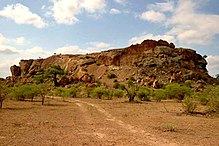
Mapungubwe Hill
Mapungubwe is an archaeological site near the border triangle South Africa - Zimbabwe - Botswana - west of Musina - in the South African province of Limpopo . Royal tombs have been found on the hill, which has been excavated since 1933, and the remains of a city in the lower areas.
The first settlements of farmers on Limpopo date around the year 900, for example the place known as Schroda . According to research by the University of Pretoria , Mapungubwe existed between 1030 and 1290. It was created as an extension of the settlement found on Bambandyanalo Hill somewhat to the southwest (also known under the name K 2 ). With the decline of Mapungubwe due to changed climatic conditions, the rise of the Empire of Greater Zimbabwe began .
The hilltop was only inhabited for about 70 years. The excavations suggest that the rulers and their soldiers lived there and were fed by the farmers living in the lower areas. This would be the earliest evidence of a class society in southern Africa . During this period, the total number of people connected with the rule in Mapungubwe is estimated at 9,000, of whom 3,000-5,000 in the city.
The artifacts found are glass beads, porcelain, ivory, copper, and gold. Many of them indicate intensive trade relations with the African east coast. They are kept in Pretoria , replicas are on display in the museum in nearby Musina. The best-known find is probably a rhinoceros carved out of wood and covered with gold foil .
Since 2003, the archaeological sites and the surrounding countryside UNESCO - World Heritage site , they also have the status of a national park (see Mapungubwe National Park ). The name Mapungubwe means 'place of the stone of wisdom'.
Coal Mine Threat
In 2011 the South African government approved the construction of a coal mine in the immediate vicinity of the World Heritage Site and the national park. Opponents feared pollution from dust development for flora and fauna as well as contamination of the drinking water for the time after the mine was completed. They also feared the construction of coal-fired power plants and increased traffic through truck traffic. Further construction of the mine was stopped at the end of 2011 by the South African Ministry of the Environment.
See also
Web links
- Mapungubwe - Information on the archaeological site, its history and the collection ( Memento from January 13, 2014 in the Internet Archive )
- History: Mapungubwe: SA's lost city of gold. (English)
- Apley, Alice. Mapungubwe (approx. 1050-1270). In Timeline of Art History. New York: The Metropolitan Museum of Art, 2000– (October 2001) (English)
- Mark Cartwright: Mapungubwe . In: Ancient History Encyclopedia , March 15, 2019 (English).
Individual evidence
Coordinates: 22 ° 13 ′ S , 29 ° 23 ′ E


