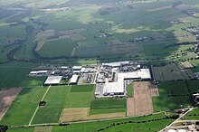
Medebach (Orke)
| Medebach | ||
|
|
||
| Data | ||
| Water code | DE : 428432 | |
| location | near Medebach ; Hochsauerlandkreis , North Rhine-Westphalia ( Germany ) | |
| River system | Weser | |
| Drain over | Orke → Eder → Fulda → Weser → North Sea | |
| source | in the Rothaargebirge above Medebach 51 ° 12 '50 " N , 8 ° 39' 44" E |
|
| Source height | approx. 490 m above sea level NHN | |
| muzzle | below Medebach in the Orke coordinates: 51 ° 10 ′ 21 ″ N , 8 ° 43 ′ 31 ″ E 51 ° 10 ′ 21 ″ N , 8 ° 43 ′ 31 ″ E |
|
| Mouth height | approx. 337 m above sea level NHN | |
| Height difference | approx. 153 m | |
| Bottom slope | approx. 19 ‰ | |
| length | 7.9 km | |
| Catchment area | 8.345 km² | |
| Left tributaries | few small streams | |
| Right tributaries | few small streams | |
| Small towns | Medebach | |
The Medebach is a 7.9 km long, northern and orographically left tributary of the Orke in the Hochsauerlandkreis , North Rhine-Westphalia ( Germany ).
Course and catchment area
The Medebach rises in the northeast part of the Rothaargebirge . Its source is about 490 m above sea level. NHN on an arable land around 200 m east of the “Rennefeld” farm, which is around 3.3 km northwest of the small town of Medebach on the L 740 road , which connects Medebach with its northwestern district of Küstelberg . The origin of the river represents the northernmost point of the river.
Medebachquelle and Rennefeldhof are surrounded by numerous wooded mountains: Böhlen ( 586.9 m ) in the northeast, Bromberg ( 557.4 m ) in the east, Hesseberg ( 596.2 m ) in the south, Engelmannskopf ( 501.2 m ) in the southwest, Kleiner Steinberg ( 601.3 m ) in the west and Großer Steinberg ( 624 m ) and Wahlkopf ( 629.9 m ) in the northwest .
The Medebach flows from its source - leaving the Rennefeldhof area and without reaching this farm - in a predominantly south-easterly direction and mostly running along the L 740 through the Medebach settlement "Am Krämershagen" to and through the center of the Medebacher Bucht located town of Medebach. He flows parallel to the slightly further northeast, the town of Medebach passing Brühne influx Harbecke and happens about north of the creek located business park Holtischer way .
The Medebach then flows in an increasingly southerly direction past the “Holtischfeld” farm, after crossing under the L 858, which branches off the L 740 that accompanies the stream and leads to the Medebach district of Medelon , at around 337 m above sea level in the west or west. Medelon flowing towards the Eder tributary Orke .
The catchment area of the Medebach, which is fed by a few streams, is 8.345 km².
nature
With the exception of the Medelon location, the course of the Orke is protected as a nature reserve and FFH area . As part of a life project of the Hochsauerlandkreis Biological Station, most of the weir systems in the Hochsauerland were made accessible for fish and other aquatic organisms. So far, kingfisher , dipper , gray wagtail and mallard have been identified as breeding birds on the Orke . Gray herons ( herons ) and black storks appear as food guests .
Footnotes
- ↑ a b Topographic map 1: 25,000
- ↑ a b c d Topographical Information Management, Cologne District Government, Department GEObasis NRW ( information )
