Middelfart
| Middelfart | ||||
|
||||
| Basic data | ||||
|---|---|---|---|---|
| State : |
|
|||
| Region : | Syddanmark | |||
|
Municipality (since 2007) : |
Middelfart | |||
| Coordinates : | 55 ° 30 ' N , 9 ° 44' E | |||
|
Population : (2020) |
15,922 | |||
| Area : | 72 km² | |||
| Population density : | 221 inhabitants per km² | |||
| Postal code : | 5500 | |||
| Website: | www.middelfart.dk | |||
 Saint Nikolai Church in Middelfart |
||||
Middelfart is the main town of the municipality of the same name in the region of southern Denmark on the island of Funen . The community is 72 km².
geography
Middelfart is about 11 km south of Fredericia, about 34 km northwest of Assens and about 46 km west of Odense. The town lies between the northern part of Snævringen and Fænøsund and has several harbors on both banks. On the south bank of Snævringen, between the two bridges over the Little Belt , are the municipal harbor, Kongebro Havn and the new Tel-Ka-Marina, on the north bank of Fænøsund in the Russelbæk district lies the Middelfart marina ( Middelfart Lystbådehavn ).
history
In the 11th century the place was called Mæthlælfar , which means "the most central crossing point". Because of its location at the narrowest point of the Little Belt, the fishing village quickly developed into the most important port between Jutland and Funen. 1,496 were from the Danish King John I the market rights granted. Another important line of business in addition to trade and handicrafts was hunting porpoises in the Little Belt from the 16th century , which were caught because of the trans . This era dragged on until the end of the 19th century, when the price of oil fell due to the increasing use of petroleum . A number of half-timbered houses from the Renaissance period bear witness to this heyday.
After two years of construction, the first protected port basin was put into operation in 1836. In 1899 the cable and wire factory Nordiske Kabel- og Traadfabriker chose Middelfart as one of its main locations. In 1935 the first bridge over the Little Belt, Lillebæltsbroen , was completed, making Middelfart a central part of Denmark's road and rail network. In 1970 a second bridge was opened over the Belt. The Ny Lillebæltsbro motorway bridge is an important link along the European route 20 .
Population development
Development of the population on (January 1st) :
|
|
Culture and sights
In and near Middelfart there are, among others, the following remarkable buildings:
- Kulturøen im Hafen is the city's cultural center and was completed in 2005.
- The Middelfart Museum has exhibitions on the recent cultural history of the municipality.
- CLAY is Denmark's ceramic museum, u. a. with a porcelain collection from Royal Copenhagen .
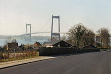
- Lillebæltsbroen from 1935 is a combined road and rail bridge.
- The Ny Lillebæltsbro 1970 is a motorway bridge over the Little Belt.
- Masts of the two 380 kV overhead line crossings of the overhead line crossing of the Little Belt
Personalities
- Wilhelm Nellemose (1890–1944), Captain and Secretary General of the International Council for the Exploration of the Sea
- Jan O. Pedersen (* 1962), speedway and long track driver
- Tino Mogensen (* 1972), handball player
- Christian Eriksen (* 1992), football player
Individual evidence
- ↑ Statistics banks -> Befolkning og valg -> BY1: Folketal January 1st efter byområde, alder og køn (Danish)
- ↑ Information from the Tourist Office on the Middelfart marinas. (No longer available online.) Archived from the original on January 2, 2010 ; Retrieved April 19, 2010 . Info: The archive link was inserted automatically and has not yet been checked. Please check the original and archive link according to the instructions and then remove this notice.
- ^ A b Søren Olsen: Danmarks Købstæder . 1st edition. Politics Forlag A / S, Copenhagen 2000, ISBN 87-567-6203-8 , Middelfart, p. 178 ff . (Danish).
- ↑ Based on tables BEF4A (1976–2003) and BEF44 (from 2006) of the statistical banks


