
Narage
| Narage | ||
|---|---|---|
| Waters | Bismarcksee | |
| Archipelago | Bismarck Archipelago | |
| Geographical location | 4 ° 32 '49 " S , 149 ° 6' 43" O | |
|
||
| length | 1.5 km | |
| width | 1 km | |
| surface | 1.43 km² | |
| Highest elevation | 307 m | |
| Residents | uninhabited | |

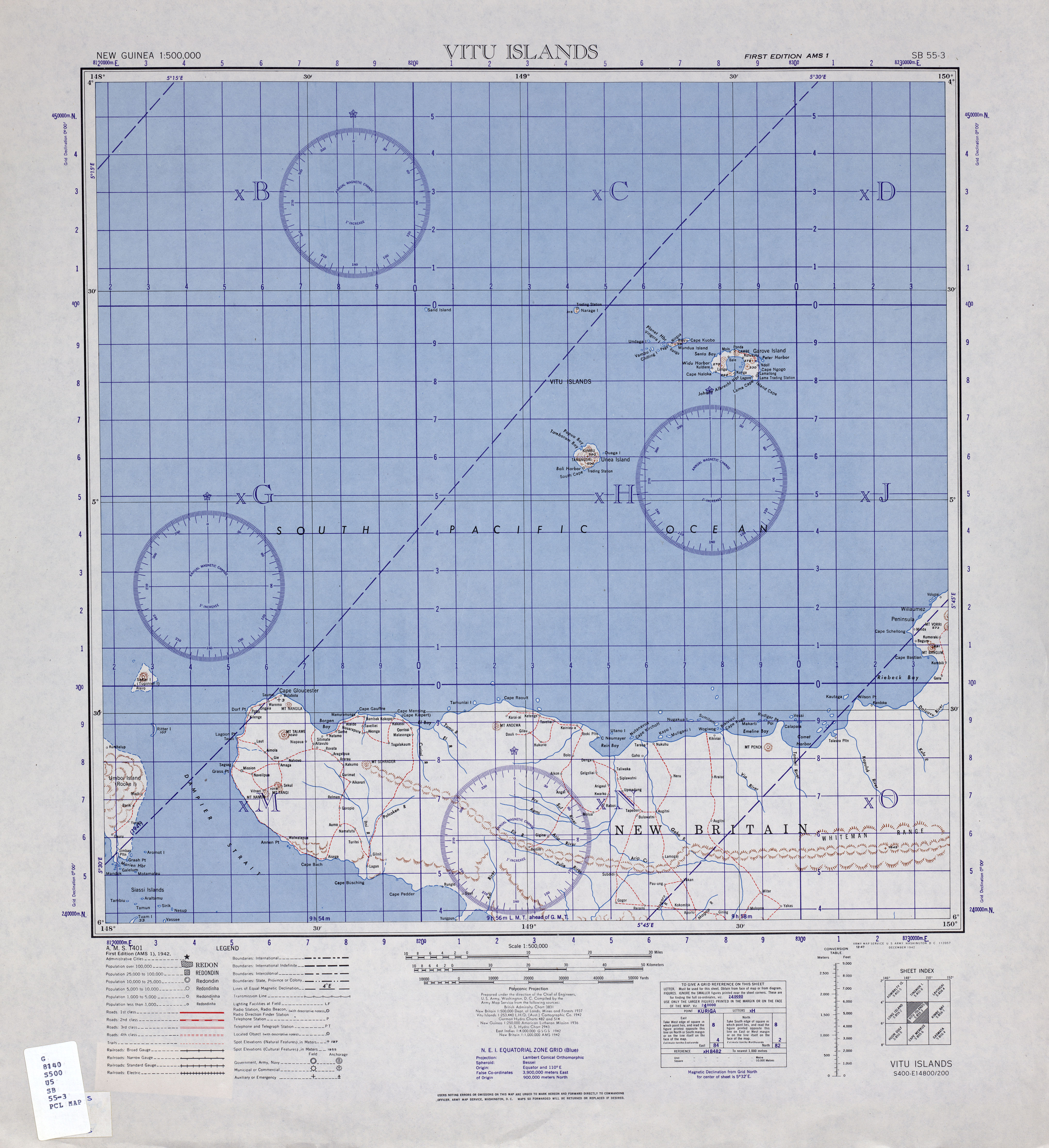
Narage (also Gipps Island , Narega , Narraga , Narrage , Nord Iceland or North Iceland ) is a volcanic island in the Bismarck Archipelago north of New Britain . It is part of the West New Britain province of the state of Papua New Guinea . Narage is the northernmost island of the Vitu Islands (also Witu Islands).
The island with an area of 1.43 km² is the wooded, 307 meter high summit of a stratovolcano that was formed in the Pleistocene . The island is surrounded by a coral reef that is 200 to 400 meters from the coast. There is no scientifically proven knowledge of volcanic eruptions . On the southwest and southeast coast of the island there are several boiling hot springs and a geyser , which is said to have reached a height of ten meters in 1880. In 1970 the geyser erupted every two to three minutes for 20 to 30 seconds and reached a height of one meter. Another geyser with a throw height of 45 meters is said to have been observed on a sandbank eight kilometers northwest of Narage in the early 1860s .
From a European point of view, Narage was discovered in 1793 by the French navigator Joseph Bruny d'Entrecasteaux . From 1899 to 1914 the island was part of the German New Guinea colony . According to an American army map with a map base from 1942, there was a trading post in the north of the island. According to the Australian film producer John Seach, residents used the island's fumaroles for cooking. A detailed map from 1944 notes for Narage that the island has no native population and that the small coconut plantation on the north coast is overgrown.
Web links
Narage in the Global Volcanism Program of the Smithsonian Institution (English)
Individual evidence
- ↑ a b Entry Naraga in the German Colonial Lexicon (1920), Volume II, p. 619.
- ^ T. Scott Bryan: The geysers of Yellowstone. 4th edition, University Press of Colorado, Boulder 2008, ISBN 978-0-87081-924-7 .
- ↑ Vitu Islands 1: 500,000 of the US Army Map Service at the University of Texas at Austin .
- ^ Narage on Volcano Live (accessed March 10, 2013).
- ↑ United States. Army. South West Pacific Area. Base Map Plant. Vitu Islands, New Britain (cartographic material): strategic map 1944.