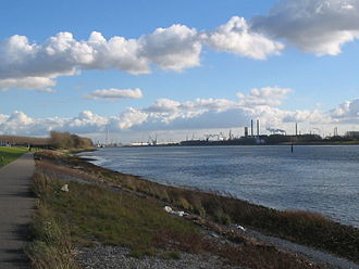
Nieuwe Waterweg
The Nieuwe Waterweg is the last section of the most important estuary for shipping in the ramified Rhine estuary . It belongs to the Dutch province of South Holland . The entire section of the river, around 20 kilometers long, between the confluence of the Nieuwe Maas and the Oude Maas in Rotterdam and the confluence with the North Sea at Hoek van Holland ( Maasmond ) is often given this name. In the real sense, however, it only applies to the last section, around seven kilometers long, which connects the former Scheur arm with the open sea as a short cut through the dune belt of the North Sea coast . The Maeslant storm surge barrier has marked the boundary between the two sections since 1997 .
The Nieuwe Waterweg is part of the Dutch waterway 102 (Nieuwe Maas - Nieuwe Waterweg - Maasmond), an important part of the North Sea – Rotterdam – Rhine shipping route . For this reason, the Delta Works regulate the water flow in such a way that at medium and low water levels, the main amount of water flows through the Nieuwe Waterweg, while the southern, much wider main channel only feeds the peak outflows via Nieuwe Merwede , Hollands Diep and the locks of the Haringvliet dam to the North Sea. Of the approximately 2900 m³ / s that the Rhine river system discharges, on average less than 1500 m³ / s flow into the North Sea via the Nieuwe Waterweg.
history
When the port of Rotterdam silted up more and more in the 18th and 19th centuries, construction of this canal began in 1866, with the engineer Pieter Caland in charge of planning and execution . It was released for shipping in 1872.
Since a further deepening of the fairway (currently around 11.6 meters) was no longer technically feasible after several lowerings of the Nieuwe Waterweg, the new outer harbors Europoort and Maasvlakte were built at the confluence with the North Sea in the second half of the 20th century . Both can be approached by the currently largest seagoing vessels. So that the Nieuwe Waterweg can also be passed by larger ships, the fairway is to be deepened from 2018. By the time the A4 motorway tunnel is crossed, the new depth should be 16.4 m, in the port area of Botlek behind it, 15.9 m.
Web links
- Nieuwe Waterweg Rijkswaterstaat (Dutch)
Individual evidence
- ↑ Wolfhart Fabarius: Rotterdam is deepening the “Nieuwe Waterweg” - “Botlek” port area to be kept attractive . In: Daily port report of October 5, 2017, pp. 1 and 13.
Coordinates: 51 ° 56 ′ 31 ″ N , 4 ° 11 ′ 29 ″ E

