
Nieuwkoop
 flag |
 coat of arms |
| province |
|
| mayor | Robbert-Jan van Duijn ( CDA ) |
| Seat of the municipality | Nieuwveen |
|
Area - land - water |
91.16 km 2 78.27 km 2 12.89 km 2 |
| CBS code | 0569 |
| Residents | 28,591 (Jan 31, 2019) |
| Population density | 314 inhabitants / km 2 |
| Coordinates | 52 ° 9 ' N , 4 ° 47' E |
| Important traffic route |
|
| prefix | 0172 |
| Postcodes | 1428, 2421, 2431-2432, 2435, 2441, 2461, 3651-3653 |
| Website | Homepage of Nieuwkoop |
 |
|
Nieuwkoop ( ) is a municipality in the Dutch province of South Holland .
Since January 1, 2007, Nieuwkoop has formed a new municipality with the name of Nieuwkoop together with the former municipalities of Ter Aar and Liemeer .
Villages
The approximate number of inhabitants in brackets (as of 2008; sources: Dutch Wikipedia, Tourist Office VVV):
- De Meije (600), part of this place is in the neighboring communities
- Korteraar (750)
- Langeraar (2300)
- Nieuwkoop (8750)
- Nieuwveen (4000), seat of the municipal administration
- Noordeinde and Zevenhoven (2750)
- North (1600)
- North Dorp (60)
- Papenveer (1200)
- Ter Aar (9000)
- Vrouwenakker (100) located on the Amstel
- Woerdense Verlaat (800)
Location and economy
The somewhat remote municipality is located in the so-called Groene Hart (Green Heart) of Holland: Ter Aar is directly north of Alphen aan den Rijn , Nieuwkoop and Nieuwveen a little further east. The area is characterized by a fen landscape with many meadows, watercourses and lakes. The Nieuwkoopse Plassen and the smaller Langeraarse Plassen are of particular importance for water sports tourism . The Amstel , which flows into the IJ in Amsterdam , begins its course at Papenveer and forms the municipal boundary to Uithoorn and De Ronde Venen . Rail travelers who want to visit the municipality, change to the bus at the train stations in Alphen aan den Rijn , Amsterdam or Woerden , which is unfortunately a rather arduous journey. There are no motorways in the area, but the country roads are easy to drive.
The population lives from gardening and agriculture and from the processing of vegetables and fruit; there is also a lot of small businesses. Water sports tourism is also of economic importance.
history
The area of today's municipality Nieuwkoop was a largely inaccessible moorland until around 1050. Then local gentlemen began to surrender land to farmers and parishes for reclamation; one such property was called cope (modern Dutch: koop, German: purchase); the place name Nieuwkoop comes from here. Zevenhoven is first mentioned in a document in 1085; in the Middle Ages the village was posted for property tax on seven farms. Later peat was extracted from the bog soil, which is what led to it. a. which led to Nieuwkoopse Plassen (Nieuwkooper Lakes). The village of Langeraar was completely lost in a flood disaster in 1788 and was completely rebuilt in another location. The area has always been characterized by agriculture; up to 1900 many of the inhabitants were quite poor and lived from cutting peat, making thatched baskets, farming and fishing in the numerous lakes and small rivers. It is noticeable that in the middle of the 19th century many inhabitants of the village of Nieuwkoop practiced the blacksmith's trade . After 1950, an important horticultural industry with cultivation in greenhouses emerged .
Attractions
- The Nieuwkoopse Plassen is an important water sports area, with marinas (in Nieuwkoop), boat rentals, restaurants, etc.
- The small Langeraarse Plassen , on the other hand, are much quieter.
- Nieuwkoop, Nieuwveen and Ter Aar each have a small local museum. The labeling on the exhibits is only in Dutch.
- The narrow road along the winding Meije stream is very picturesque; You can also go on bike tours in the polder landscape elsewhere.
- In the village of Nieuwkoop there is an old court house ( Regthuys ) from 1628.
politics
Distribution of seats in the municipal council
The local elections on March 21, 2018 resulted in the following distribution of seats:
| Political party | Seats | |||
|---|---|---|---|---|
| 2006 | 2010 | 2014 | 2018 | |
| Seed Beter Nieuwkoop | - | 4th | 6th | 6th |
| CDA | 6th | 4th | 4th | 5 |
| VVD | 4th | 4th | 3 | 4th |
| Natuurlijk Nieuwkoop a | - | - | 4th | 4th |
| D66 | - | 2 | 3 | 1 |
| ChristenUnie / SGP | 1 | 1 | 1 | 1 |
| Midden Partij Nieuwkoop | 8th | 3 | - | - |
| Progressief Nieuwkoop | 2 | 3 | - | - |
| total | 21st | 21st | 21st | 21st |
mayor
Robbert-Jan van Duijn ( CDA ) has been the acting mayor of the municipality since February 3, 2020 . The councilors include Guus Elkhuizen ( Samen Beter Nieuwkoop ), Bernadette Wolters ( Natuurlijk Nieuwkoop ), Antoinette Ingwersen (CDA) and the municipal secretary Govard Slooters .
Daughters and sons of the church
- Petra de Bruin (* 1962), racing cyclist
- Laurien van der Graaff (* 1987), Dutch-Swiss cross-country skier
photos
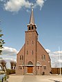
Zevenhoven, church

Woerdense Verlaat, drawbridge


Web links
- Website of the municipality (Dutch)
- Tourist office website (Dutch, English)
Individual evidence
- ↑ a b Nieuwe burgemeester in Nieuwkoop. In: rijksoverheid.nl. Rijksoverheid, January 22, 2020, accessed February 7, 2020 (Dutch).
- ↑ Bevolkingsontwikkeling; regio per maand . In: StatLine . Centraal Bureau voor de Statistiek (Dutch)
- ↑ Result of the local elections: 2014 2018 , accessed on June 6, 2018 (Dutch)
- ↑ Allocation of seats in the municipal council: 2006 2010 2014 2018 , accessed on June 6, 2018 (Dutch)
- ↑ Samenstelling college Gemeente Nieuwkoop, accessed on June 6, 2018 (Dutch)
Alblasserdam | Albrandswaard | Alphen aan den Rijn | Barendrecht | Bodegraven-Reeuwijk | Brielle | Capelle aan den IJssel | Delft | The Hague | Dordrecht | Goeree-Overflakkee | Gorinchem | Gouda | Hardinxveld-Giessendam | Hellevoetsluis | Hendrik-Ido-Ambacht | Hillegom | Hoeksche Waard | Kaag en Braassem | Katwijk | Krimpen aan den IJssel | Krimpenerwaard | Lansingerland | Suffering | Unfortunatelydorp | Leidschendam-Voorburg | Lisse | Maassluis | Midden-Delfland | Molenlanden | Nieuwkoop | Nissewaard | Noordwijk | Oegstgeest | Papendrecht | Pijnacker-Nootdorp | Ridderkerk | Rijswijk | Rotterdam | Schiedam | Sliedrecht | Teylingen | Vlaardingen | Voorschoten | Waddinxveen | Wassenaar | Westland | Westvoorne | Zoetermeer | Zoeterwoude | Zuidplas | Zwijndrecht