
Obertrebra
| coat of arms | Germany map | |
|---|---|---|
 Help on coat of arms |
Coordinates: 51 ° 4 ′ N , 11 ° 34 ′ E |
|
| Basic data | ||
| State : | Thuringia | |
| County : | Weimar Country | |
| Fulfilling municipality : | Bad Sulza | |
| Height : | 140 m above sea level NHN | |
| Area : | 3.24 km 2 | |
| Residents: | 258 (Dec. 31, 2019) | |
| Population density : | 80 inhabitants per km 2 | |
| Postal code : | 99510 | |
| Area code : | 03644 | |
| License plate : | AP, APD | |
| Community key : | 16 0 71 069 | |
| Address of the municipal administration: |
Dorfstrasse 37 99510 Obertrebra |
|
| Website : | ||
| Mayor : | Dieter Feldrappe | |
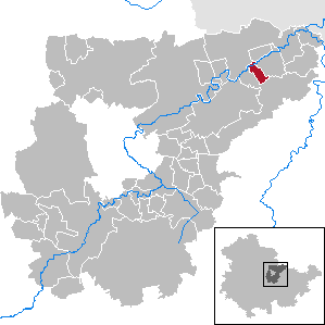
| Location of the community Obertrebra in the Weimarer Land district | ||
  |
||

Obertrebra is a municipality in the northeast of the Weimarer Land district . The fulfilling municipality is the city of Bad Sulza .

location
Obertrebra is a village in the flood-affected but fertile Ilmaue between Apolda and Bad Sulza . The district road 107 runs through the village. The Weimar - Berlin railway runs south .
history
At the beginning of the 9th century, Treba was first mentioned as a dribure in a list of the goods lent by Archbishop Lullus († 786) of Mainz to the monastery of Hersfeld von Free .
The place belonged to the Ernestine Office Dornburg founded in the 14th century . From 1815 the place was part of the Grand Duchy of Saxony-Weimar-Eisenach , which incorporated it into the Roßla office and in 1850 the Weimar II administrative district ( Apolda administrative district ). Obertrebra has belonged to the state of Thuringia since 1920 and with this became part of the Soviet occupation zone and the GDR after 1945 .
Memorials
A grave in the churchyard and a memorial plaque on the outside wall of the church commemorate an unknown concentration camp inmate who was murdered by SS men in 1945 on a death march from Buchenwald concentration camp .
church
literature
- Ruth-Barbara Schlenker: "Lass de Kerche in the village" - local stories and stories. Obertrebra , (series "Pfarrscheune" PS 13), Niedertrebra 2020, ISBN 978-3-9822110-4
Individual evidence
- ^ Population of the municipalities from the Thuringian State Office for Statistics ( help on this ).
Web links
At Ettersberg | Apolda | Bad Berka | Bad Sulza | Ballstedt | Blankenhain | Buchfart | Dobrich | Eberstedt | Ettersburg | Frankendorf | Grammetal | Big herring | Großschwabhausen | Hammerstedt | Hetschburg | Hohenfelden | Ilmtal Wine Route | Kapellendorf | Kiliansroda | Kleinschwabhausen | Klettbach | Crane field | Lehnstedt | Magdala | Mechelroda | Mellingen | Nauendorf | Neumark | Niedertrebra | Obertrebra | Oetter | Rannstedt | Rittersdorf | Blacksmiths | Tonndorf | Umpferstedt | Vollersroda | Wiegendorf