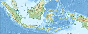
Obi Islands
| Obi Islands | ||
|---|---|---|
| Archipelago | ||
| Waters | Moluccas , Halmaherasee , Seramsee | |
| archipelago | Moluccas | |
| Geographical location | 1 ° 30 ′ S , 127 ° 45 ′ E | |
|
|
||
| Main island | Obi | |
| Topography of the main island Obi (= Obira) | ||
The Obi Islands , also known as Ombirah , are a group of islands in the Moluccas belonging to Indonesia . They are located in the south of the province of Maluku Utara ("North Moluccas") about halfway between Ternate in the north and the island of Ambon in the south.
Main island of Obi
Smaller islands
Large sections of the coast are made up of mangroves , with sago palms in some areas serving as a food source. In addition to the main island, the Obi Islands include numerous smaller islands, including:
- Concern : very small, flat island on the northwest coast
- Bisa : in the north, opposite Laiwui, highest point 469 meters
- Gomumu : flat island in the south
- Malamala : here too, research into nickel deposits requires deforestation
- Obilatu : in the northwest, 841 meters high
- Tapat : west of Bisa Island, 563 meters high
- Tobalai : flat island in the east


