Ohakune
| Ohakune | ||
| Geographical location | ||
|
|
||
| Coordinates | 39 ° 25 ′ S , 175 ° 24 ′ E | |
| Region ISO | NZ-MWT | |
| Country |
|
|
| region | Manawatu-Wanganui | |
| District | Ruapehu District | |
| Ward | Waimarino-Waiouru Ward | |
| Residents | 987 (2013) | |
| height | 583 m | |
| Post Code | 4625 | |
| Telephone code | +64 (0) 6 | |
| UN / LOCODE | NZ OHK | |
| Photography of the place | ||
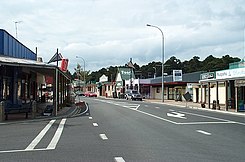
 Main street of Ohakune |
||
Ohakune is a place in the Ruapehu District of the Manawatu-Wanganui region on the North Island of New Zealand .
geography
The place is located around 21 km southwest of the summit of the Mount Ruapehu volcano at the southern end of the Tongariro National Park . The closest places are Raetihi , around 10 km west and Waiouru , around 24 km southeast. Wanganui, the closest major city, is around 65 km southwest. The Mangawhero River passes west of the place.
population
In the 2013 census, the town had 987 inhabitants, 10.1% less than in the 2006 census.
economy
The place is considered a rural service center and lives from tourism. Ohakune is the starting point for skiers in the Turoa ski area. In addition to accommodation and services for skiing, the site also organizes hiking tours.
Infrastructure
Road traffic
The New Zealand State Highway 49 runs through Ohakune and connects the town to the New Zealand State Highway 4 to the west and to the New Zealand State Highway 1 to the east . Through the village to the road leading to the to the northeast, on the slopes of draws Mount Ruapehu located Turoa leads -Skigebiets.
Rail transport
The North Island Main Trunk Railway also runs through the place where the Northern Explorer stops at Ohakune Station. From December 18, 1917 to January 1, 1968 , the Raetihi Branch , a branch line to Raetihi, also branched off in Ohakune .
Tangiwai railway accident
17 km east of Ohakune is the Tangiwai Bridge, where the Tangiwai railway accident occurred on December 24, 1953 , New Zealand's worst railway accident , with 151 deaths.
Attractions
On the southern edge of the village is a large replica of a carrot as a sign that the area supplies a large part of New Zealand's carrots.
Individual evidence
- ↑ a b 2013 Census QuickStats about a place : Ohakune . Statistics New Zealand , accessed September 7, 2017 .
- ↑ Topo250 maps . Land Information New Zealand , accessed September 7, 2017 .
- ↑ Tanigwai railway disaster . Christchurch City Libraries , accessed September 7, 2017 .

