Pangasinan
| Basic data | |
|---|---|
| Region : | Ilocos |
| Capital : | Lingayen |
| Population : | 2,956,726 August 1, 2015 census
|
| Population density : | 551 inhabitants per km² |
| Area : | 5,368 km² |
| PSGC : | 015500000 |
| Governor : | Amado Espino |
| Official website: | http://www.pangasinan.gov.ph/ |
| structure | |
| - Highly urbanized cities | |
| - provincial cities | 4th |
| - municipalities | 44 |
| - Barangays | 1364 |
| - electoral districts | 6th |
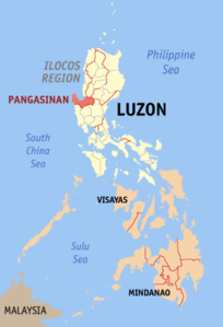
| Location of the province in the Philippines | |

|
|
Coordinates: 16 ° 0 ' N , 120 ° 18' E
Pangasinan is a province of the Philippines in the Ilocos region on the main island of Luzon . It was founded in 1578 . The capital of the province is Lingayen .
Amado Espino has been the current governor of Pangasinan since 2007 .
Location and geography
Pangasinan borders the provinces of La Union and Benguet in the north, Nueva Vizcaya and Nueva Ecija in the east, and Zambales and Tarlac in the south. To the west is the South China Sea .
In the Gulf of Lingayen is the Hundred Islands National Park , a national park with 123 small islands.
population
2,956,726 people live in Pangasinan (August 1, 2015 census). It has an area of 5,368 km², resulting in a population density of 551 inhabitants per km².
In addition to Pangasinian , Ilokano and Bolinao are also spoken in the area. The proportion of the two peoples of the Pangasinans and Ilokanos is about the same.
Cities and municipalities
Pangasinan is subdivided into four cities and 44 municipalities, which in turn in 1364 barangays split:
Cities
Boroughs
- Agno
- Aguilar
- Alcala
- Anda
- Asingan
- Balungao
- Bani
- Basista
- Bautista
- Bayambang
- Binalonane
- Binmaley
- Bolinao
- Bugallon
- Burgos
- Calasiao
- The oil
- Infanta
- Labrador
- Laoac
- Lingayen
- Mabini
- Malasiqui
- Manaoag
- Mangaldan
- Mangatarem
- Mapandan
- Natividad
- Pozorrubio
- Rosales
- San Fabian
- San Jacinto
- San Manuel
- San Nicolas
- San Quintin
- Santa Barbara
- Santa Maria
- Santo Tomas
- Season
- Sual
- Tayug
- Umingan
- Urbiztondo
- Villasis
history
The name Pangasinan literally means “the place where salt is made”. The name refers to the long-standing salt production in the province.
The Spanish conquistador Martín de Goiti came to Pangasinan from Pampanga in 1571 . A year later the Conquistador Juan de Salcedo reached the Gulf of Lingayen from the south and landed at the mouth of the Agno . In 1611 Pangasinan was officially named a province, which at that time still included parts of other present-day provinces, including Zambales , La Union and Tarlac . As a result, Lingayen also became the provincial capital and has remained so to this day. The residents of the province rose against Spanish rule several times, the most famous uprisings were the Malong uprising (1660–1661) and the Palaris uprising (1762–1765).
The Gulf of Lingayen was an important strategic point in World War II . Japanese troops under the command of Lieutenant General Masaharu Homma landed in Pangasinan in December 1941 , just days after the attacks on Pearl Harbor, and thus began the occupation of the country. It was not until 1945 that the province was liberated from the Japanese by American troops.
politics
The province has six constituencies for the House of Representatives of the Philippines .
