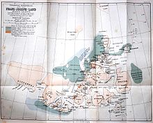
Petermann country
Petermann Land is a phantom island in the Arctic Ocean , which was suspected to be north of Rudolf Island in the Franz Josef Land archipelago .
During the Austro-Hungarian North Pole Expedition , the most important result of which was the discovery of Franz Josef Land, Julius Payer made his third sled trip to Cape Fligely on Rudolf Island in 1874 . Here he and the ensign Eduard Orel thought they could see more land to the north at a distance of 60 to 70 miles. Payer named it in honor of the geographer August Petermann , who, as a leading proponent of the theory of the ice-free Arctic Ocean, had a great influence on polar research of his time. Petermann had also advised the Austro-Hungarian North Pole Expedition. The mountainous west end of Petermann-Land, which Payer said was “still beyond the 83rd parallel”, called Cape Vienna. The land mass he thought he saw in the northwest was named King Oskar Land .
Fridtjof Nansen first had doubts about the existence of Petermann-Land when he left the ship on his expedition with the Fram and crossed Franz-Josef-Land with his companion Hjalmar Johansen :
“… But that Petermann Land cannot be of any significant size seems to be proven by our observations, since we saw no land when we passed a short distance east of it on the way south; the ice also seemed to be drifting westwards unhindered when we were on the breadth of Petermann-Land. "
Petermann-Land was still shown on Nansen's own map. Payer defended his supposed discovery with the correct reference to the fact that Nansen's chronometer had already been idle for two months when he traveled through the north of Franz-Josef-Land “without any real orientation”. Frederick Jackson , who mapped the central area of Franz Josef Land between 1894 and 1897, did not get far enough north to settle the question, but shared Nansen's doubts.
In 1900 Luigi Amadeo of Savoy attempted to reach the North Pole via Franz Joseph Land . To do this, he wanted to travel as far north as possible with his ship Stella Polare , to Rudolf Island or, preferably, to Petermann Land. Although Umberto Cagni and two companions advanced to 86 ° 34 'north latitude, he could find no trace of the hypothetical island.
The final proof that the Petermann Land does not exist was provided by Georgi Brusilov's Russian expedition from 1912 to 1914 . His schooner St. Anna, frozen solid in the ice, drifted right through the assumed island. Since no land was seen in any direction, it was clear that Payer was wrong. The reason for his mistake can be found in the complicated observation conditions in the Arctic, especially in mirages and often thick fog.
Individual evidence
- ↑ Julius Payer: The Austro-Hungarian North Pole Expedition in the years 1872–1874, together with a sketch of the second German North Pole expedition 1869–1870 and the polar expedition of 1871 . Alfred Hölder, Vienna 1876, p. 338 .
- ^ A b Julius Payer: The Austro-Hungarian North Pole Expedition in the years 1872–1874, together with a sketch of the second German North Pole expedition 1869–1870 and the polar expedition of 1871 . Alfred Hölder, Vienna 1876, p. 334 .
- ↑ Fridtjof Nansen: In night and ice . Second volume, Brockhaus, Leipzig 1897, p. 351 .
- ^ Moritz Lindeman : Franz-Joseph-Land. Controversy and New Discoveries . In: Globus . Volume 71, 1897, pp. 44-48, p. 47 .
- ^ Moritz Lindeman: Franz-Joseph-Land. Controversy and New Discoveries . In: Globus . Volume 71, 1897, pp. 44-48, p. 48 .
- ↑ Ludwig Amadeus of Savoy: The Stella Polare in the Arctic Ocean . Brockhaus, Leipzig 1903, p. 69
- ↑ Ludwig Amadeus of Savoy: The Stella Polare in the Arctic Ocean . Brockhaus, Leipzig 1903, p. 72
- ^ William James Mills: Exploring Polar Frontiers - A Historical Encyclopedia . tape 1 . ABC-CLIO, 2003, ISBN 1-57607-422-6 , pp. 108 (English, limited preview in Google Book search).
Coordinates: 83 ° N , 59 ° E

